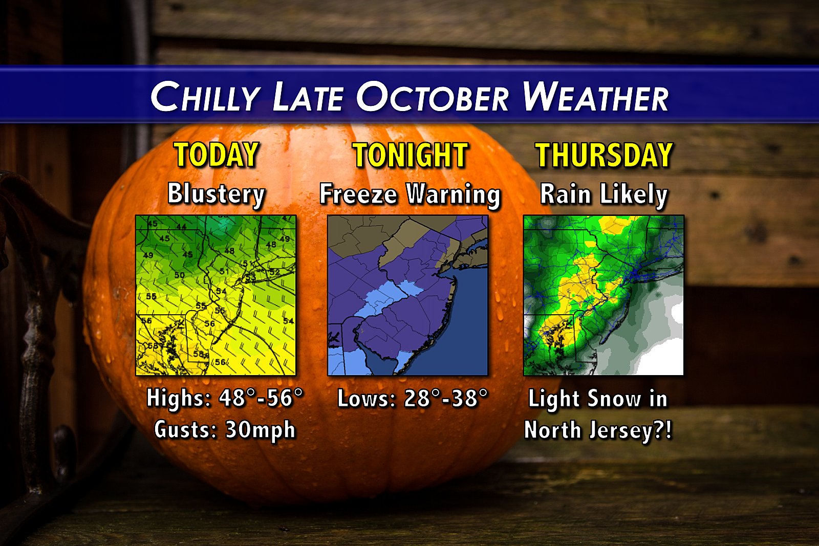
Chilly, Blustery Tuesday – Freeze Warning Tuesday Night
New Jersey is almost certainly heading for the first widespread frost/freeze of the season Tuesday night.
Ready or not, here it comes... As New Jersey falls under the influence of the coldest air of the fall season so far, we're looking ahead to a chilly Tuesday, a frosty (well, even "freeze-y") Tuesday night, and maybe a few snowflakes in the coming days!
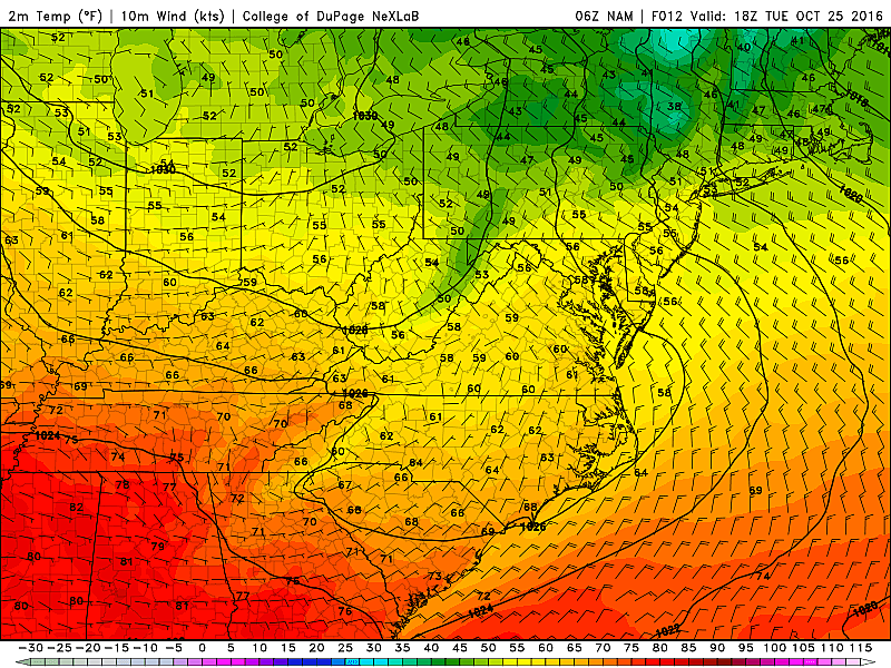
So far, we've fared well for Tuesday morning, as low temperatures have fallen as forecast into the upper 30s to lower 40s. A light northwest wind has picked up some moisture from Lake Ontario, producing some clouds over NW NJ. A few sprinkles or even flurries have popped up on radar in Sussex County too.
Even though skies will be mainly sunny Tuesday, it's going to be a chilly and blustery day. Wind gusts up to 30 mph and high temperatures limited to the mid 50s will combine for a "sweater weather" kind of day. That's 5 to 10 degrees below normal for late October, and likely to be our coolest day of Fall 2016 to date.
Thermometers are expected to bottom out Tuesday night through early Wednesday morning. With lows in the upper 20s to mid 30s, a frost or freeze is almost certain for the vast majority of New Jersey. (The only possible exceptions will be urban areas and along the immediate coast.) The National Weather Service has issued a Freeze Warning for most of the state, with a Frost Advisory in effect for a few counties too.
I'm not going to list which counties are and aren't under each advisory type, as such differences are just a technicality. Just know it's going to be the coldest night of the year so far. And the growing season is about to officially end for most of New Jersey.
Wednesday will end up well below normal too, with highs limited to the lower 50s at best. Clouds will increase as the day progresses, but at least winds will be lighter than on Tuesday.
Our next piece of interesting weather comes along Thursday morning. A storm system is expected to arrive in New Jersey, providing a persistent chance of precipitation during the daytime hours on Thursday.
It'll be mostly rain, totaling less than an inch. Could be heavy at times through Thursday afternoon.
But...
If the precipitation arrives early enough, and if temperatures fall cold enough, there's a decent chance of light SNOW for North Jersey Thursday morning. (Yes, I'm pulling the "s word" out of seasonal retirement!) This morning's run of the European model even popped out an impressive 2 inches of snow around Sussex County!
Snow fans, don't get your hopes up too much. Snow foes, don't freak out. The ground will be relatively warm, and any precipitation will be light at onset. So there's not much hope of significant accumulation. Still, I could see a coating or dusting of snow on the ground north of Interstate 80 by the time temperatures rise and any snow changes over to rain.
Beyond Thursday, models get really wishy-washy and indecisive about temperatures and potential rain shower chances heading into the Halloween weekend. According to the latest info, I'd warm temperatures into the 60s for the weekend with a chance of showers on Sunday. But again, that's a low confidence outlook.
More From WPG Talk Radio 95.5 FM