Hurricane Matthew’s Weird Track Puts NJ In the Clear For Now
It now appears likely that Hurricane Matthew will not directly hit New Jersey this weekend, but we're not completely out of the woods yet.
New Jersey has been in a frenzy this week, from #Matthew to #NoGasTax to #CreepyClowns. At least I can ease some of your weather-induced anxiety with the latest update on Hurricane Matthew.

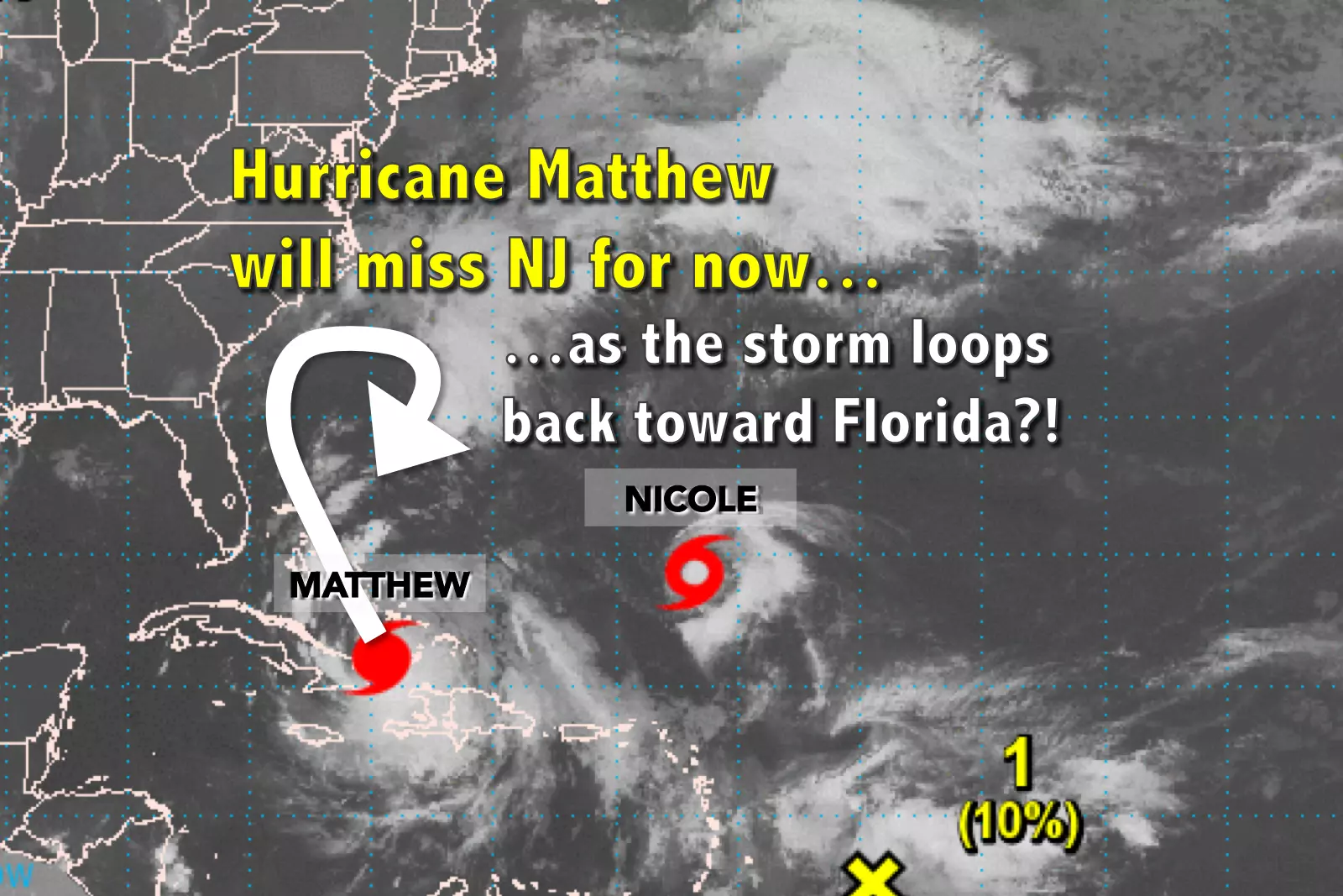
Hurricane Matthew weakened a bit upon passing over Cuba, but is still a category 3 "major" hurricane with maximum sustained winds of 125 mph. The Bahamas will get smacked from the strong side of Matthew on Wednesday and Thursday. The Atlantic coast of Florida is under the gun for Friday.
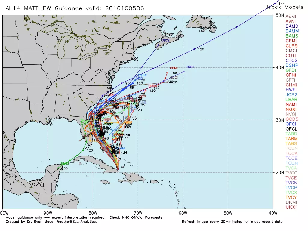
And then? Ha. Both the GFS and European models show Matthew to begin a loop de loop, passing by the Carolinas and then circling back toward the Bahamas and Florida again! There are no words to describe how unusual this track is.
The reason for the unusual loop? The atmospheric trough that was expected to pull Matthew up the coast is further north and weaker than originally thought. As Matthew tries to push eastward (out-to-sea), it encounters newly named Tropical Storm Nicole. Matthew then will have nowhere else to go but back to the southwest, toward the Bahamas again. Fascinating. Astonishing. And practically guaranteeing that Matthew will be a case study in meteorology classes across the country for years and decades to come.
I'm pleased to say that this track practically ensures New Jersey will not endure direct impacts from Hurricane Matthew this weekend.
Do I have reservations? Yeah. The looping storm track is just so difficult to believe. Additionally, the NAM model shows the storm hugging the U.S. East Coast a bit longer than other models. So, while I maintain that direct impacts on NJ are highly unlikely over the Columbus Day Weekend, I reserve the right to revise that statement over the next 24 hours.
Additionally, as the storm loops back along the southeastern United States, it may make another run at New Jersey later on. The GFS actually shows New Jersey to experience heavy rain, gusty winds, and surf problems next weekend as Matthew finally passes by. Do I completely buy this forecast, 10 days away? No way. But it means we'll have to continue monitoring (and yes, taking about) Matthew through at least the first part of next week.
So, with the big, bad Matthew threat out of the way for now, how does the forecast look? Pretty good!
Wednesday looks like a pleasant early autumn day, with mostly sunny skies and temperatures climbing from the 50s in the morning to around 70 degrees by the afternoon. That's close to normal for the fifth day of October.
Despite a few clouds tonight, reasonably dry air will allow temperatures to dip into the cool zone for Wednesday night. Most lows will end up in the lower to mid 50s. A few 40s will be possible in the "usual" chilly spots.
Thursday's weather gets even better, featuring sunny skies and highs bumping into the lower to mid 70s.
Despite increasing clouds on Friday (enhanced by the outer edge of Matthew), highs should still make it into the 70s.
Without Matthew, the weekend looks good - but not quite perfect. Saturday will be cloudy, limiting high temperatures to around 70 degrees. As a cold front approaches, some light rain is expected from Saturday night through Sunday morning. But rainfall amounts will be low, probably well below a half-inch across the state.
Sunday will be cooler and somewhat breezy, with wind gusts up to about 35 mph. Even though skies should clear to sunshine, high temperatures will only end up between 65 and 70 degrees.
More From WPG Talk Radio 95.5 FM