Near-Record Heat Today in N.J., Rain Coming Later This Week
Temperatures will be in the 90s yet again for Tuesday, with steady and even heavy rain likely within the next few days.
Here are your weather headlines for Tuesday, September 8, 2015...
Back to Work/School Heat
Fun climatology fact! Today is the last day of the year with normal high temperatures at or above 80°. Yes, autumn is just around the corner, and we should have some cooler temperatures arriving right on schedule later this week.
However... those cooler temperatures aren't here quite yet. The Labor Day heat will continue to make us sweat Tuesday, with high humidity and abundant beating sunshine. Afternoon high temperatures across the Garden State will mostly reach the lower 90s. Today's 94° forecast high at Newark would tie the current record for September 8, set in 1939. The records of 95° at Trenton and 94° at Atlantic City will probably remain intact.
The mugginess continues for Tuesday night, preventing low temperatures from dropping much below the 70-degree mark. Additionally, the high humidity will present another chance for patchy fog by early Wednesday morning.
Wednesday will begin with sunshine, but clouds will increase throughout the day. We could see a shower or thunderstorm pop-up Wednesday afternoon or evening, but any rainfall during the day on Wednesday should remain isolated at best. Because of the clouds and impending rain, high temperatures will be a bit lower on Wednesday, in the 85° to 90° range.
Midweek Rain
We really need some solid rain. Last week, the Drought Monitor upgraded much of northeast New Jersey to the "Moderate Drought" category, given the lack of rainfall and diminishing streamflow and reservoir levels. If it stays dry, there could be significant impacts on agriculture, and our fire danger will remain high. Thankfully, I'm happy to say we have a likelihood of steady or even heavy rain coming later this week.
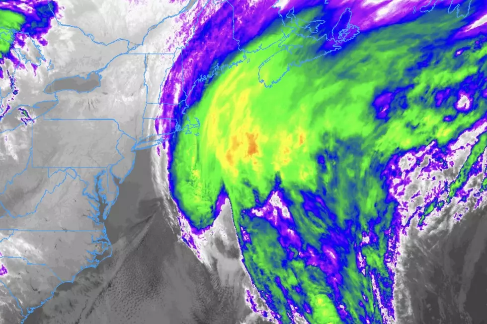
Thursday looks downright wet, as a slow-moving front will push through New Jersey. New Jersey's atmosphere will provide plenty of moisture to sustain periods of steady rain and thunderstorms from this system throughout the day on Thursday. The slower the front moves, the more rain we will see. At the moment, the heaviest rain and storms are modeled to move through Thursday afternoon and evening.
I'm currently thinking we'll see widespread 1+ inch rainfall totals (with locally higher amounts) by the end of Thursday. That's substantial! Yes, Thursday could be a washout, but we could really use that good soaking rain right now.
By Friday morning, we could have some lingering showers. Skies are expected to clear to partial sunshine by Friday afternoon. A refreshing northerly breeze behind the front will keep temperatures in the pleasant lower 80s on Friday.
The Weekend is Only 4 Days Away...
It is an abbreviated workweek, so I'm happy to remind you that the weekend is closer than usual on this back-to-work day! (Of course, the minutes and hours are just going to drag on and on this week...) Following Thursday's rain, our weather looks to clear away nicely by next weekend. It will feel a bit more "autumnal" than Labor Day Weekend, with high temperatures on Saturday and Sunday in the upper 70s to lower 80s. A passing storm system could bring some extra clouds and cooler temperatures on Sunday, but for now we are keeping the forecast dry.
More From WPG Talk Radio 95.5 FM