One More Day of Extreme Heat and Humidity Tuesday
Heat warnings and advisories are in effect across the Garden State, with the potential for strong thunderstorms on Tuesday, too.
Here are your weather headlines for Tuesday, August 16, 2016...
Heat and Humidity Roar Back
A warm front lifted through New Jersey early Tuesday morning, and brought a few not-really-refreshing showers to the southern and central parts of the state. As those raindrops come to an end, we'll face the return of high humidity and dangerous heat.
High temperatures on Tuesday are expected to climb into the lower to mid 90s. As dew points once again climb to the tropical mid 70s, our heat index will likely rise to about 102 to 106 for Tuesday afternoon.
An Excessive Heat Warning continues until 8 p.m. Tuesday for Mercer, NW Burlington, Camden, and Gloucester counties.
A Heat Advisory is in effect for most of New Jersey for Tuesday afternoon and early evening.
That simply means it's one of those days where you have to cognizantly take care of yourself outdoors in the elements. Dressing for the heat, staying hydrated, and taking frequent breaks would be very wise throughout Tuesday.
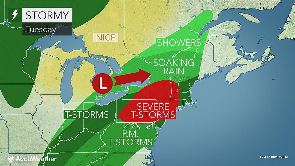
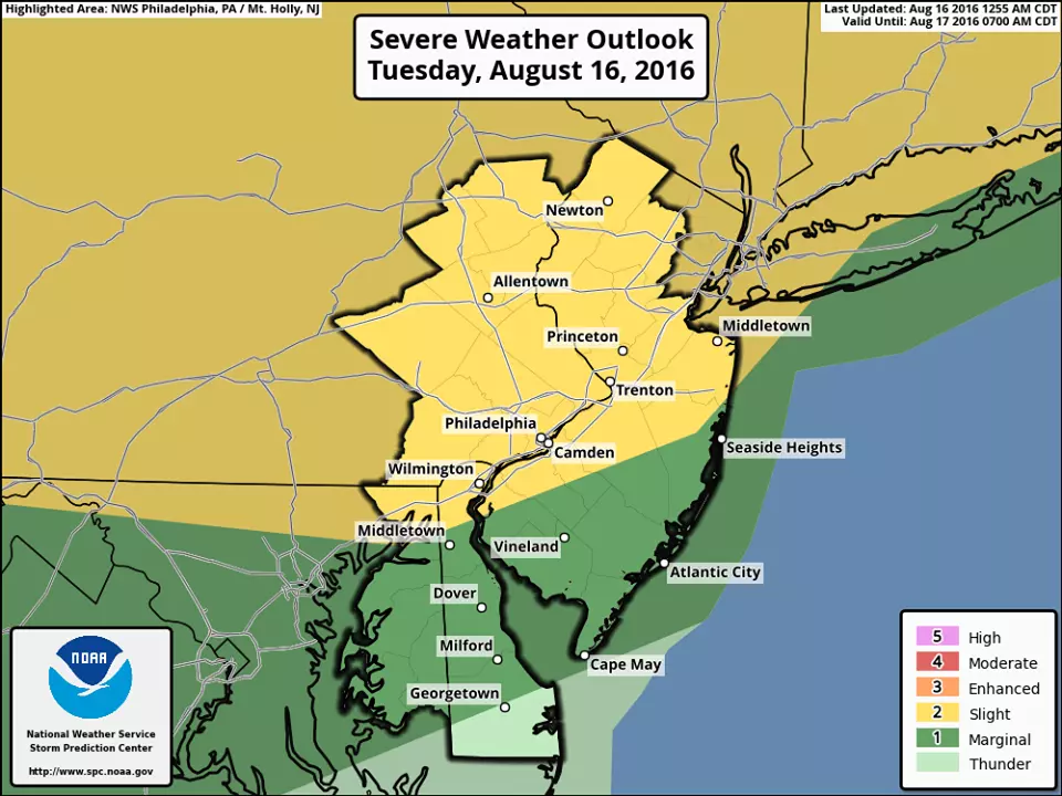
Strong Thunderstorms
In addition to the heat, we have to watch the chance for scattered strong to severe thunderstorms. The latest models suggest the storm chance will be a bit later than you might expect, between about 6 p.m. and 2 a.m. Heavy rain and gusty winds will be the primary concerns, as we've seen many times this summer. As the Storm Prediction Center map indicates, the best chance for severe weather occurs the further north and west in NJ you go.
While there could be a shower leftover early Wednesday morning, skies should clear to partly sunny.
Some Relief
This isn't the fresh breath of dry air you've probably been craving, but it's going to be a noticeable improvement. Humidity levels will drop on Wednesday, with dew points retreating to the 60s. That's still somewhat humid, but a sizable drop from the 70s. It's still going to be very warm for Wednesday, with highs in the upper 80s to lower 90s. A nice west-northwest breeze up to about 20 mph will keep the air moving around. I suspect it will turn into a pretty nice day.
And more pleasantly warm days are ahead through the rest of the workweek. Yes, we'll still be close to 90 degrees. And yes, it'll still be somewhat humid. But it will be much more comfortable overall, especially with overnight low temperatures returning to the 60s (starting Thursday morning).
The weekend might get a little iffy, as an on-shore flow and a cold front may combine to push some clouds and rain chances over the Garden State. At least it looks like the extreme heat and humidity will not build back anytime in the next seven days.
More From WPG Talk Radio 95.5 FM


