Weather Blog: Light Snow Tonight
A passing storm system will clip New Jersey and provide a chance for light snow accumulations through Friday morning.
Here are your weather headlines for Thursday, January 29, 2015…
Light Snow Tonight
Notice the word "light". In other words, NOT a "bread and milk" storm. But it certainly could cause some snowy/icy spots on the roads, and perhaps some delayed openings on Friday morning.
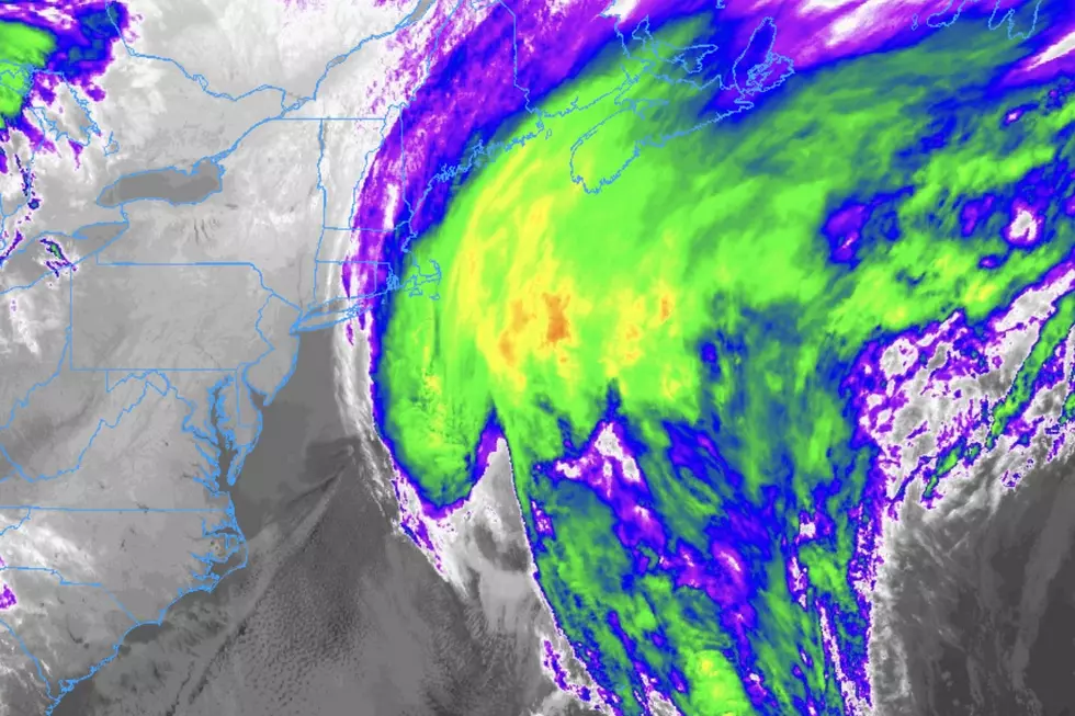
The center of this storm system will pass through northern New York and New England. So New Jersey, right on the fringes of this storm, will only see light precipitation at best. While temperatures will certainly be cold enough to sustain accumulating snow (especially in North Jersey), our presently dry air may become an issue here as well. Furthermore, South Jersey (particularly south of the AC Expressway) will see lows tonight in the 33 to 35 degree range; so the snow could end up as all rain. Or if the storm tracks a bit further north than expected, South Jersey could be nothing at all.
The forecast for this storm looks like this...
- Timing: flurries this afternoon, potentially picking up after about 7 p.m tonight. and lasting through as late as 10 a.m. tomorrow morning
- North of I-195: light snow, with 1 to 2 inches of new snow accumulation possible
- South of I-195: snow and rain showers, with up to 1 inch of snow accumulation possible
- Impacts: Friday morning rush hour could suffer from reduced visibilities and slippery roads
Will the storm travel far enough south to bring this precipitation to New Jersey? Will our atmosphere have enough moisture to work with to sustain snow and/or rain? Will temperatures be cold enough for snow instead rain? Probably. It’s yet another storm system where we’re right on the edge. But confidence is decent that we’ll see accumulating snow somewhere in New Jersey.
Arctic Air Arrival
New Jersey was feeling pretty frigid this morning, with many temperatures bottoming out in the single digits. If the current forecast holds, we have even colder days ahead. Brrrr!
Following tomorrow night’s light snow, the door opens to some much colder air. That cold will flow into New Jersey through the day on Friday, carried on a gusty northwest wind ranging from 20 to 30 miles per hour.
But wait, there’s more! The core cold air settles over us just in time for Saturday morning. And, unfortunately, that brisk wind will still be here as well. Saturday morning's low temperatures are forecast to be in the 6° to 13° range. With a 15 to 25 MPH wind, that will produce widespread wind chills below zero. Highs on Saturday will struggle to make it to the lower 20s.
But wait, there’s even more!! Following another (stronger) storm system on Monday (see below), another (stronger) blast of arctic air will be pushed southward into the United States. (I don’t like to use the now-buzzword Polar Vortex, but that is what’s driving this cold air intrusion.) Tuesday could be yet another day with highs barely making it to 20 degrees.
Watching Monday’s Storm
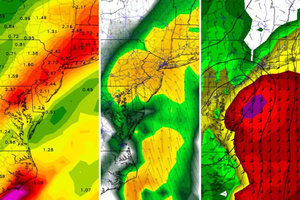
Yesterday, I stressed the need to remain vigilant about a potential "mostly heavy rain" storm over 5 days away on Monday. Now that we’re 4 days out, the storm is still in the forecast, but the precipitation and temperature forecast has changed dramatically. This is not particularly surprising, especially given the computer forecast models' poor performance lately. This stresses the need to carefully monitor more than one model from more than one run before communicating a forecast with any confidence and authority.
Confidence is still very low here, as forecast high temperatures for Monday have swung 10 to 20 degrees cooler. That's a huge change. And, of course, it changes the forecast for that potential "rain" storm to a potential "snow" storm. With plenty of moisture and cold air to work with, the current storm track would be conducive to some solid snow for New Jersey.
However... I need more information before I can confidently give more details about this system’s timing and biggest impacts. That will hopefully come into view tomorrow (72 hours before the storm). And it’s still way too early to competently talk about potential snow totals. If everything holds together, I’d be aiming to add that to the forecast on Saturday (48 hours in advance). Stay tuned!
More From WPG Talk Radio 95.5 FM