
Winter Weather Advisory: Light Snow for NJ Through Friday
New Jersey will be barely clipped by a winter storm system, producing light accumulations of snow across much of the state by Friday morning.
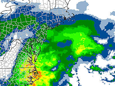
Setup
New Jersey will be on the fringes of a powerful winter storm system pushing across Virginia and North Carolina from Thursday night through Friday morning. As the Garden State gets clipped by the precipitation bands, some light snow is expected. It is important to note that this will only be a minor "nuisance" or "conversational" snowstorm.
Advisory
The National Weather Service has issued a Winter Weather Advisory from 10 p.m. Thursday to 1 p.m. Friday, for counties south of Interstate 195: Atlantic, Burlington, Camden, Cape May, Cumberland, Gloucester, Ocean, and Salem.
An advisory is not as severe as a warning, and merely serves to caution about potentially poor travel conditions. Part of the reasoning behind the advisory is the timing of this system, specifically impacting the Friday morning commute.
Timing
In Thursday morning's weather blog, I mentioned that this storm is NOT expected to cause heavy bands of thumping snow in New Jersey. Several hours of persistent light snow will cause light accumulations and some travel issues.
As of this writing, the first bands of light rain/snow are already knocking on the door of South Jersey. That's slightly ahead of schedule. Heavier snow is modeled to arrive in the early morning hours of Friday, just before and during the morning rush.
By late morning, the snow will taper off as this system pushes out to sea. All precipitation should be done falling in New Jersey by around 2 p.m. Friday afternoon.
Accumulations
I am still comfortable with our prediction of "an inch or two" of snow accumulation in the advisory area of South Jersey - along and south of Interstate 195. A localized 3-inch total is still possible along the southwest corner of the state. However, it is worth noting that the latest models have trended downward slightly in snow totals.
Our forecast calls for just a coating to an inch of snow accumulation for the northern half of the state (north of I-195). Far North Jersey (especially above I-80) may not see anything at all stick to ground.
There may be a brief transition to rain or wintry mix along the Jersey Shore as the system pulls out to sea around the late morning to early afternoon hours on Friday. That may ultimately lead to lower snow totals along the coast.
A warm ground and blowing snow may also may it hard for the snow to "stick" at first. The "biggest" snow accumulation (and I use that term loosely) will probably be found on the coldest surfaces - cars, trees, grass, etc.
Biggest Impacts
--Roads could get a bit messy by the Friday morning commute. I don't anticipate any big problems on major roads that are pre-treated with salt and/or brine. Bridges, overpasses, and side streets could be a bit slippery if they become covered in ice or snow. You might want to set the alarm clock a bit earlier, in case your ride to work takes some extra time.
--Airlines tend to play it safe in inclement weather such as rain or snow, so delays or possibly cancellations are possible for the first half of Friday.
--Schools will probably have to make a gametime decision regarding a closure or a delay. Superintendents across New Jersey will be staring out the window early Friday morning to gauge whether it's safe. We will, of course, update the latest list of schedule changes as they come in:
What's Next?
After the snow and rain tapers off by Friday midday, skies will clear through Friday afternoon. High temperatures will be on the chilly side, in the upper 30s to lower 40s.
We'll start a slow warmup this weekend, that will eventually lead to some very springlike weather through the middle of next week. Saturday's highs will be stuck below normal, in the lower 40s. A few rain or snow showers will be possible Saturday night into Sunday morning, as a weak wave pushes through New Jersey. Sunday's highs will bump into the seasonable mid to upper 40s.
Monday and Tuesday will be in the 50s. And I think widespread 60s are a good bet for Wednesday and Thursday. Could we make a run for 70 degrees? Absolutely!
Be sure to keep these warm temperatures in mind as you're braving the snow Friday morning!
More From WPG Talk Radio 95.5 FM


