NJ weather: A quick hit of rain and gusty wind to end the weekend
(College of DuPage Meteorology)
Sorry to bother you over the weekend. I just want to give you a quick heads-up to some active weather coming up, as another autumn cold front aims for New Jersey. The nastiest conditions will be brief, but potent. Let's run through what to expect.
Rain
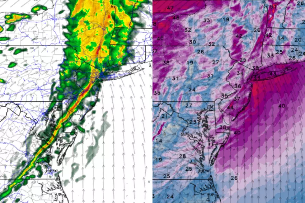
Aside from an isolated shower, we'll make it through the Sunday daytime hours unscathed and dry. The "main event" will sweep from west to east between about 5 p.m. and 11 p.m. Sunday evening.
It will be a quick hit of wet weather, but potentially torrential. The atmosphere is going to be so stirred up and convective, thunder and lightning are a good possibility. Amongst the latest model guidance, there are some differences regarding rainfall totals. A quarter-inch of rainfall seems like a good bet statewide. But if/where it really pours, I could see up to a quick inch in the rain gauge, enough to cause some brief localized flooding issues.
One thing is very clear — there is a distinct separation between the precipitation and the eventual colder air. So, there is no threat of snow or ice this time around.
Wind
Likely to be the most surprising and impactful element of this frontal passage.
Sunday will become breezy by midday, blowing out of the south around 20 mph. As the rain ramps up in the early evening, breezy will quickly become windy, gusting to about 30 mph. Peak gusts will come just as the front itself arrives, in the 7 p.m. to 9 p.m. time frame, over 40 mph in many spots. That's enough to thoroughly relocate your garbage can, test the security of your Thanksgiving and Christmas decorations, and bring down some tree branches. Sporadic power outages and road closures will be possible as a result.
Now, here's the thing. Winds are going to be screaming fast about a half-mile above our heads. Back-of-the-envelope calculation puts gusts aloft on the order of 90 mph. If that wind mixes down to the surface, even just a little bit, it could rapidly turn into a more dramatic and damaging situation. Just something to keep an eye on.
Winds will remain elevated through at least Monday morning too (gusting in the 30+ mph range).
Cooldown
As the name implies, a cold front usually opens the door to cooler (and drier) air. Falling temperatures is what autumn is all about, after all!
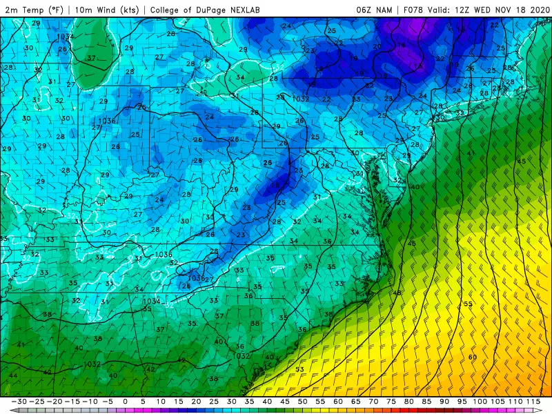
While Sunday's highs will reach the lower 60s across most of New Jersey, it will easily be the warmest day of the week. Monday's high will only reach about 50 — already below-normal for mid-November. Tuesday most of New Jersey will get stuck in the 40s all day. And Wednesday will be the "bottom of the barrel" with highs barely to 40 degrees — akin to a chilly mid-winter day!
Just as importantly, widespread frosts and freezes become more and more likely as the week presses on.
So there you have it — be ready to get wet, blown away, and bundled up! Plan your day accordingly, and please be safe out there. Next weather blog coming at usual time early Monday morning.
More From WPG Talk Radio 95.5 FM