NJ weather: Chilly sunshine Tuesday, Thanksgiving will start wet
The Bottom Line
All eyes are on Thanksgiving Day now, which I usually call one of the most important weather forecasts of the year. While we're not really talking about "travel impacts" this time around, the weather will still be important for those celebrating the holiday outdoors, with open windows and doors, etc.
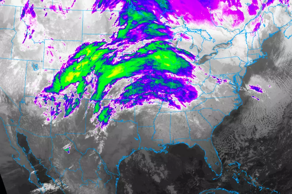
And Thanksgiving Day 2020 does look wet, at least through the morning. But we're still not talking about a washout. Nor do we expect anything dramatic, like flooding, lightning, wind, or snow.
Tuesday
Just chilly. 30s in the morning, and only mid 40s in the afternoon. That's on the order of 5 degrees below normal for late November. There will be a breeze through the morning, becoming even lighter (or non-existent) later on. Skies will be sunny, and our weather will stay dry.
Tuesday night will be potentially frosty again, again from cities and coast. Low temperatures will mainly reach the mid 30s. Clouds will be on the increase overnight.
Wednesday
Not bad, as we stay dry and mild during the daytime hours. Clouds will win the sky, with peeks of sun along the way. High temperatures will bump into the above-normal mid 50s Wednesday afternoon.
As our next storm system creeps closer from the west, showers will push into New Jersey some time Wednesday night. There are some variances in the arrival time (7 p.m. vs. 1 a.m.), depending on which forecast model you look at. Initial rainfall should be scattered.
Thanksgiving Day (Thursday)
The only change in thinking here is to remove the words light and showery from the Thanksgiving morning forecast.
Everyone in New Jersey will get wet Thursday morning, as pockets of steady rain drive through the state. Lingering showers are possible into the afternoon too — but there is good reason to stay optimistic we'll dry substantially out as the day presses on. Rainfall totals will likely end up in the quarter-inch to half-inch range. A swath of southern New Jersey may see some heavier and/or more prolonged rainfall, leading to rainfall closer to an inch.
Even though the holiday will be partially soggy, at least the warming trend will continue too. Highs will reach the lower 60s across most of NJ Thursday afternoon. (Some models show runaway warmth after the rain wraps up, pushing into the mid-upper 60s — I'm not buying it just yet.)
(Black) Friday
Looks great. Sunny, dry, and mild with highs holding steady in the lower 60s.
Saturday & Beyond
A little impulse will bring clouds and a few midday showers to New Jersey on Saturday. We should still hover close to the 60-degree mark.
Chances will ensue on Sunday, as highs fall to around 50 degrees. Skies will progress from sun to clouds on Sunday.
Our next substantial storm system arrives around Monday, the final day of November. For now, the forecast looks wet, wet, wet. Although there will be a chance of snowflakes on the backside of that thing.
Long-range models show another storm system late next week (Thursday-Friday-ish). Usually I wouldn't touch a 10-day forecast with a 10-foot pole — but those models have been remarkably consistent for some time. Just like every storm system in the cold weather months, that one will be worth watching for any wintry potential.

More From WPG Talk Radio 95.5 FM


