A Surprisingly Snowy and Uncomfortably Cold Forecast for NJ Friday
For the second Friday in a row, we have a last-minute ramp-up in the snow forecast. A Winter Weather Advisory has been issued for the southern half of NJ.
From this past Tuesday's edition of the MDZ weather blog:
There’s a coastal storm system worth watching in the late Friday-early Saturday time frame. At the moment, models show a near-miss — of course, we know how that outlook worked out last weekend… As temperatures will remain cold through the start of the weekend, this one absolutely bears monitoring for accumulation potential.
Then, on Wednesday, I wrote the following:
I had been watching a potentially complicated and snowy setup for the start of the weekend. However, models are now falling on a solution that phases this system too far off-shore to bring precipitation to New Jersey.
And finally, on Thursday, my forecast read:
In addition, a very weak storm system will graze New Jersey throughout the day Friday. I have put a chance for light snow showers in the forecast, but accumulations will be limited to a dusting at best.
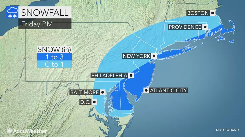
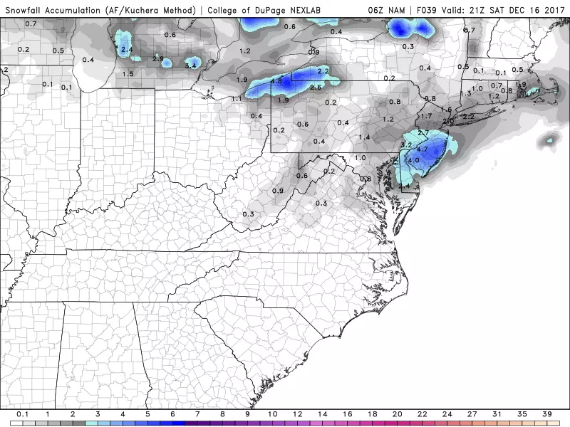
Well, late Thursday, models started to turn toward to a snowier forecast. A coastal storm system to the southeast and a clipper system to the west do look to phase over New Jersey from Friday afternoon through Friday evening. There is now strong consensus supporting a few inches worth of light, fluffy snow accumulation for the southern half of New Jersey. Yes, a bit more than the "dusting" I promised just 24 hours ago.
I completely understand the frustration of a last-minute change to the forecast, especially when accumulating snow is involved. Believe me, I feel it too. But to quote the Ice Queen Elsa, "let it go." My job is to report the weather forecast as honestly and accurately as I can — as that forecast evolves I'm not going to be stubborn or complacent and ignore any significant changes. Weather is chaos. I hope and pray the forecast fluctuations get a bit less chaotic as the winter presses onward.
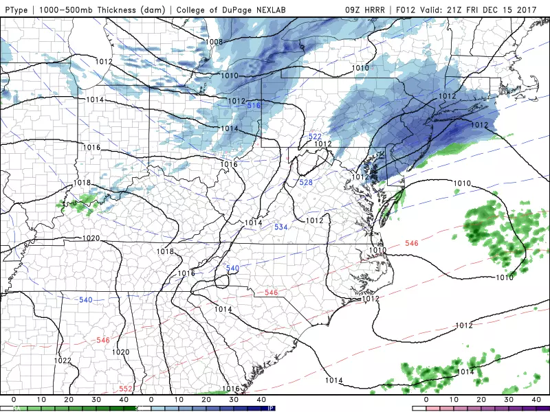
TEMPERATURES: To start, Friday is very cold — the coldest morning and afternoon of the season so far, in fact. Morning temperatures have fallen into the single digits in North Jersey, with teens and 20s through the rest of the state. High temperatures will be limited to about 30 degrees. Only South Jersey will climb above the freezing mark Friday afternoon.
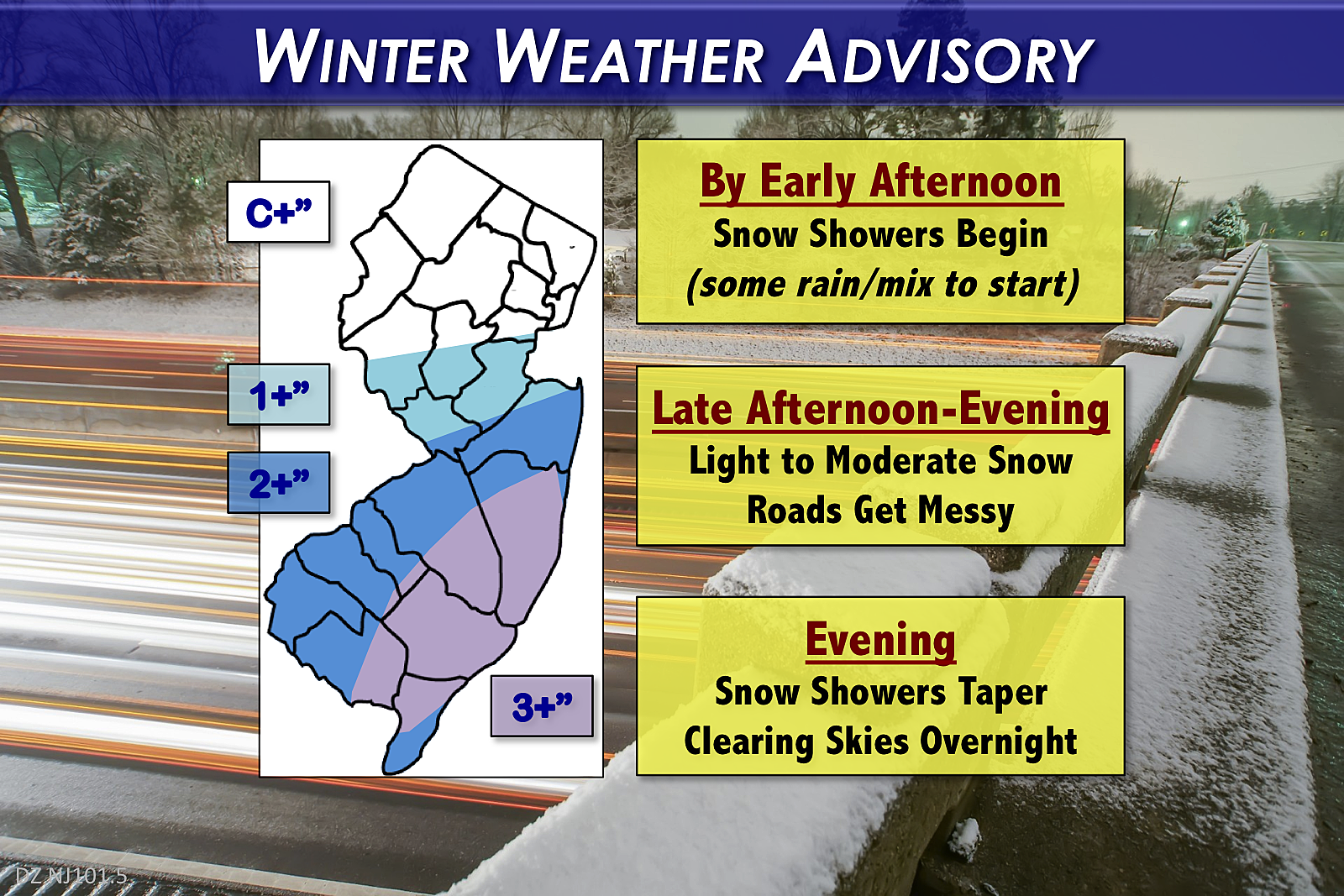
TIMELINE: While there could be a few flurries flying around before lunchtime Friday, snow showers will substantially start to fill in starting in the early afternoon (around 1 p.m.) Steadier snow (light to moderate intensity) will arrive from late afternoon through early evening (4 p.m. to 7 p.m.) — just in time to mess up the evening commute. Snow showers will taper off later in the evening (by about 9 p.m.) with clearing skies and cold temperatures expected overnight.
TOTALS: Just like Tuesday, Friday's snowfall will be dry and fluffy and will probably begin accumulating on all surfaces (including roads) immediately at onset. And, just like earlier this week, our impending snow falls in the "minor" category — enough to cause travel issues, but certainly not a "bread and milk" storm.
The "sweet spot" looks to be in the area around Ocean, Burlington, and Atlantic counties — I believe 3 to (maybe) 4 inches of snow will fall and accumulate there. The area just north and west of this swath will probably fall out of the heaviest snowfall — my forecast calls for about 2 to 3 inches there. From coastal Atlantic to Cape May county, I'm concerned the snow will begin as rain and/or wintry mix, limiting snowfall totals to 2 inches, rather than 3-plus. Further north, a coating to an inch may still cause some driving headaches during the weekend getaway.
ADVISORY: The National Weather Service has issued a Winter Weather Advisory from 1 p.m. to 9 p.m. for the southern half of New Jersey: Atlantic, Burlington, Camden, Cape May, Cumberland, Gloucester, Ocean and Salem counties. An advisory suggests less hazardous conditions as a warning.
IMPACTS: Once again, we're facing a run-of-the-mill snowstorm. While it will be very cold throughout Friday, there are no wind, coastal flooding, or widespread icing concerns. The worst part of the storm? The timing. Reduced visibility and slippery road conditions could make your ride home from work quite treacherous. As always, common sense and extra caution will go a long way.
BEYOND: A slow warmup begins this weekend, but you're not really going to feel it on Saturday. Despite mostly sunny skies, it will be blustery and cold with below-normal high temps in the upper 30s to around 40 degrees. We'll fare better on Sunday, as thermometers crawl into the lower to mid 40s. Clouds will increase on Sunday, with a few showers developing late-day (could be rain, could be snow). The warmup continues for Monday (near 50) and Tuesday (lower to mid 50s) before our next cooldown for the middle of next week.
Be smart and stay safe. Oh, and have a great weekend too!
More From WPG Talk Radio 95.5 FM


