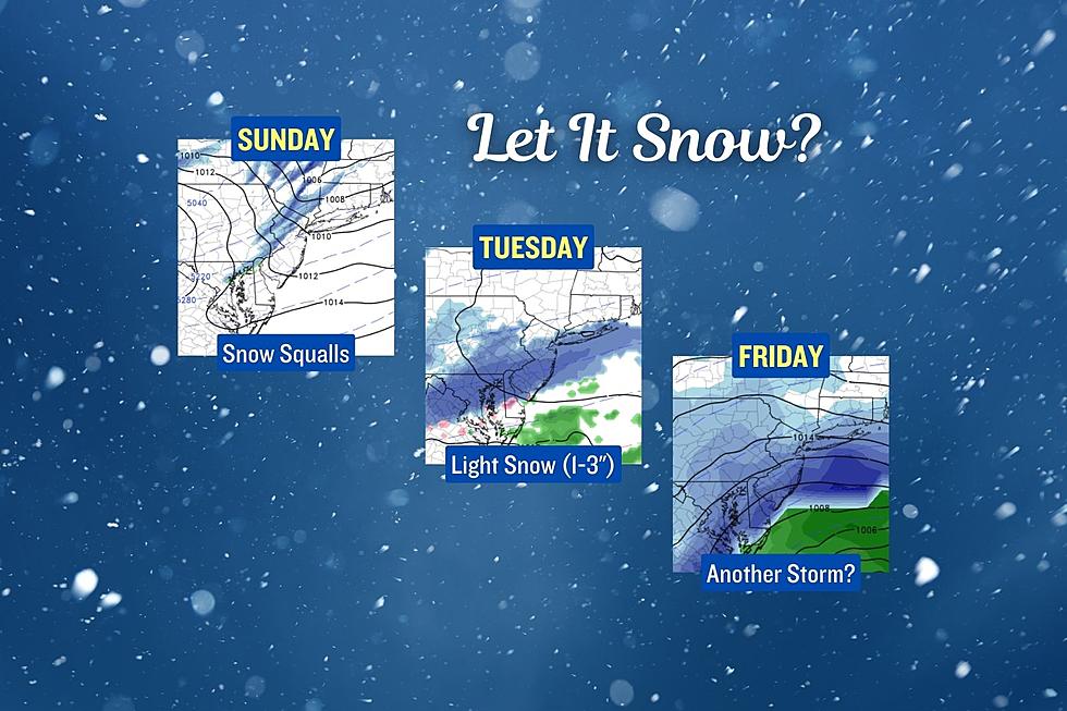
A wintry week of weather for NJ: 3 snow chances, frigid temps
The "dead of winter" is here. Mid to late January is, on average, New Jersey's coldest period of the year. Normal high temperatures do not even break 40 degrees. Normal low temperatures sink deep into the 20s.
We are almost a month into winter. And snowfall so far across central and southern New Jersey has been unimpressive so far, to say the least. Even North Jersey has only had two 2-inch snow events so far this season.
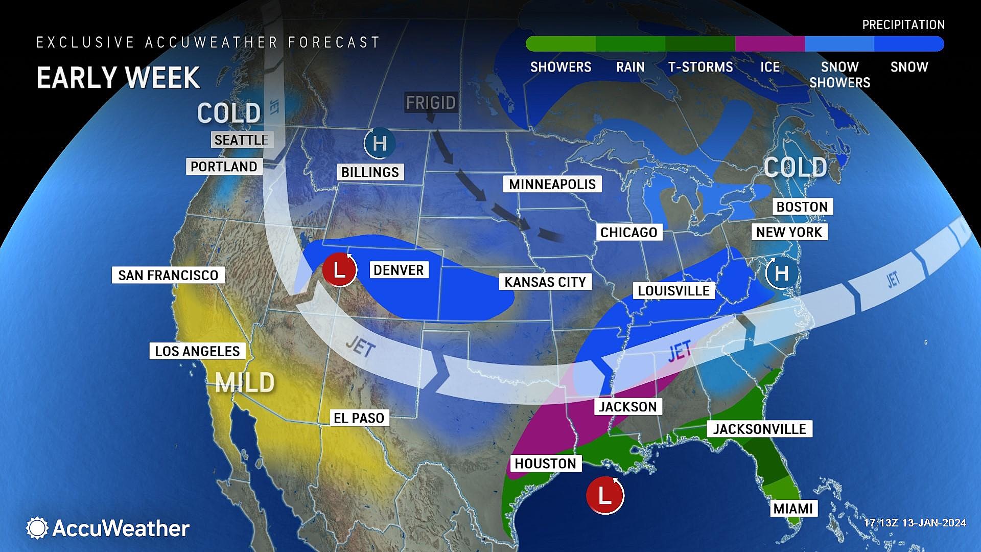
Right on cue, this week marks a notable departure from our recent stretch of rainy, generally warm weather. An arctic air mass settles into New Jersey on Sunday. And that will open the door to not one, not two, but three snow chances this week.
To be clear, I would not qualify any of those three threats as a "major" snow storm. But there will be accumulations and travel issues, on top of biting cold.
Let's dig into the details, so you know what to expect.
Cold Air, Ahoy!
The first, and most important, weather story of the week is the surge of cold air that has already begun. A secondary cold front will push into New Jersey on Sunday, reinforcing that arctic chill.
High temperatures on Sunday will come close to 40 degrees, likely falling backward a bit through the afternoon.
Monday morning will be downright frigid. As low temperatures end up close to 20 degrees, even a 10 mph light breeze would put the wind chill in the single digits. Not quite "dangerous" cold, but biting and uncomfortable.
Temps through the rest of the week will struggle to even reach the freezing mark. This is 5 to 10 degrees below normal, even in dead-of-winter late January. I do not see any sign of warmer, more seasonable weather for the next 7 to 10 days. So bundle up!
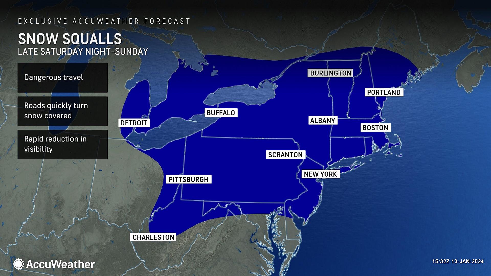
Snow Chance #1: Sunday Snow Squalls
With the arrival of cold air comes the discussion of wintry weather. And it does like some snow will affect New Jersey's weather during the day Sunday.
As the arctic cold front rolls from northwest to southeast across the state, it will likely spark a round of snow showers and/or snow squalls. They will be brief, but potentially heavy. Accompanied by a spike of 30+ mph wind.
The timing for potentially inclement weather would be Sunday's "midday" hours. Starting around 10 or 11 a.m. to the northwest. Exiting the state around 2 or 3 p.m. (Note: Snow could mix with or turn to rain to the south and along the coast.)
The issue here is not accumulation. It is visibility. Snow squalls can be extremely hazardous to drivers, as near-whiteout conditions take over the road suddenly. Stay extra alert - two hands on the wheel, scan the horizon, and watch for slippery spots. If your phone receives a Snow Squall Warning via the Wireless Emergency Alerts (WEA) service, take it seriously.
Snow Chance #2: Tuesday Light Snow
This midweek storm system has been hyped up on the interwebs for almost a week now. And now that we are getting some clarity and realism in the forecast? Honestly, it's a hot mess.
Forecast models have converged on a consensus that puts light snow over New Jersey on Tuesday, from the early morning hours into the afternoon. Emphasis on the word "light". This storm system is not going to be especially dynamic, severely limiting the opportunity for snow-downpours. Plus, our air is going to be very cold and therefore very dry. If snow is able to form and make it to the ground, it will be light and fluffy.
Some models have suggested a transition to wintry mix or rain late Tuesday along the southern coast, as warmer air accompanies the core of this storm system. Another possibility we will have to watch.
I think upwards of 4 inches by the end of Tuesday is a reasonable expectation for "maximum" snow accumulation. (Since it's light-and-fluffy stuff, the snow ratio is higher and will allow for higher totals.) That is advisory-level snowfall (not warning-level). And certainly enough to cause some slippery travel by late-day.
Rather than publish a detailed "official" snow map for this system just yet, let's just call it 1 to 3 inches for the entire state. Highest totals to the north and west. I'll refine that on Monday morning, as it gets closer.
Snow Chance #3: Friday
There is a signal at the end of this week for another potential winter storm. And it could be the most impactful of the bunch.
The GFS model favors a coastal storm affecting New Jersey during the daytime hours on Friday, perhaps lingering into Friday night. This solution is a "South Jersey special" — dumping 6+ inches of snow along the southern and eastern edges of the state. More like 3+ inches to the north and west.
However, our friend, the Euro model? Has a big fat nothing.
This is the story of the winter season. One model says "hit" and another says "miss". Ensemble forecast models, which are key in resolving this kind of conflict, are leaning more towards snow rather than no-snow. So that's the direction I am leaning for Friday, although not totally convinced at this point.
As always, let's take this one storm at a time. Let's get through Sunday's squalls and Tuesday's sideswipe, and then we'll focus on the late week potential. Keep your Friday (and maybe Saturday) plans flexible, and keep an eye on the forecast.
Let it snow: 12 things to know about winter forecasting in NJ
Gallery Credit: Dan Zarrow
First flakes: When does snow season start in NJ?
Gallery Credit: Dan Zarrow
More From WPG Talk Radio 95.5 FM


