‘Monster’ midweek storm: Big flooding and wind threat for NJ
I do not use the phrase "monster storm" often.
Nor do I take such hyperbolic vocabulary lightly.
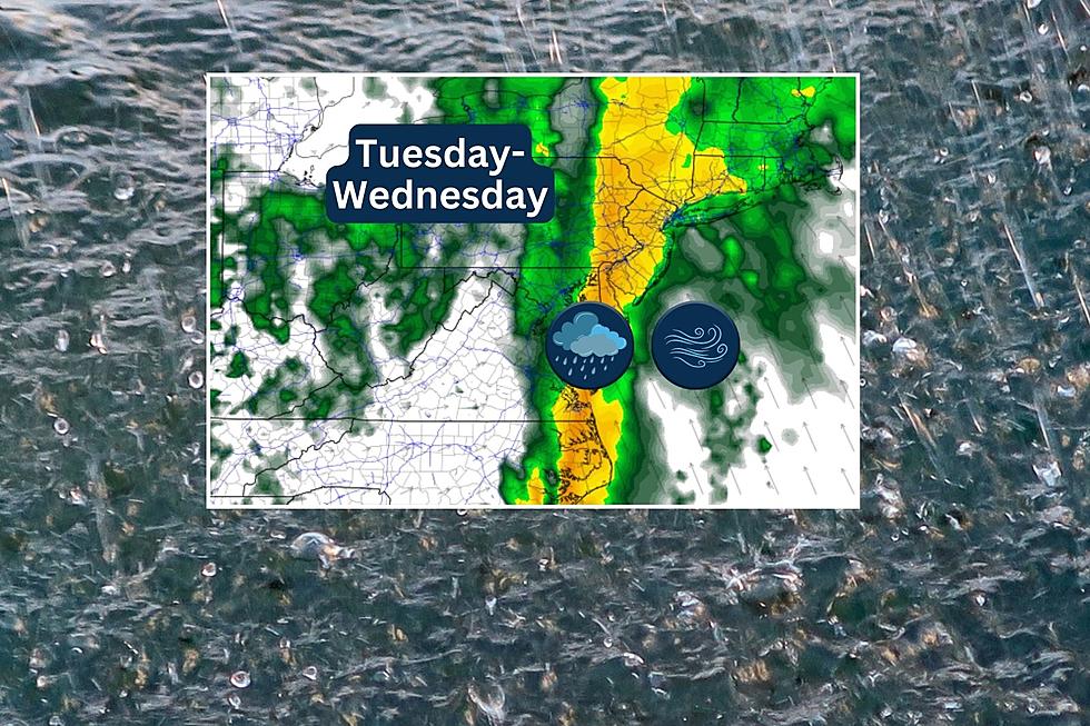
As this weekend's nor'easter winds down with lingering snow and rain, our attention turns to the next storm. It is bigger, it is stronger, and the impacts for New Jersey will be way more intense and dangerous. (Yes, even more serious than a foot of snow.) Heavy rain, wind, and coastal flooding are all on the table.
With just about 48 hours until the first raindrops fall in New Jersey (Tuesday), it is time to take this one very seriously.
Have I captured your attention yet? This post runs through the basic timeline and potential impacts, with a particular emphasis on why this storm has me very worried.

One Storm Winds Down...
We are not quite done with the weekend nor'easter, although the brunt of the storm is long gone. Temperatures have dropped, which means the final bands of precipitation are mainly snow and wintry mix.
Up to an inch of additional accumulation is possible, but really only the snow-covered area in North Jersey. In other places, the ground is too wet and too warm for snowflakes to "stick". Still, watch for slippery spots and reduced visibility.
Final snow and rain showers should clear the coast by Sunday mid-afternoon, around 3 p.m.
Freezing temperatures are likely for much of inland New Jersey Sunday night. Not a hard freeze (deep in the 20s), but cold enough for some icy puddles Monday morning. Be vigilant and watch your step.
Monday, we get a break of fairly quiet weather. It will be mostly sunny, breezy, and seasonably chilly with high temperatures in the lower 40s.
...Here Comes the Next One
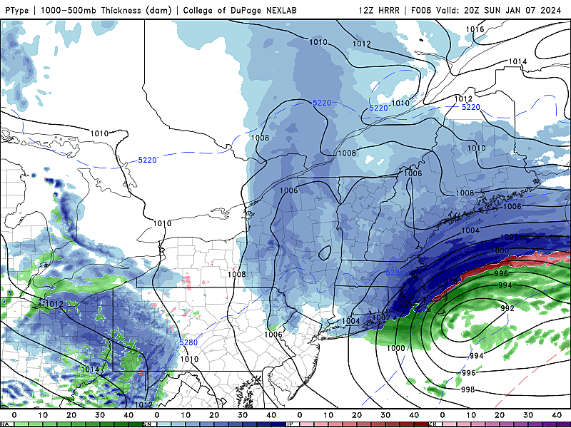
A broad, strong area of low pressure will approach from the west on Tuesday. It will be a major snowstorm from Kansas to Michigan.
Here in New Jersey, we will end up on the warm side of the storm. And the storm will tap into a very rich flow of moisture off the Atlantic. So it will be a heavy rain machine for us. (With very limited snow potential at onset, to the northwest only.)
Furthermore, a very strong low-level jet will set up right over New Jersey during the peak of the storm Tuesday night. If those winds can mix down to the surface, even partially, we are going to see some very powerful and potentially damaging gusts. Yup, it's a wind machine too.
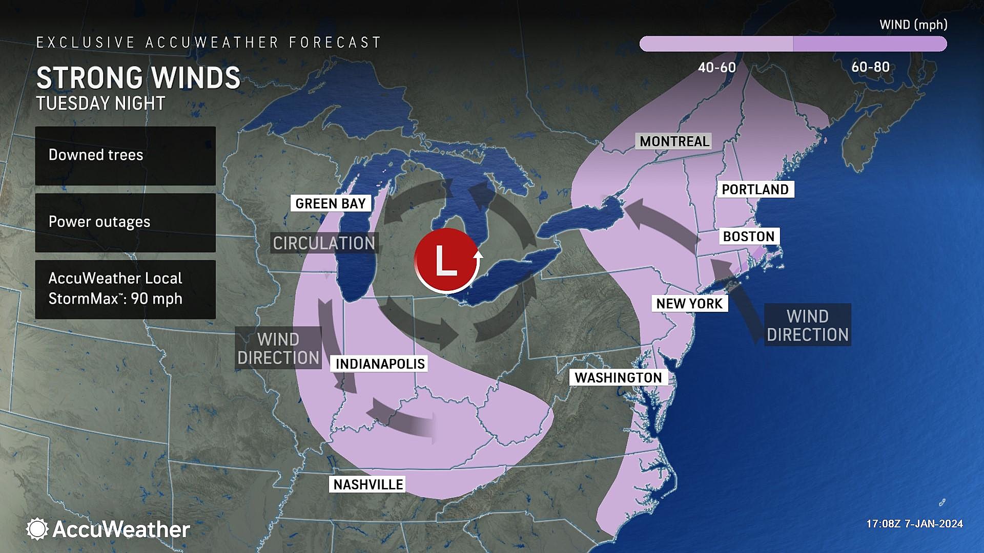
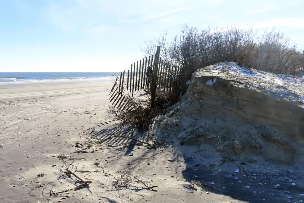
And all that wind is sure to cause problems along the Jersey Shore, including storm surge and coastal flooding, big waves and beach erosion.
Timing
—Tuesday morning... A few showers are possible ahead of the main body of this storm system, but they will be light and scattered through the early rush hour.
—Tuesday midday... Steady rain will push in from the west starting around late morning. By early afternoon, everyone in NJ will probably see precipitation falling.
—Tuesday afternoon... The threat of heavy rain only goes up throughout the day. It is going to be a wet ride home from school and work.
—Tuesday night... The brunt of the storm, with a period of torrential downpours and ferocious winds. Up to 80% of this storm's total rainfall is likely to occur within a 3 to 6 hour time span overnight.
—Wednesday morning... This storm will exit very quickly, once the heavy stuff passes. By sunrise, the rain should be done. Residual wind and flooding threats will linger for a while.
Potential Impacts
—Rain... Big impact #1. Very heavy downpours are likely Tuesday night, possibly topping 1" per hour. Total rainfall will likely range from 1.5" to 3", with locally higher amounts to 4" possible. As storm drains become inundated, flash flooding is likely along roadways and low-lying areas. River flooding is likely to occur too, due to heavy runoff.
—Snow... At storm onset Tuesday, a few hours of snowflakes are possible in NW NJ, along and north of Interstate 80. Maybe a half-inch of accumulation, before temperatures warm and precipitation becomes all rain by mid-afternoon Tuesday.
—Wind... Big impact #2. Widespread wind gusts over 60 mph may bring down trees (especially with saturated soil), cause property damage, and spark widespread power outages. Strongest winds will occur during the overnight hours, from late Tuesday night through early Wednesday morning.
—Coast... Tidal guidance is already forecasting widespread minor flooding along the Jersey Shore starting Wednesday morning. I would conservatively estimate storm surge around 2 to 3 feet, for now. Wave models show ocean wave heights exceeding 10 feet Wednesday morning too. (Possibly far over 10 feet just off-shore, by the way.) Beach erosion could be significant.
Why It's Very Concerning
To an extent, this storm setup reminds me of the mid-December storm, that brought historic flooding to several major waterways in North Jersey.
This Tuesday-Wednesday's storm is even worse, because:
1.) The ground is already saturated from this weekend's heavy rain and snow. Meaning even a brief downpour could lead to ponding and flooding issues.
2.) Heavy snow will still be on the ground in North Jersey. Over a half-foot in spots. Heavy rain is the most effective snow-melter in nature. So a lot of locked-up water will be released.
3.) The wind threat, which is quite significant. I do not put 60+ mph winds in my forecast often. But here you go. It is going to be a nasty night.
4.) Power outages, road closures, and flooded areas will likely impact Wednesday morning's commute too.
Because of both of these factors, I will likely upgrade Tuesday and Wednesday from a "yellow alert" to a "red alert" day on my 5 Day Forecast.
The Next Next One
The active weather pattern continues, as forecast models suggest another storm will impact New Jersey in the late Friday-Saturday time period. It does look like another rain and wind threat, rather than snow and ice.
However, keep in mind, this is at the tail-end of the five-day forecast period. So we do not have a confident handle on the storm's potential timing and impacts just yet.
Just like last time around, weather forecasting works best when you manage one storm at a time. Once the midweek storm clears, we will talk about the late-week threat.
Dan Zarrow's Top 10 Weather and Climate Stories of 2023
Gallery Credit: Dan Zarrow
LOOK: The most expensive weather and climate disasters in recent decades
Gallery Credit: KATELYN LEBOFF
More From WPG Talk Radio 95.5 FM