
NJ Weather: Chilly Start to November, Freeze Warning in Effect
The Bottom Line
Welcome to November! On average, this is New Jersey's 5th coldest month of the year. It is also the 2nd driest (behind only February). And the 6th snowiest — yes, a reminder that NJ snow season has begun. November is the final month of climatological autumn, and the last month of the Atlantic hurricane season.
And we begin the new month with a definite chill in the air. The new air mass that takes hold of New Jersey on Wednesday is not only cool, but also very dry. Some of the coolest days and coldest nights of the season so far are coming up. That includes the risk for our first widespread freeze of the fall, putting an end to New Jersey's growing season.
(Remember a week ago, when we hit 80 degrees? Yeah, keep those nice, warm thoughts in mind this week.)
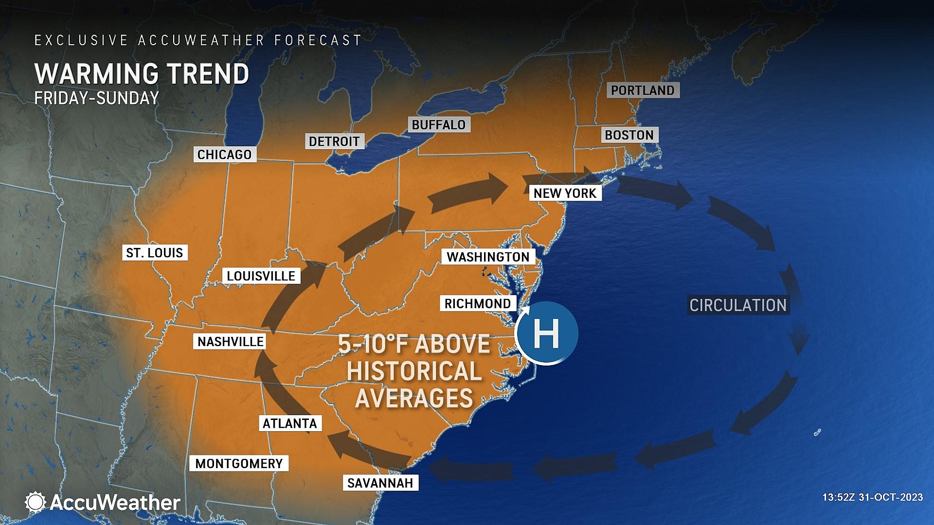
The good news is that we do have a warmup on the way, kicking on Friday. As temperatures shoot back into the 50s and 60s, we should have a nice stretch of weather through the weekend and early next week. Meanwhile, our weather stays high and dry for about a week.
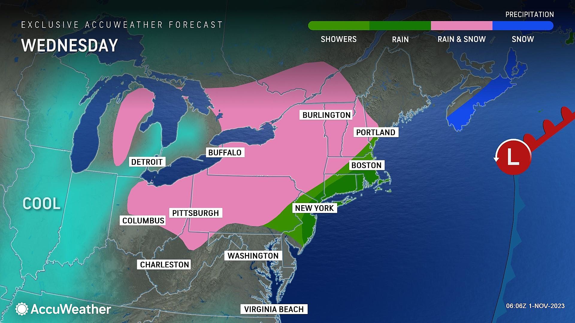
Wednesday
For the fourth day in a row, we do have to talk about some raindrops in the forecast. Showers and drizzle are frontloaded, with wet weather exiting the Garden State by Noon at the latest. As of this writing (6 a.m.), light rain is parked over northern and eastern New Jersey — that will likely be the dampest part of the state Wednesday morning.
As we dry out, by late morning into Wednesday afternoon, skies will start to clear from southwest to northeast. But temperatures will not respond. Highs will only reach about 50 degrees — similar to or slightly cooler than Tuesday. And we'll pick up an occasional chilly breeze, blowing out of the northwest up to 20 mph.
Wednesday night will be cold. Period. With clear skies, calming winds, and that cold/dry air mass, temperatures will really plummet. On average, lows will end up in the lower 30s by Thursday morning.
A Freeze Warning has been issued for almost all of inland New Jersey, in effect from late Wednesday night through Thursday morning. For most of New Jersey, this one doesn't mean much. It does not suggest there will be icy spots around. It does not mean you should cancel plans or not venture out of your house. It's not going to be bone-chillingly frigid. A Freeze Warning does mean gardeners and farmers should be aware that the growing season is about to come to an end. Frosty grass and windshields are a good possibility.
The only places insulated from a potential freeze Wednesday night are the immediate coast and city centers. A hard freeze is possible in northwestern New Jersey — my latest forecast puts thermometers as low as 26 degrees.
Thursday
You might be reaching for the heavier coat Thursday morning, thanks to that cold start. And it will be a chilly finish, as high temperatures only reach the upper 40s to around 50 degrees. That is 10+ degrees below normal for early November.
Skies will be sunny. Weather will be dry. Winds will be light.
Friday
Friday morning will also be cold, with another potential widespread frost/freeze on the table. But as winds shift to blow from the southwest Friday, warm air advection will kick in.
Again, we'll see sunny skies and only a light breeze. Highs should push into the mid 50s. Still below seasonal normals, but we're getting there.
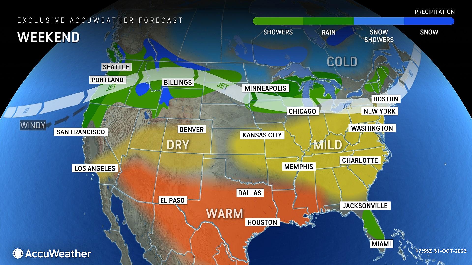
Saturday & Sunday
After eight weekends in a row with measurable rain in New Jersey, the first weekend of November could break the streak. Yes, a 100% dry weekend is a good possibility.
(Worth noting: There is one model — the NAM — that paints a spotty shower over NJ Saturday morning. But I do not see a compelling reason for those raindrops, so I am keeping the forecast dry for now.)
Saturday will feature a mix of sun and clouds, with high temperatures pushing into the lower 60s. A nice November day.
In a classic NJ weather paradox, Sunday trends warmer but cloudier. Forecast highs reach the mid 60s.
The Extended Forecast
We will keep 60s for Monday and possibly Tuesday too, before the inevitable cooldown arrives. The exact timing of tumbling temperatures is in question this far away. And also whether that cold front will drive in any showers. Right now, model guidance leans toward a dry solution.
No worries though, as that is 6-7 days away. If you're a fan of cold fall weather, enjoy the next few days. If you like cool fall weather, the weekend will be great.
LOOK: Which movies were filmed in New Jersey?
Gallery Credit: Stacker
LOOK: Most common jobs 150 years ago in New Jersey
Gallery Credit: Stacker
More From WPG Talk Radio 95.5 FM


