
NJ Weather: Cold Air Punctuated By a Chilly Breeze and Flurries
The Bottom Line
Unseasonable cold will continue to chill New Jersey for two more days. Still nothing dramatic or extreme for now — just a chilly breeze and some flurries. High temperatures will barely reach the 40s for both Wednesday and Thursday.
A warmup kicks in starting Friday, pushing thermometers back into the 50s.
60 is a possibility this weekend.. But here comes our next weathermaker, a strong cold front set to arrive on Sunday. That will drive in a period of heavy rain and potentially gusty winds to close out the weekend. To be perfectly clear: It will be wet, not wintry.
Wednesday
A chilly breeze will kick up throughout Wednesday, blowing out of the north-northwest up to about 20 mph. Keeping the cold air moving around, and adding a little bite to it.
Most of the state is not frozen to start the day, thanks to a blanket of clouds that prevented temperatures from really tanking.
Highs on Wednesday afternoon will only reach the lower 40s. A few degrees colder than Tuesday — and you will really feel that with the breeze and the clouds. And we are holding 5 to 10 degrees below normal for early December.
Although our air will be quite dry on Wednesday, there may be enough energy to spark some flurries and/or sprinkles. No accumulation or travel impacts — just adding to an overall less-than-perfect weather day.
Skies should substantially clear Wednesday night. And that means temperatures will nosedive. We should average upper 20s by Thursday morning — a freeze for non-coastal and non-urban areas.
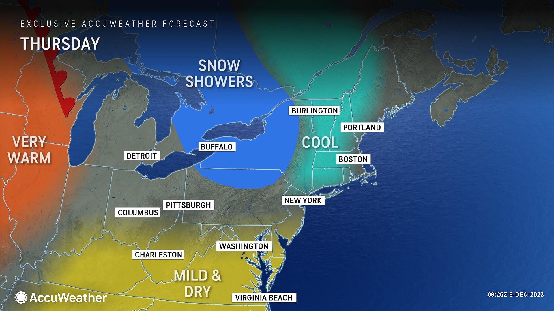
Thursday
An even better chance of snowflakes will supplement the coldest day of the week.
Highs on Thursday will barely reach 40 degrees. Once again, clouds will dominate the sky, with some breaks of sun.
A weak disturbance could spark an outright snow shower during the daytime hours Thursday. Some models hint at a trace of accumulation in spots — just enough to whiten up the ground. However, travel impacts are highly unlikely. Based on the trajectory, the best chance for some flakes will be to the south and west.
Friday
Let the warmup begin. Friday should be a decent day, as we clear to partly sunny skies. There are some differences amongst model guidance about just how warm it will (or won't) get. I like a forecast of lower 50s. That is 10+ degrees warmer than the day before. And slightly above seasonal normals for this time of year.
Saturday
Again, Saturday looks pleasant and dry. Expect a mix of clouds and sun, with mild temperatures pushing into the mid 50s.
Sunday
Sunday will be warm. But — eventually — wet.
You may salvage several dry hours Sunday morning. But as a strong cold front approaches, steady rain will fill-in from west to east. As it stands right now, the most likely timing for wet weather will be Noon to Midnight. That rain looks to be particularly heavy into Sunday evening.
And I do mean heavy. Over the course of a few hours, we will get soaked by about 1 to 2 inches of rain. Enough for some big puddles, for sure. (Especially since leaf piles are still blocking storm drains out there.) I do not think the dynamics will be present for widespread thunder and/or severe weather.
Gusty winds are a concern too, as a screaming fast low-level jet develops overhead. If those 75 mph winds aloft even partially mix down to the surface, we could easily see some ambient gusts in the 40+ mph range.
As rain ends Sunday night, cold air will return. But the cooldown will not be fast enough to cause a transition from rain to snow. Once again, wet not wintry.
The Extended Forecast
The cooldown settles in for early next week. Monday will be blustery, with temperatures settling in the lower-mid 40s in the afternoon. Tuesday looks calmer and more seasonable in the mid-upper 40s. Both days should feature plenty of sunshine, at least.
There are no significant winter storms in the forecast for the next week and a half. Just more flip-flopping temperatures, as we eye the Winter Solstice coming up in 15 days.
Humorous Signs Return to New Jersey Highways
Gallery Credit: Dan Alexander
Biggest NJ company layoff notices in 2022 and 2023
Gallery Credit: Erin Vogt
More From WPG Talk Radio 95.5 FM


