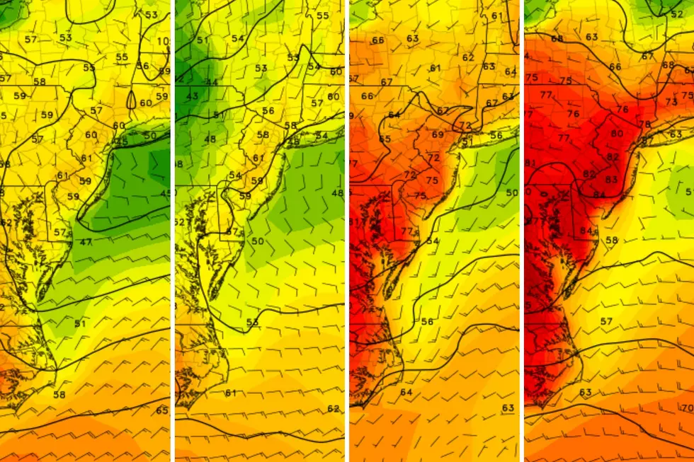
NJ’s weather settles down for the last few days of January
The Bottom Line
The past few days have been pretty dreary and pretty dismal. The whole month of January has been active with storms, both wintry and wet.
We have some improvements on the way. Not only in the form of drier weather and brighter skies. But also rising normal temperatures — as the calendar page turns from January to February, we mark the end of the "dead of winter". Days get slightly longer and temperatures trend slightly warmer (on average).
At the beginning of winter, almost every seasonal forecast called for a "backloaded" snow season. So we still have plenty of wintry potential in February and March. Having said that, there is no threat of widespread accumulating snow for New Jersey within the next 7 to 10 days.

Monday
The day begins with a continuation of this weekend's blah, damp, raw weather. But I promise our weather will start to improve by lunchtime.
As of 6 a.m., there are a couple bands of showers along with patchy drizzle and light fog around the Garden State. You will probably need the umbrella and windshield wipers through the morning commute.
Temperatures are starting in the 30s. Almost the entire state is above the freezing mark. While there could be some snowflakes or ice pellets mixed in with raindrops, only wet weather travel impacts are expected. Not wintry.
By around 10 a.m. Monday morning, showers and drizzle should exit the Garden State. The rest of the day will be mostly cloudy. But I do expect some breaks of sun (with abundant clouds) through the midday and afternoon hours.
High temperatures will inch into the upper 40s Monday afternoon. Close to normal for this time of year. It will be breezy at times too.
Monday night stays quiet and dry. Let's call it partly cloudy, with seasonably chilly low temps around 30.
Tuesday
A dry weather day. We will see a mix of sun and clouds across Tuesday. (Leaning more toward sun in the morning and clouds in the afternoon.)
We will be in a cool air mass though, with high temperatures only reaching the upper 30s. Light winds, dry air, no weather headaches.
Wednesday
A clipper system is forecast to dive south of New Jersey on Wednesday. While we will miss the main body of that storm system, the increase in cloud cover, moisture, and on-shore winds will bring a one-day return of cloudy, dreary weather.
In addition, I think some sprinkles and/or flurries are possible on Wednesday. It should not be an all-day or incredibly impactful weather event. (In fact, I have left raindrops and snowflakes off the 5 Day Forecast for now.)
Highs on Wednesday will pop back into the lower 40s or so.
Thursday
Thursday is the shining star of this week's weather forecast. Easily the nicest day of the week.
With partly sunny skies, a light southwest breeze, and completely dry weather, high temperatures on Thursday will shoot for about 45 to 50 degrees. Not quite "warm" — but not too shabby!
Friday & Beyond
Our next storm system rolls in on Friday, a cold front that will drive in some showers and then a cooldown.
The extent and duration of rain is a bit in question. (In other words, could we salvage part of Friday afternoon?) I think it will be warm enough — in the 40s — to avoid any big wintry issues. But we will have to watch for some snowflakes on the backend of that system, especially in North Jersey.
This weekend, we will fall into a cold, dry air mass. Saturday will be sunny and blustery, with highs only in the 30s. About the same for Sunday.
As I mentioned earlier, there is no strong signal toward widespread snow for the foreseeable future. Through about mid-February.
LOOK: Best high schools for sports in New Jersey
Gallery Credit: Stacker
Dan Zarrow is Chief Meteorologist for Townsquare Media New Jersey. Follow him on Facebook for the latest forecast and realtime weather updates.
LOOK: Counties with the highest unemployment in New Jersey
Gallery Credit: Stacker
More From WPG Talk Radio 95.5 FM


