Unsettled weather returns to NJ: Clouds, rain, possible flooding
The Bottom Line
We bid a fond farewell to sunshine for a few days, as unsettled weather conditions take over New Jersey's sky once again. First, clouds and drops of drizzle roll on a persistent on-shore breeze. Then, a series of disturbances ride along a very slow-moving stationary boundary, producing periods of rain.
In fact, New Jersey's forecast has trended considerably wetter, with 1 to 2+ inches of total rainfall now on the table. That may be enough to spark another round of ponding and flooding issues, among our saturated ground and swollen waterways. Especially to the south and east, centered on Thursday.
Our weather should largely clear out and calm down just in time for the holiday weekend. But even that won't be a perfect forecast, with some wind and a shower chance to talk about.
Tuesday
Just OK. Not the prettiest weather day, Tuesday will trend cooler and cloudier than Monday. But it will be mainly dry.
We are still under the influence of a northeasterly (on-shore) breeze. That will help to fuel a noticeable increase in cloud cover Monday morning. And we could see a few sprinkles or drops of drizzle too. (But again, I am comfortable calling it a "mainly dry" day overall.)
After starting the day in the 30s, highs will only reach the mid to upper 40s Tuesday afternoon. Below normal for late March. And definitely "jacket weather".
Tuesday night stays quiet and mostly cloudy, with patchy fog a possibility. Lows will once again dip into the upper 30s.
Wednesday
There is an uncomfortable uncertainty surrounding the forecast for Wednesday into Thursday, as our weather turns increasingly unsettled.
At the very least, it will be another mostly cloudy day. With a few rain showers developing, especially late-day. High temperatures will rise no farther than the lower 50s.
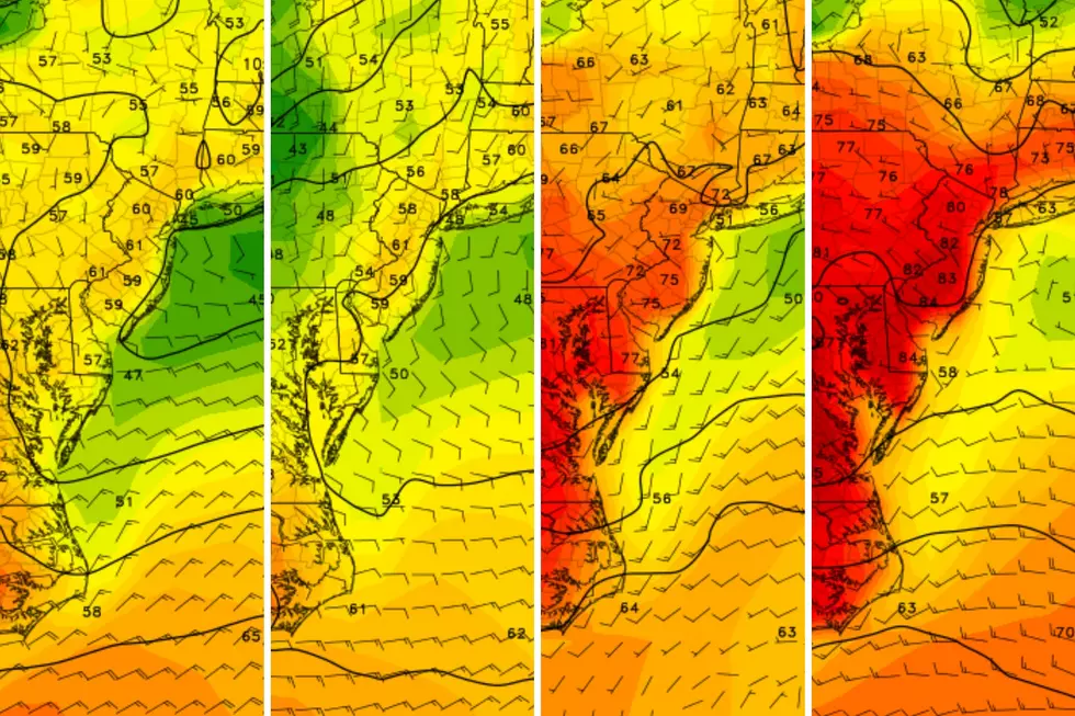
There are some forecast model solutions — namely the short-range NAM — that paint a much wetter Wednesday afternoon and evening, as bands of steady rain set up over the Garden State. I am leaning away from such a scenario at this time, but it is worth keeping in mind.
Bottom line for Wednesday: Carry an umbrella, since you probably will get wet at some point.
Thursday
You will definitely get wet on Thursday. It is just a matter of how heavy that rain will be.
I am confident that the southern and eastern edges of New Jersey will get soaked by a plume of steady to heavy rain on Thursday. The wettest estimates put total rainfall at or over 2 inches in that zone. Yet again, that is a lot of water, and could cause some ponding and flooding issues through the day Thursday. (Read: Big puddles.)
Farther inland, I think you'll still see some rain on Thursday. From there, the forecast gets really fuzzy. There are two very different possibilities:
1.) Northern and western NJ may fall completely outside of that "highway of heavy rain," picking up less than an inch.
2.) A more inland storm track could bring 1 to 2 inches of rain across a wide swath of New Jersey.
Bottom line? Prepare for a wet, potentially sloppy day Thursday. It should not be as wet and dramatic as last Saturday (and previous flooding events this winter). Umbrellas up, windshield wipers on.
Friday
By the time you wake up Friday morning, skies should have cleared to sunshine. We will dry out Friday. But there will be a new weather nuisance: wind.
A northwest wind will likely gust over 30 mph for much of Friday, adding a blustery characteristic to the day. Despite the pressure gradient induced wind, the newly-arriving air mass will not be dramatically different than the departing one. High temperatures on Friday should still reach the seasonable 50s.
The Extended Forecast
The rest of the Easter Weekend should feature bright skies and warming temperatures.
The only potential hiccup is a batch of spotty showers from late Saturday into each Sunday.
My latest forecast shows a breezy Saturday, with a mix of sun and clouds and that shower chance. High temperatures should reach into the mid 50s.
60s are possible for Easter Sunday, our next instance of substantially above-normal temperatures.
And then ... it's April! There will be some April showers around next week. Temperatures should stay relatively close to normal, with no dramatic warmups or cooldowns showing up in medium to long range forecast models.
Final flakes: When does snow season end in NJ?
Gallery Credit: Dan Zarrow
NJ is a top producer of these crops
Gallery Credit: Dino Flammia
More From WPG Talk Radio 95.5 FM


