
NJ weather: Spring will begin with a little taste of winter
The Bottom Line
March is all about temperamental temperatures. We have been so spoiled by spectacular springlike weather lately, with thermometers reaching into the 60s and 70s. Now it is time for the pendulum to swing in the other direction, as a February-ish chill returns for most of this week.
The coolest days will be Tuesday, Thursday, and Friday, as temperatures may not escape the 40s. Plus, we are facing our first widespread freezes in almost three weeks.
Among the unseasonable chill will come relatively quiet weather. It will be breezy more often than not. And we will see a few rain/snow showers around, especially on Wednesday. Our next threat for a substantial storm system will be at the end of the week, eyeballing Friday night into early Saturday for potential rain.
Monday
Overall, not a terrible day. We will stay completely dry. Skies will be bright to start. And temperatures close to seasonal normals.
We are starting out in the 40s across most of New Jersey on this Monday morning. To the northwest, however, it is considerably colder — in the 20s and 30s in Sussex and Warren counties. That is a reinforcing shot of colder air that will spread throughout the state Monday.
The biggest impact of that cold air push? A chilly breeze, that will become especially noticeable through the afternoon. While we will start with partly sunny skies Monday, clouds will thicken up later on.
High temperatures on Monday will be around 50 degrees. I could see a few spots flirting with mid 50s — it all depends on when the chilly breeze and cloud cover put a stop to the warming for the day.
Monday night will be notable as it becomes New Jersey's first widespread frost/freeze since the first of March. Low temperatures will bottom out in the lower 30s. (It will be a little warmer near cities and the coast.) For the record, freezing temperatures are not unusual in mid to late March — normal lows right now are 33 to 35 degrees.
Tuesday
Pretty cold. February-ish. In fact, by the numbers, my forecast shows Tuesday to be New Jersey's coldest day since February.
Not exactly ideal for the first day of Spring. The Vernal Equinox officially arrives at 11:06 p.m. Tuesday.
After a potential freeze in the morning, Tuesday's high temperatures will only reach the mid 40s. That is running about 5 degrees below normal for this time of year.
We should enjoy lots of sunshine throughout the day, with some late-day clouds building. It should be a completely dry day once again. But the chilly breeze will still be with us, gusting out of the west up to 20+ mph.
Wednesday
The chill will relax on Wednesday, allowing high temps to reach about 50 to 55 degrees.
We will see a mix of clouds and sun on Wednesday, likely leaning toward more cloud cover than breaks of blue.
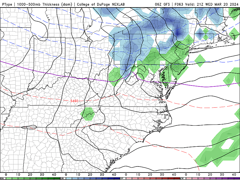
Forecast models are picking up on shower chances on Wednesday too. One quick flurry in the morning in North Jersey. And then a more organized batch of spotty rain/snow showers around the late afternoon. I do not anticipate any accumulations, nor any travel issues. Just a little spurt of snowflakes and raindrops. Precipitation will largely be based on timing, day vs. night.
Thursday
Another shot of chilly air will hold temperatures below normal for the end of the workweek. Thursday will be mostly sunny and (hopefully) not as breezy. High temperatures will only reach the mid 40s.
Friday & Beyond
Expect 40s on Friday too, with increasing clouds and a stiff breeze. Almost same story, different day.
We are watching our next big weathermaker, a coastal storm that will slide by New Jersey in the Friday night to Saturday morning time frame. There are still a few solutions on the table, ranging from a lot of rain to only showers. There could be a minor wintry component among the higher elevations of northwestern NJ. There will probably be some coastal flooding concerns along the Jersey Shore.
For now, just know that the first weekend of Spring will probably start wet. But the forecast for the rest of Saturday and Sunday looks fine, with temperatures hopefully warming into next week.
Must-visit NJ shops with homemade chocolate
Gallery Credit: Erin Vogt
2024 Philadelphia Flower Show
Gallery Credit: Jen Ursillo
More From WPG Talk Radio 95.5 FM


![Atlantic City, NJ Entertainment For 2026 Is Off The Charts [Photos]](http://townsquare.media/site/564/files/2026/04/attachment-img_0327.webp?w=980&q=75)

![Best Lobster Mac & Cheese In The Atlantic City, NJ Area [Photos]](http://townsquare.media/site/564/files/2026/04/attachment-img_0245.jpeg?w=980&q=75)


