
Another round of strong storms Thursday evening: Wind, rain, and more for NJ
Wednesday was such a wonderful weather day. So it's hard to talk about the return of heat, humidity, and summertime thunderstorms. But here we are, with a trio of potentially nasty weather days.
—The Return of Heat and Humidity... Dew points are already surging toward 70, and high temperatures Thursday are expected to top 90 degrees across inland New Jersey. Heat index ("feels like" or "apparent" temperature) about 95. As we talk about so often, that will not only lead to a sultry, summery day, but the heat and humidity will also fuel thunderstorms that are sparked later on.
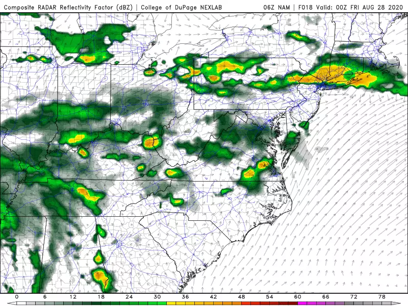
—Timing: 6 p.m. to 11 p.m... As an area of low pressure tracks to our north, the trailing cold front is expected to spark a line of thunderstorms Thursday evening. Forecast models are in good agreement that storm action won't fire up in North Jersey until around 6 p.m. Thursday evening. They'll arrive fast, and punch hard. Thunderstorms should exit and/or pulse down by 11 p.m.
—Wind, Rain, Hail, Tornado... This storm system presents a smorgasbord of severe weather concerns. Number one is wind. With a screaming low-level jet overhead (85 mph winds up in the atmosphere), these thunderstorms will be capable of producing severe 60-70+ mph wind gusts at the surface. Heavy rain is also likely, which may lead to flooding. The risk of golf ball size hail and tornadoes depends on the "mode" of these storms. If it is linear, hail and tornadoes are possible, but not our biggest headache. If the storms are scattered and cellular (or supercellular, meaning they rotate), look out.
—SPC Outlook... It is rare that New Jersey falls under an "Enhanced Risk" of severe weather, by the Storm Prediction Center's daily outlook. (That's the 3rd highest risk category.) It is even most unusual for it to happen twice in one week. Luckily, Tuesday's thunderstorms were more isolated than expected. But today's highly charged atmosphere is absolutely worthy of ringing alarm bells once again.
—Geography... As I mentioned, the strongest thunderstorms are primarily expected to crash through the northern half of the state. However, strong to severe thunderstorms may drift into southern New Jersey later Thursday evening too. Everyone in the state needs to remain weather aware here.
—Friday Thunderstorms... Another round of scattered thunderstorms is expected late-day Friday. I'm thinking storm timing will be about 4 p.m. to Midnight. Once again, there will be a rain and wind and lightning threat. The risk of organized hail or a tornado will be much lower this time around.
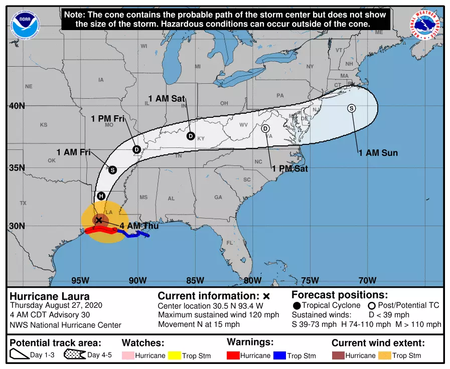
—Laura... Laura made landfall near Cameron, Louisiana early Thursday morning, as a category 4 major hurricane. As the storm swings north and then east, we'll experience Laura's remnants on Saturday — likely a "post tropical depression" at that point. Rainfall totals over an inch are possible. Wind gusts over 30 mph are possible. Embedded severe thunderstorms (including tornadoes) are possible too. But there's nothing overly hype-worthy here — to me, Saturday really reads like a yucky, rainy, windy day. New Jersey's worst weather will likely occur in the afternoon hours.
Be smart and stay safe out there today. I am on leave for the remainder of this week, but our outstanding weather, news, traffic, programming, and digital teams will continue to keep you updated before, during, and after these powerful storms.
Dan Zarrow is Chief Meteorologist for Townsquare Media New Jersey. Follow him on Facebook or Twitter for the latest forecast and realtime weather updates.

More From WPG Talk Radio 95.5 FM


