
The heat is on for NJ: Summerlike 80s, poor air quality
Hazy sunshine. Very warm temperatures. Sticky humidity. Air quality concerns. It sounds like a typical midsummer day for New Jersey, but that is our forecast for Wednesday and Thursday as we face the warmest stretch of weather since September. The heat will break with a shot of rain this weekend.
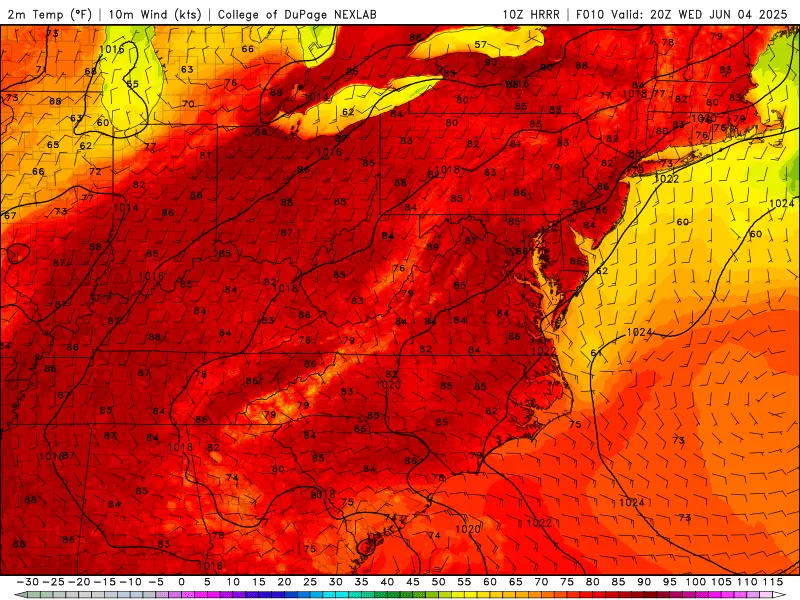
Wednesday NJ weather: Heating up
Tuesday was such a beautiful day, wasn't it? Bright sunny skies, seasonably warm temperatures near 80, low humidity, and a light breeze. I would take such spectacular weather any day.
Wednesday will be slightly different. 5 degrees warmer. And more humid, as dew points bump into the 60s. That will make a big difference in the "sweat factor" of the day, especially since we are not yet acclimatized to summertime heat and humidity this year.

Wednesday morning is beautiful, with temperatures mainly in the 50s. Soon enough though, thermometers will soar into the mid 80s. That would be typical in late July or early August. Here in early June, it is a full 10 degrees above seasonal normals.
Along the Jersey Shore, the influence of the 64-degree ocean will be readily apparent as a sea breeze kicks in. Mainland beaches will be limited to the 70s Wednesday afternoon. Barrier islands might get stuck in the 60s, surrounded by that (relatively) chilly water.
Expect hazy sunshine and a completely dry weather day throughout Wednesday.
An Air Quality Alert has been issued has been issued for much for New Jersey on Wednesday — basically the "Turnpike corridor," away from NW NJ and the coast. This is cautioning of both elevated ground-level ozone concentrations (due to heat) and fine particulates (due to Canadian wildfire smoke).

It is a "Code Orange" day, which means the air may be unhealthy to sensitive groups such as the very old, the very young, and those with preexisting respiratory issues. If you fall into one of those categories, you should spend as much of the day indoors as possible.

Wednesday night will stay clear and quiet, with a hint of stickiness in the air. Look for low temperatures in the mid 60s.
Thursday NJ weather: The hottest day of the week
The summertime heat continues on Thursday, as high temps soar into the 85 to 90 degree range.
It will likely be the 2nd or 3rd day this year that a thermometer in NJ hit 90+. (Depending whether it happens Wednesday too.) That is hot!
Expect a mix of sun and clouds. With a cold front stalled just north of New Jersey and another storm system developing to our south, a spot shower is not impossible — but I do believe the vast majority of NJ will stay dry and hot.

The haze and air quality concerns will likely continue into Thursday too.
Friday NJ weather: Still very warm
That spot shower chance on Thursday will carry into Friday too. Otherwise, it will be another warm, humid, and uneventful day.

Skies will be partly sunny, with highs in the 80s.
Saturday NJ weather: Watching raindrops
That stalled front will finally shove southward through New Jersey as we start the weekend. (Yes, even weather systems want to head for the Jersey Shore on the weekend!)

It should not translate to an all-day rain event. But we will likely see a round of scattered showers and thunderstorms around the morning and early afternoon hours on Saturday. That means everyone in New Jersey potentially gets wet at some point.
I am concerned about the potential for localized downpours, given the heat and humidity in the air. So while it will not be an all-day washout, rain could be impactful in short spurts.
Because of the rain and mostly cloudy skies, temperatures will probably get stuck in the 70s on Saturday. Those "moderate" humidity levels will become even more noticeable with relatively cooler temperatures — so it will "feel" like an unsettled weather day.
Sunday NJ weather: The shining star of the weekend
As long as Saturday plays out as forecast, I expect Sunday to be a fantastic weather day.
Early clouds give way to sunshine, allowing high temps to return to the warm lower 80s. Dew points drop a little bit, allowing for some relief in humidity. There should be a nice breeze keeping the warm air moving around too.
Pleasantly warm weather will hopefully carry into early next week too, before our next chance of thunderstorms arriving late Tuesday.
It's here! The complete 2025 NJ county fair summer schedule
Gallery Credit: Mike Brant
Dan Zarrow is Chief Meteorologist for Townsquare Media New Jersey. Follow him on Facebook for the latest forecast and realtime weather updates.
The complete list of names for the 2025 Atlantic Hurricane Season
Gallery Credit: Dan Zarrow
More From WPG Talk Radio 95.5 FM


