
Feeling Like February: NJ Turns Colder Again as Snow Stays South
Thursday's big story in the weather world is a storm system digging through the mid-Atlantic. Accumulating snow — possibly up to 8 inches — is possible for parts of Virginia and North Carolina.
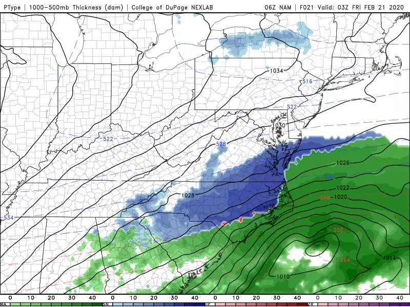
New Jersey will find itself on the very northern edge of this system. Close enough to drag in some cloud cover. Possibly close enough for some snow showers. But our big headline here is a (temporary) return to cold temperatures.
Yes, it feels like February again! Temperatures on this Thursday morning have mainly dipped into the 20s. (Teens in NW NJ, lower 30s along the Jersey Shore.) As we have discussed, it's neither frigid nor dangerous cold. Just time to dig out the heavier coat, hat, and glove for a day or two.
High temperatures Thursday afternoon will be limited to the upper 30s. That is 5 to 10 degrees below normal for mid-late February. Skies will range from partly sunny in North Jersey to cloudy in South Jersey. And again, a few snowflakes are possible in southern New Jersey late-day.
Things will get even colder Thursday night. As skies clear out, thermometers will bottom out in the upper teens by early Friday morning. And with a little breeze kicking up, my wind chill calculations come awfully close to the single digits.
We'll face one more unseasonably chilly day Friday, with high temperatures only in the mid 30s. It will be a much brighter day than Thursday though, with sunshine and dry weather.
As the last full weekend of February approaches, we're facing abundant sunshine and warmer temperatures. This forecast looks pretty good!
Sunny skies on Saturday and a switch from northerly to westerly winds will push high temperatures into the upper 40s.
Sunday's highs will reach the lower 50s, with mostly sunny skies.
We'll see 50s on Monday too, before our next storm system becomes a concern. Rain is currently modeled to arrive late Monday through much of Tuesday. Once again, this looks wet and not wintry. And we'll likely see another cooldown for the second half of next week.

More From WPG Talk Radio 95.5 FM


