Light Snow for Almost All of NJ Sunday
Good morning. I just wanted to give a quick update on New Jersey's super snowy Sunday situation, as the forecast has changed a bit.
Cold air is back. As of this writing (6 a.m.), temperatures are hovering around 30 degrees, as light to moderate snow falls across almost all of New Jersey. (Surprisingly, thermometers are holding on to upper 30s in South Jersey, for now.)
The primary snow band set up about 30 miles farther northwest than expected. That means almost everyone in the state could now see up to a few inches of accumulation Sunday. Meanwhile, the southern coast (which had been the "bullseye" for snowfall) will actually miss out on snow for the first part of the day.
It's hard to believe it was 60+ degrees just 12 hours ago!

The northward jog in storm track also means snow may linger over New Jersey into a good part of the afternoon. It will all be light to occasionally moderate in intensity.
To be clear: this is still nowhere near a "major" winter storm. The main core of low pressure will miss the New Jersey coast by hundreds of miles.
I do not redraw my snow forecast map after a winter storm has already begun — it gets way too confusing, and it's kind of "cheating". But I would estimate that all of New Jersey (outside of Atlantic, Cape May, and Cumberland counties, perhaps) could see 1 to 3 inches of accumulation by the end of the day.
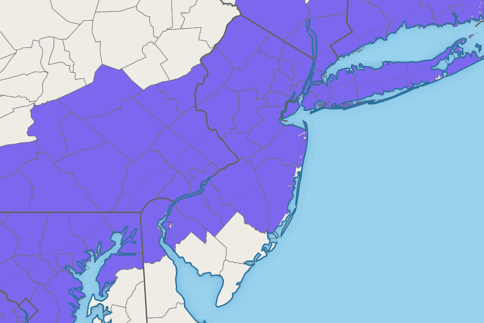
Accordingly, the National Weather Service adjusted their Winter Weather Advisory to cover 18 of NJ's 21 counties Sunday:
—Until 1 p.m... Bergen, Essex, Hudson, Hunterdon, Mercer, Middlesex, Morris, Passaic, Somerset, Sussex, Union, and Warren.
—Until 4 p.m... Burlington, Camden, Gloucester, Monmouth, Ocean, and Salem.
An advisory cautions that travel may become hazardous due to snowy, icy road conditions and/or reduced visibility.
The impacts has not changed. I suspect grassy areas and cars are already snow-covered across most of the state. I just did a tour of traffic cameras, showing main roads are really just wet so far. However, there have been several accidents reported already. So be super careful if you're heading out. And make sure to brush all the snow off your vehicle first.
The extended forecast shows a cold, quiet Valentine's Day, with temperature stuck below freezing all day. A warming trend will take over through midweek. Our next storm system arrives Thursday night with heavy rain, followed by a cooldown. Beyond Sunday, there are no snow storms on the horizon for New Jersey.
LOOK: 20 Fascinating Photos From the First Modern Olympic Games in 1896
NJ Diners that are open 24/7
More From WPG Talk Radio 95.5 FM


