Day Full of Tornado Warnings, Floods, Storms — NJ a Mess of Dangerous Weather
A new tornado warning has passed for the Trenton area — the second such warning in New Jersey today. But alerts for dangerous weather throughout the state remained
A tornado warning is issued when a tornado is imminent or occurring. The Trenton-area warning lasted until 6 p.m.
An earlier tornado warning issued for a sliver of New Jersey — in the area around Lambertville, including nearby NJ and Pennsylvania towns — expired earlier in the afternoon. There was weak rotation in that storm, capable of producing a tornado. Locations in the warning included Stockton and Lambertville.
The National Weather Service issued severe thunderstorm warnings for several towns throughout the afternoon, though several have now passed. A severe thunderstorm warning for Lakewood, Sayreville and Old Bridge was in effect until 5:30 p.m. Warnings for Toms River, Trenton and New Brunswick were to continue until 6:45 p.m.
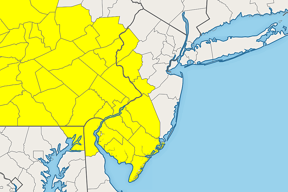
A Tornado Watch has been issued until 8 p.m. for 10 counties in western and southern New Jersey: Atlantic, Burlington, Camden, Cape May, Cumberland, Gloucester, Hunterdon, Mercer, Salem, Warren. A Tornado Watch means severe weather - including tornadoes, wind, hail, and flooding - is likely to occur. It does not mean you need to seek shelter immediately, nor that a storm is guaranteed to hit you — it is just a formal "heads-up" to potentially dangerous conditions.
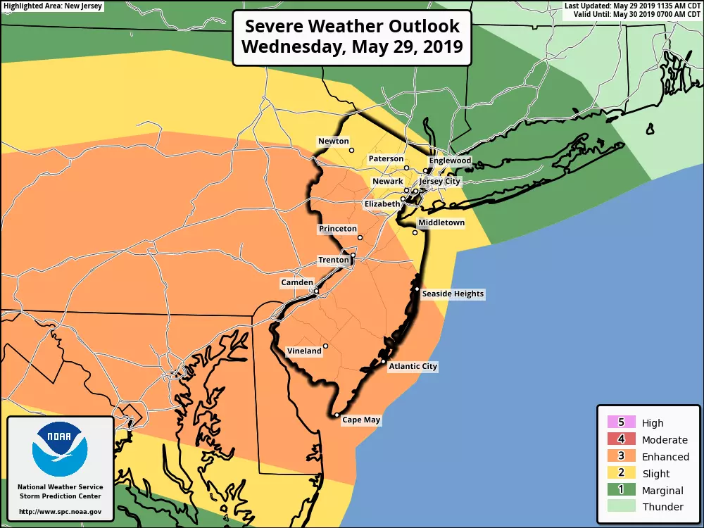
Just like Tuesday, the Storm Prediction Center estimates a 5% tornado risk, a 30% severe wind risk, and a 30% hail risk for most of New Jersey.
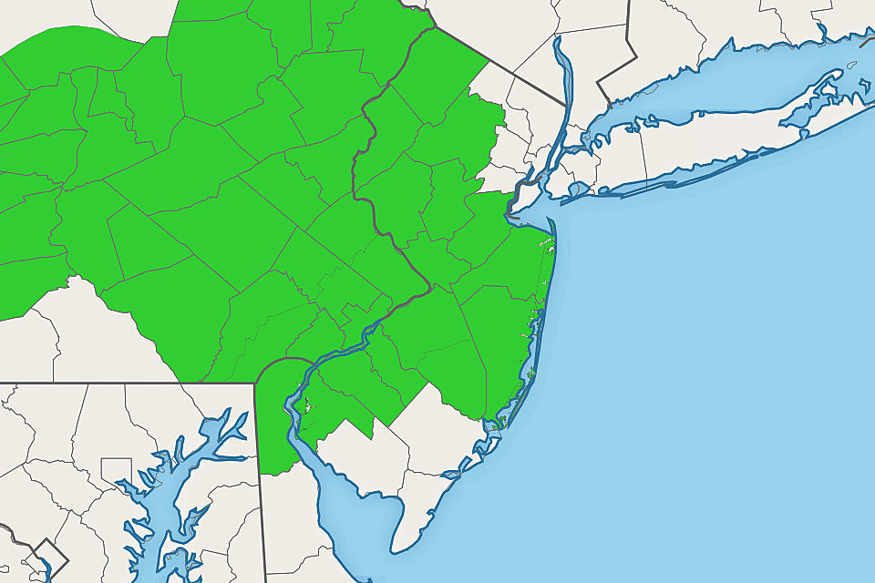
Additionally, a Flash Flood Watch is posted from 4 p.m. to 2 a.m. for 13 NJ counties: Burlington, Camden, Gloucester, Hunterdon, Mercer, Middlesex, Monmouth, Morris, Ocean, Salem, Somerset, Sussex, and Warren. 1 to 2 inches of rain may fall in a very short period of time, inundating storm drainage systems and causing ponding and flooding issues on roads and in low-lying areas.
By mid-afternoon, storms were popping across Pennsylvania and starting to move across the Delaware River into New Jersey. The timeline for this round of severe weather is a bit earlier than Tuesday's. The strongest storms and the greatest tornado risk will occur through sunset — about 8 p.m., coinciding nicely with the official watch. Additional thunderstorms and showers are possible through about Midnight.
Yet again, it will be very important to stay "weather aware" through this afternoon, the evening commute, and beyond. As we saw on Tuesday, these powerful storms are capable of producing some dramatic damage. If a tornado, severe thunderstorm, or flash flood warning is issued for your area, you'll want to stay inside a sturdy building.
More From WPG Talk Radio 95.5 FM