
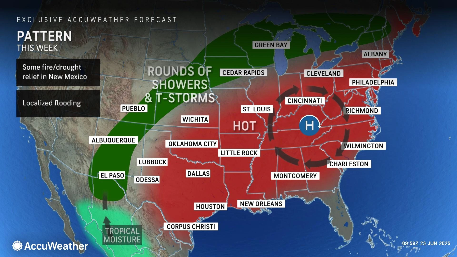
NJ’s first heat wave of 2025 is on: Two days of triple-digit temps
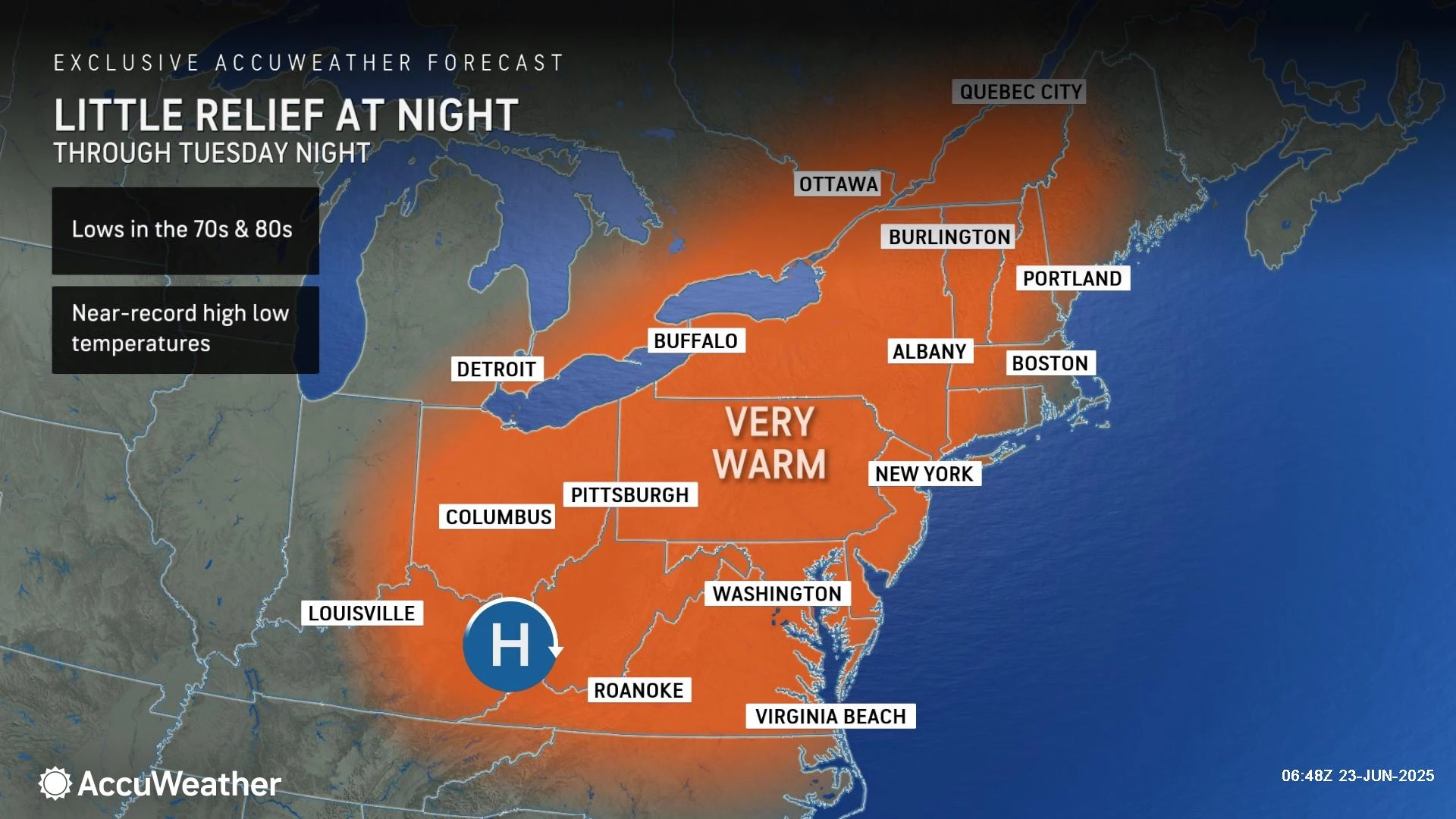
The heat is on, with an Extreme Heat Warning now in effect for most of New Jersey until Wednesday. Monday and Tuesday will likely be the worst of it, as high temperatures will reach about 95 to 100 degrees. Factor in humidity, and you get a heat index as high as 110 — downright dangerous. Nighttime low temperatures will only dip to around 75 to 80, making for uncomfortable, muggy conditions. The heat wave will extend into Wednesday and Thursday, before we get a round of thunderstorms and then brief relief.

Monday NJ weather: Hot, steamy soup
There's regular summertime heat, and then there's dangerous heat. This heat wave will absolutely fall into the latter category, as temperatures soar and humidity remains steamy.
It is already warm to start Monday morning, with temperatures near 80 degrees. Highs on Monday should reach about 95 to 100 degrees across most of New Jersey.
There are a few important notes here:
1.) Sunday's temperatures underperformed due to surprise morning thunderstorms. We did hit 90 in a few places, but only 90. Because that will not happen Monday, there is nothing in the way of ferocious temperatures this time around.
2.) When you factor in the high humidity, you get the heat index. We often call it the "feels like" or "apparent" temperature — more importantly, it is an indicator of how hot weather will affect human health. The heat index will reach about 100 to 110 degrees. Definitely in the "danger zone".
3.) There will be some relief at the Jersey Shore Monday, as a sea breeze should set up by the afternoon. That means the mile or two closest to the oceanfront will be golden — likely in the 80s, and up to 20 degrees cooler than a few miles inland.
The chance of rain is very low Monday. We will see lots of blazing sunshine overhead, with some clouds building in by late afternoon.
Monday night stays warm and muggy. Often, one of the worst parts of a heat wave is when the environment can not cool down, reset, and refresh at night. Lows will only dip into the mid 70s or so. Sweltering city centers may not drop below 80 degrees — yuck.
Tuesday NJ weather: More of the same
We'll do it again. Monday and Tuesday will battle each other as the "worst" day of this 6-day heat wave.
Expect highs in the upper 90s to 100 degrees. The heat index will again reach well into the triple digits. With mostly sunny skies, only a light breeze, and dry weather.
Wednesday NJ weather: A few degrees cooler
The heat wave rolls right along into Wednesday. With a mix of sun and clouds, the forecast calls for slightly cooler temperatures. But highs in the mid 90s are still unseasonably and potentially dangerously hot.
Forecast models do suggest an isolated shower may pop up early Wednesday evening. Best chance for raindrops looks to be in northern New Jersey.
Thursday NJ weather: Steamy then stormy
Changes to our steamy weather begin on Thursday, with relief on the way! Eventually...
Thursday should be the 6th and final day of this heat wave, with high temperatures in the lower 90s. Cloud cover will increase throughout the day, progress from partly sunny to mostly cloudy.
As a cold front approaches, a wave of scattered thunderstorms looks likely Thursday afternoon and evening. Given the heat and humidity, strong to severe storms could become a problem. I am particularly concerned about the potential for inch-plus downpours, given how "juicy" the air is this week.
Friday NJ weather: Sweet relief, but will it last?
Friday will feature slightly cooler temperatures and a noticeable reduction in humidity, making New Jerseyans far and wide let out a relieving "Ahhhh!"
High temperatures should scale back to the seasonable lower 80s. Much friendlier than 90s and 100s.
Most of Friday will feature partial sunshine. A few more showers and thunderstorms will be possible late-day.
What happens after Friday is a bit of a question mark for now. I think there is a good chance that heat comes roaring back in — my latest forecast shows a return to 90s for next weekend. But that is not a slam dunk, as some models paint cooler, more reasonable, more seasonable 80s. Of course, such a cooler solution would come with occasional pockets of rain too. Let's give it another day or two, and we will see how things shake out.
Tips to stay safe during summer heat in New Jersey
Dan Zarrow is Chief Meteorologist for Townsquare Media New Jersey. Follow him on Facebook for the latest forecast and realtime weather updates.
Dog Breeds That Struggle Most in the Summer Heat
Gallery Credit: Barb Birgy
More From WPG Talk Radio 95.5 FM


