
NJ’s Second Heat Wave of 2021 is On
The Bottom Line
It's another good ol' fashioned Jersey heat wave. There are three things that make extreme heat even more uncomfortable and unbearable:
1.) Humidity. Almost always a given here in New Jersey.
2.) Warm and muggy overnights. Directly related to #1.
3.) The length of the heat wave. This time around, it will last 4 or 5 days total.
It's worth mentioning that Monday will be the Garden State's 9th 90+ degree day of 2021. That's pretty significant. By the end of this run of heat and humidity, that streak could grow to 13. That ties the record for June 90s, set in the scorchingly hot summer of 2010.

Monday
High temperatures are expected to soar into the lower 90s across most of the state. And the heat index, the "feels like" or "apparent" temperature, factoring in the humidity, will probably reach about 95 to 100 degrees.
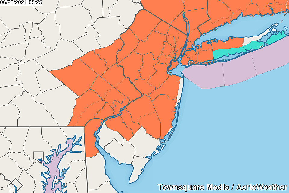
A Heat Advisory continues through Wednesday evening for most of the state. The pieces of the Garden State that fall out of the advisory - South Jersey and the immediate coast - will just barely miss the criteria for "dangerous heat".
You know the drill. Heat is dangerous, but only if you don't take care of yourself. Wear lightweight, light-colored clothing. Stay extra hydrated, ro replace the fluids lost from sweating. And take frequent breaks from the heat, ideally in air conditioning.
These are the days that the Jersey Shore really hopes and prays for a sea breeze, to keep the heat and flies inland. I think that will be the case at the beaches Monday. But we'll probably still see 80s on the beaches Monday afternoon. Still with high humidity, of course.
Overhead, you'll find a mix of sunshine and clouds. The chance of a stray shower or thunderstorm is low, but not zero. Best chance would be as temperatures cool Monday evening, in northwestern New Jersey only.
One of the worst parts of any heat wave is when we don't cool down at night. Everything - humans, animals, flora, infrastructure, etc. - needs to push a "reset button" during hot, humid weather. That's not really going to happen Monday night, as lows only dip into the mid 70s.
Tuesday
Let's do it again. Lots of hazy sunshine will push high temps into the lower to mid 90s. That is almost 10 degrees above normal for late June, by the way. Once again, the heat index will approach triple digits. Once again, a late-day shower is possible in NW NJ.
Wednesday
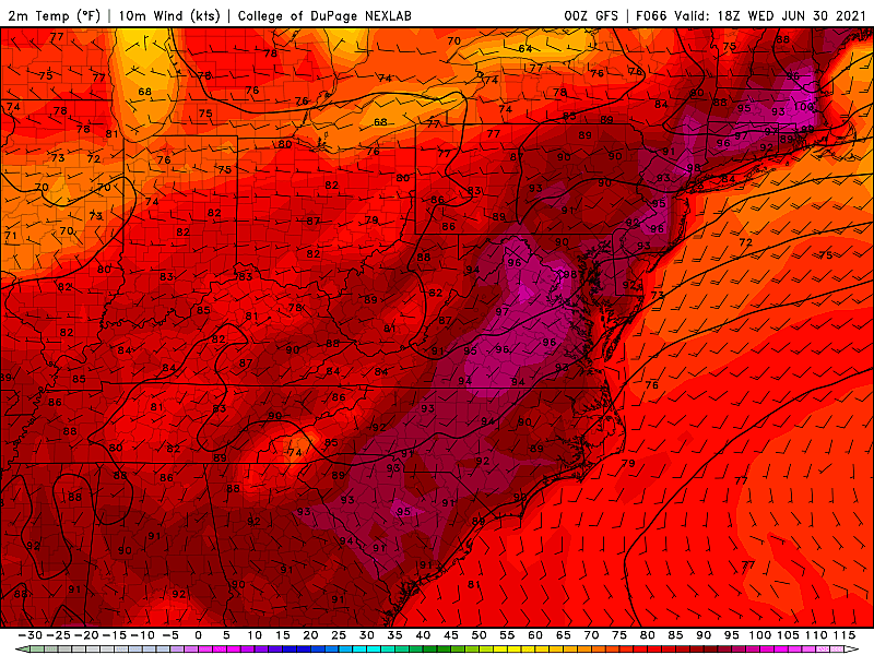
I'm not sure which day of the week will be our hottest, but Wednesday is definitely a candidate. (My forecast goes as high as 98 degrees in the urban center of NE NJ and/or SW NJ.)
Not only will it be hot and humid, but we'll pick up a "blast furnace" southwest wind up to 20 MPH. Yes, that breeze will keep the hot air moving around. But it will also transport even more hot air into the Garden State. Look for high temperatures in the lower to mid 90s once again.
There's also a decent chance for widespread scattered thunderstorms Wednesday evening through Wednesday night (8 p.m. to 4 a.m.) If you manage to get a little bit of rain, it will cool you off temporarily.
Thursday
Ah, the big cooldown day! Having said that, some thermometers may still reach 90 degrees, especially in South Jersey. And then we face a heavy rain threat.
It looks like rain will fill in around midday Thursday, lasting through Thursday night. Given the "juicy" humid air, that rain will probably pour at times. Embedded thunderstorms and marginal severe weather could be concerns.
The Extended Forecast
Here's where things get tricky. Especially since all eyes are on the big 4th of July Weekend coming up.
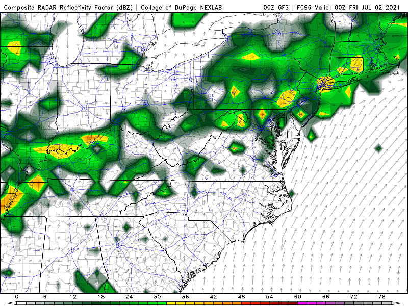
Your holiday weekend forecast will be largely dictated by how "cleanly" Thursday's cold front passes through the state. The GFS model favors a "not clean at all" outlook, keeping scattered rain and unseasonably cool temperatures over NJ through Friday 7/2, Saturday 7/3, and part of Sunday 7/4. That particular model forecast shows up to 5" of rain as a result of that extended stretch of wet and unsettled weather.
However, I favor the Euro model - not only because it's a more optimistic forecast, but because the dynamics and numbers make a bit more sense. As the front exits on Friday, so do our chances of widespread rain. Probably about an inch of healthy rainfall total. Temperatures would end up cooler than normal for Friday and Saturday, and conditions would still be pretty humid. But at least we'd see substantial periods of dry, sunny weather. And both Sunday 7/4 and Monday 7/5 would be spectacularly summer-ish.
So there are your two scenarios for the first five days of July. Neither is perfect. But the Euro would definitely be more conducive for boardwalks, beaches, backyards, and fireworks. Over the course of the next two days, we'll zero in on which solution trends more likely. Stay tuned!
Why you shouldn't visit the Jersey Shore this summer
Gallery Credit: Mike Brant - Townsquare Media
Take a Dip In The Most Breathtaking Backyard Pools in New Jersey
Gallery Credit: Matt Ryan
More From WPG Talk Radio 95.5 FM


