Tuesday NJ Weather: Happier Skies, Lower Humidity, Minimal Rain
The Bottom Line
Monday evening's storms were scary for a while. Wind gusts over 60 mph did bring down trees and cause power outages, especially along the Interstate 295 corridor of southwestern New Jersey.
But because of the near-sunset arrival time and because the squall line's forward motion was so fast, the severe weather threat decreased very quickly. So for most of the state, we only experienced regular, run-of-the-mill thunderstorms with some rain, wind, and lightning.
Tuesday's forecast is calmer, clearer, and — well — happier. There could be a few raindrops around, but falling humidity will begin a 2-day trend toward fair weather through Wednesday.
Our next storm system arrives on Thursday, with a period of rain likely. A bit of unsettled weather may crop up over the upcoming weekend too.

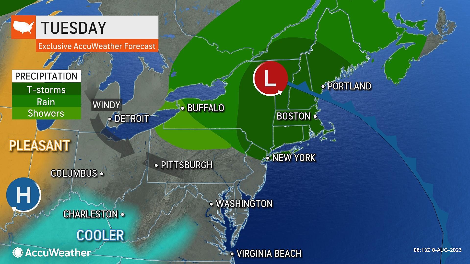
Tuesday
We are waking up to temperatures around 70, with a hint of stickiness in the air. Not bad for an early August morning.
There are two limited opportunities for a shower or thunderstorm on Tuesday. (Although, needless to say, any pockets of rain will be less widespread and less intense than Monday night's storm.) One piece of energy is sliding drizzle through SW NJ as of this writing (7 a.m.) And then, through the afternoon, a shower may pop up in northern New Jersey. Most of the state should stay completely dry.
Dew points will slide from the upper 60s to lower 60s as Tuesday goes along, making the air less steamy and more comfortable. That is always good news in the summertime.
High temperatures Tuesday afternoon will be limited to the lower 80s. You will see clouds with occasional peeks of sun.
It is also going to become breezy late-day, as our new air mass takes hold. Wind gusts may top out around 25 mph — definitely noticeable.
Tuesday night, skies will clear and winds will calm. And, thanks to that newfound dry air, it will be comfortable. Low temperatures should end up in the mid 60s, on average.
Wednesday
I am giving Wednesday the blue ribbon as New Jersey's nicest weather day of the week.
It is going to be very warm, as high temperatures aim for the seasonable mid 80s. But with mostly sunny skies, dry weather, a light breeze, and low humidity, it will be very nice from start to finish.
(Hopefully that westerly land breeze is not too strong, or else the beaches will be hot and buggy.)
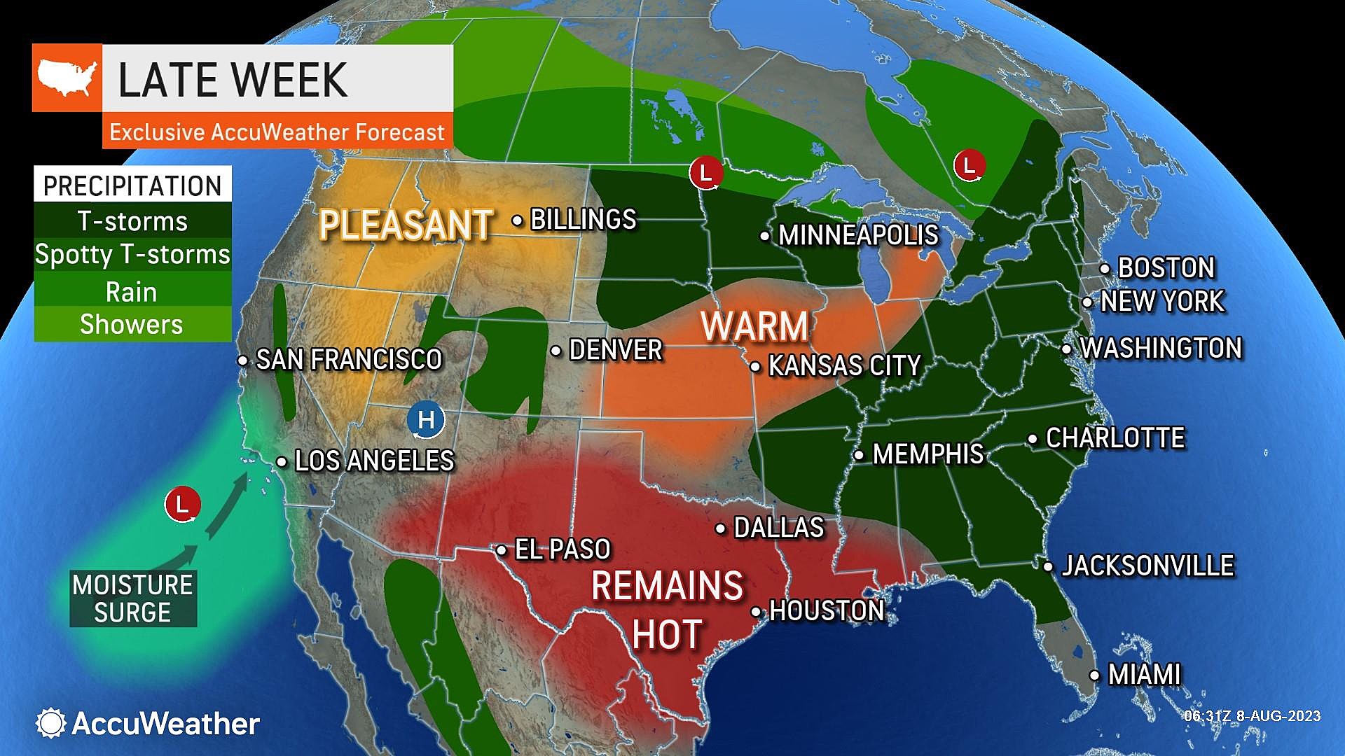
Thursday
Thursday's forecast is unsettled, but the details of our next batch of rain are still hazy. Forecast models have wildly different opinions on just when the rain will arrive and how much we see. (The short-range NAM shows afternoon showers, the GFS likes all-day pockets of rain, and the Euro leans toward a midday-afternoon scattered rain event.)
So it is probably going to rain. And I currently favor the Euro solution, placing the best chance of showers and thunderstorms around the afternoon hours.
There will be a touch more humidity in the air. Along with cloud cover. Temperatures will come down a couple degrees as a result, topping out in the lower 80s.
So not a terrible day. But outdoor activities may become soggy for a few hours.
Friday
On Friday, we should find another pleasant pocket of the atmosphere.
Lingering clouds may affect southern and coastal NJ. But farther north, sunshine should win out.
High temps on Friday are forecast to once again reach the mid 80s. Very close to normal for this time of year.
The Weekend & Beyond
On Saturday, humidity ramps up again and cloud cover will increase. The afternoon could turn unsettled, with spotty showers and thunderstorms developing too. I am not overly concerned about the severe weather or washout prospects at this point, but we will be watching this piece of the forecast very carefully as the week presses on. (Summer weekends are precious, after all.)
I would say Sunday is the better bet for nicer weather this weekend.
The long-range forecast for next week looks hot and stormy. We might see the return of 90s at some point through the midpoint of August.
Unique museum in South Jersey
How to pronounce these 20 town names in NJ
More From WPG Talk Radio 95.5 FM