
Unsettled weather continues for NJ, but at least we’re warming up
The Bottom Line
As promised, Sunday was not a nice weather day. It was cloudy. It was rainy. It was miserably cool, with temperatures stuck in the 50s all day. More like March than May.
The new week promises improvements in the forecast. But with numerous frontal boundaries and pieces of energy riding through New Jersey's atmosphere, we are still going to see some unsettled, murky weather for the time-being. That means at least a slight chance of showers and thunderstorms daily through at least Thursday.
At least temperatures will warm back into the 70s and 80s. It might even feel a bit muggy, as dew points rise and winds stay light.
If all goes well, our weather will hopefully clear out, dry out, and cool down a little just in time for the Mother's Day Weekend. (Although pleasant weather is not a sure bet at this time.)
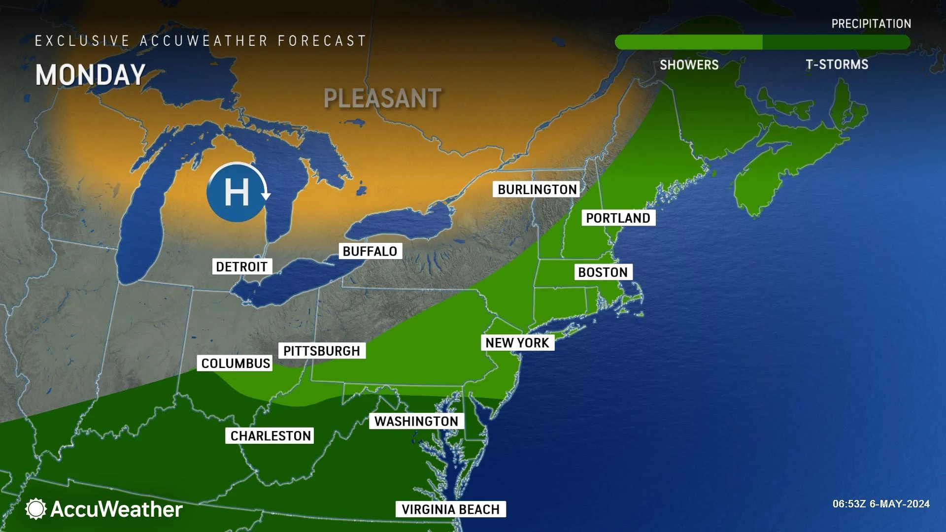
Monday
We had some spotty showers overnight in South Jersey, which exited in the early morning hours. You will find some fog, low clouds, and drizzle around the state to begin the day. Visibility is quite low in some spots, so you may have to slow down.
Conditions should generally improve by late morning. But skies will remain mostly cloudy to overcast throughout your Monday. At least temperatures will be allowed to warm to the mid 60s (coast) to mid 70s (inland). Holistically, we will be right on the average high temperature for this time of year.
In terms of rain, it will be limited going forward Monday. But there will be a slight chance of a hit-or-miss shower at any time.
The next big push of scattered showers and thunderstorms will likely come Monday night, after Midnight. Otherwise, it will be another mostly cloudy and foggy overnight. Low temperatures will dip into the mid 50s.
Tuesday
Tuesday's shower chances bookend the day: Early and late. In the middle, the sky will brighten significantly — let's call it partly sunny. And temperatures will continue to warm. There is a lot to like about Tuesday's forecast.
Look for highs in the mid 70s across most of the state. 80 degrees is a possibility in inland South Jersey. Along the coast, we will most likely have a sea breeze set up, keeping temperatures in the 60s at best.
Wednesday
Wednesday will be the warmest day of the week. But that extra energy in the atmosphere could fuel some stronger thunderstorm cells.
Once again, Wednesday's rain chances will be hit-or-miss. I could see a storm cell popping up at any time. It will be worthwhile to watch out for pockets of heavy rain, frequent lightning, and gusty winds that may develop during the day.
Meanwhile, with a mix of clouds and sun, high temperatures will surge into the lower 80s away from the coast. Summerlike humidity may build in too — not stifling or suffocating, but noticeable.
Thursday
Thursday looks like the wettest day of the week, as a slow-moving cold front eventually causes a pattern change.
Having said that, it does not look like a total washout — just the best chance of widespread scattered showers throughout the day. Rainfall totals will probably end up between a quarter-inch and half-inch.
Amidst the thick clouds and raindrops, temperatures will come down a little bit. But I do not expect it to be quite as "miserably" cool as Sunday. Look for highs still in the 70s.
Friday & Beyond
Uncertainty swells late this week into the weekend, as we ponder the grand question of What comes next?
The unsettled weather pattern will almost certainly break. I favor a mainly dry forecast on Friday, with partly sunny skies. Breezy and cooler, with highs around the upper 60s. The European model is an outlier, showing some spotty showers — it is a possibility we have to keep in the back of our mind.
Saturday comes up dry in all solutions, but unseasonably cool. Expect sun and clouds, an occasional breeze, and mid 60s.
Sunday is a very important forecast, because it is Mother's Day. And once again, I can't say much. I side with the GFS model, which shows a dry, partly sunny, seasonably mild day. But the pesky Euro model shows another round of scattered showers. Two very different solutions.
This is exactly why I only publish a 5 Day Forecast. Not seven. Not ten. After five days, forecast confidence and accuracy plummets. We will fill in those important weekend details soon, once things become much clearer.
The best supermarkets in New Jersey
More From WPG Talk Radio 95.5 FM