Typical Cool January Temps and Quiet Weather Settles in to NJ
The next three days will feature temperatures very close to seasonal normals with a warmup expected by the weekend.
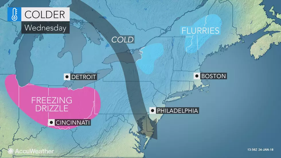
Tuesday was certainly an active weather day for the Garden State, with heavy rain and thunderstorms followed by wind and then the beginnings of our latest wintertime cooldown. As advertised, this cooldown is not a ferocious arctic blast, just a return to more seasonable temps. This refreshed chill is also temporary, with noted improvements in the weekend forecast.
Thermometers have fallen to about the 40 degree mark overnight, and will only nudge to the lower 40s by Wednesday afternoon. While I believe sunshine and dry air will dominate the sky throughout the day, there will be periods of cloudiness (especially in the morning hours). It will be a breezy day too, with gusts over 20 mph — certainly cool, but not terrible.
We'll keep a few clouds in the forecast for Wednesday night. More importantly, it's going to get quite cold, with overnight low temperatures in the lower 20s. Any little breeze, even 5 or 10 mph, will push the wind chill ("feels like" temperature) into the teens.
As the core of this cold air mass settles overhead Thursday, limiting our high temperatures to the mid to upper 30s. That will be a few degrees below normal for this time of year. At least we'll enjoy bright sunny skies all day.
Friday morning will also be seasonably cold, and Friday afternoon will also be seasonably cool. High temps will once again reach either side of 40 degrees, under pleasant mostly to partly sunny skies.
The final weekend of January will feature another warmup, with widespread 50s in the forecast for both Saturday and Sunday. There will be lots of cloud cover, in addition to a rain shower chance from Saturday evening through Sunday midday.
We'll cool down again for early next week, but once again only to near-normal levels. Our next significant storm system and potential pattern change (toward much colder weather) is expected late next week, around Groundhog Day.
More From WPG Talk Radio 95.5 FM


