Cooler Thursday With Light Rain Showers Later
There will be small wiggles in temperature and cloud cover in the coming days, with a few showers, but no big storms are expected anytime soon.
What a glorious day Wednesday was! The warm spot was Woodbine, Cape May County at 67 degrees, according to the NJ Weather Network. All but Sussex County hit 60+ degrees. I was sorry to sleep through such beautiful Fall weather!
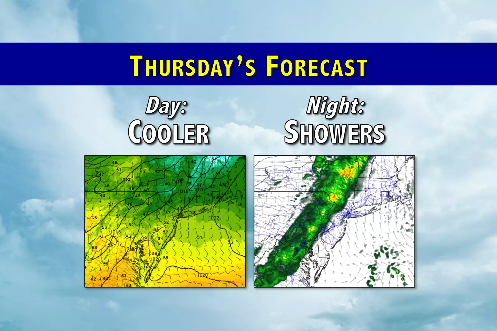
Thursday will be a very different weather day, as cooler air has returned to the Garden State. The morning chill is back, as thermometers have dipped into the 20s and 30s for most of the state. High temperatures will be limited to about 50 degrees — that's normal for the final day of November.
Skies will be mostly cloudy to start Thursday morning, but the latest model data suggests we'll get some solid breaks of sunshine through Thursday afternoon.
While the daytime hours will remain dry, another weak cold front Thursday night will spark some showers. We're just talking about rain here, as overnight low temperatures will only fall to the 38 to 44 degree range. Best timing for this rain is about 10 p.m. Thursday to 7 a.m. Friday. Rainfall totals will be unimpressive, less than 0.05". (In fact, South Jersey may remain completely dry.)
Beyond the rain, skies will clear very quickly Friday morning. That means Friday will feature some good sunshine, along with a brisk breeze up to 20 mph. Thermometers should climb a little bit higher than Friday, with highs in the lower 50s. Not a bad way to start December.
My best shot at following the daily wiggles and wrinkles in the forecast through the weekend... Friday night will be cold, at or below freezing for most. Saturday will be the cooler, cloudier day of the weekend with highs near 50 degrees and a sprinkle chance. Sunday looks sunnier and slightly warmer, as highs bounce back into the lower 50s.
Monday should stay quiet, and Tuesday looks warm with temps once again making a run for 60 degrees.
There have been some internet murmurs about a trend toward a colder, more active weather pattern by mid-December (specifically starting around the 8th or 9th). I'll buy that — forecast models and teleconnections certainly support that long-range forecast. However, within that extended forecast period, any specific storm threat is dubious at best. As usual, my forecast and analysis focuses on the next 5 to 7 days — once this potential arctic blast enters that time frame, I'll start exploring more details.
More From WPG Talk Radio 95.5 FM