Dry, Sunny, Summerlike Weather Returns to NJ Wednesday
Tuesday's thunderstorms turned out to be pretty fierce — a Tornado Warning for Sussex/Morris counties, a Flash Flood Warning for Bergen County where over 2 inches of rain fall, wind damage in Ewing (Mercer County), etc. Final showers and sprinkles are just now exiting the Garden State on this Wednesday morning, and the rest of the day looks fantastic.
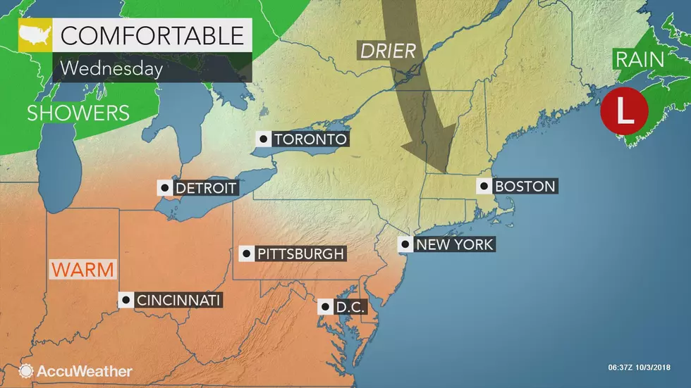
Skies should quickly become mostly sunny Wednesday, with additional passing clouds through the afternoon. High temperatures will end up in the mid 70s (north/coast) to upper 70s (central) to lower 80s (south). That's just a degree or two cooler than Tuesday, and still almost 10 degrees warmer than normal for early October.
Wednesday night should be pleasant too. We'll see partly cloudy skies with patchy fog. Low temperatures will dip into the upper 50s to lower 60s.
We'll fare OK for most of Thursday. It will be another summerlike day, with a stiff breeze and high temperatures in the lower 80s. (Record high temps are currently in the 80s, so this "heat" is pretty unseasonable.) Increasing clouds throughout Thursday will be the precursor to our next storm system, a cold front set to arrive Thursday night.
That front won't bring very much rain to New Jersey. Sure, there will be a few showers and thunderstorms late Thursday through early Friday. But nothing heavy, and certainly nothing like the severe weather that hit the state Tuesday night.
The big impact from Thursday night's cold front will be a big cooldown for Friday. Morning temperatures will range from upper 40s (north) to lower 60s (south). Afternoon temperatures won't make it much past 70 degrees. Needless to say, it's going to feel much more like October. Early clouds will hopefully give way to some afternoon sun.
I'm liking the forecast for the weekend, and I think it includes "something for everyone". Saturday will be the cooler day, with highs in the lower 70s under mostly sunny skies. Sunday will be the warmer day of the weekend, with highs in the lower 80s (away from the coast) with a few extra clouds.
Above-normal temperatures will continue for early next week. My forecast keeps high temperatures generally in the 80s for Columbus Day Monday and beyond, with only an isolated shower chance.
I have a feeling this sustained warmth will make for a late start to the fall foliage season here in New Jersey. However, given the recent stretch of soaking wet weather, I suspect the eventual colors will be vivid and bright.
More From WPG Talk Radio 95.5 FM