Hermine Headlines for NJ: Bad Coastal Flooding, Possible Power Outages
As New Jersey approaches primetime for the impacts of Hermine, the latest forecast looks especially dire for the Jersey Shore.
The Latest on Hermine
As of the 5 p.m. Saturday advisory from the National Hurricane Center, Hermine is a post-tropical cyclone located about 100 miles east of the Virginia-North Carolina state line. Maximum sustained winds are holding at 70 mph. The storm is quickly moving toward the northeast, away from the Atlantic coast.
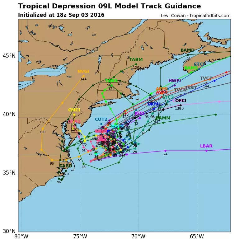
The forecast track has taken almost a zigzag shape. Essentially, the center of Hermine will hover between about 75 and 200 miles off-shore as the storm very slowly slides past Virginia, Maryland, and Delaware.
This off-shore track means the threat for deluges of tropical rainfall will remain low (but not non-existent). However, tropical storm force winds, moderate to major coastal flooding, and severe beach erosion remain likely.
Inland Forecast
Forgive me for almost neglecting to address the Hermine forecast for inland New Jersey in my past few blog entries. But let's face it: your issues will be far less severe as those within a few miles of the coast. While there could be a little bit of rain along the way, the overall threat for inland flash flooding or river flooding is lessened. So, the biggest problem for inland communities will be wind.
Interior New Jersey's winds should peak from Sunday to Monday. Sustained winds of 20 to 30 mph are expected statewide, with potential gusts to 40 or 50 mph. That's enough to cause scattered (hopefully not widespread) power outages, bring down trees, and make driving difficult (especially in high-profile vehicles like trucks and buses).
Big Problems 'Down the Shore'
Sorry, Bruce... Down the Shore, everything is not all right this weekend.
I don't know how many more ways I can say it: the storm surge and coastal flooding threat along New Jersey's southern coast is very real and very serious. In a briefing Saturday morning, the National Hurricane Center referenced the possibility of "life-threatening inundation" along the Jersey Shore through Monday. The NHC doesn't use that language unless they mean it.
As I've discussed before, Cape May and Atlantic counties are apt to get hit hardest by the storm surge, with near-record to historic tide crests expected. Yes, that means for some areas Hermine is probably going to be worse than Irene, worse than Sandy, and worse than the January 2016 blizzard (the current record crest at Cape May).
Further north along the coast, from Ocean to Monmouth counties, moderate flooding is forecast. While not a flood of "Sandy" proportions, such water inundation may still require road closures and water rescues.
High Tides
Hermine's slow movement and constant barrage of water upon the coast means we'll have to endure several high tide cycles of abnormally high water. The sea is already rough, and beach erosion is already occurring.
Rather than show complicated, technical graphs with highly detailed statistics, I've broken down the timing and severity of the next 6 high tides in a simple graphic:
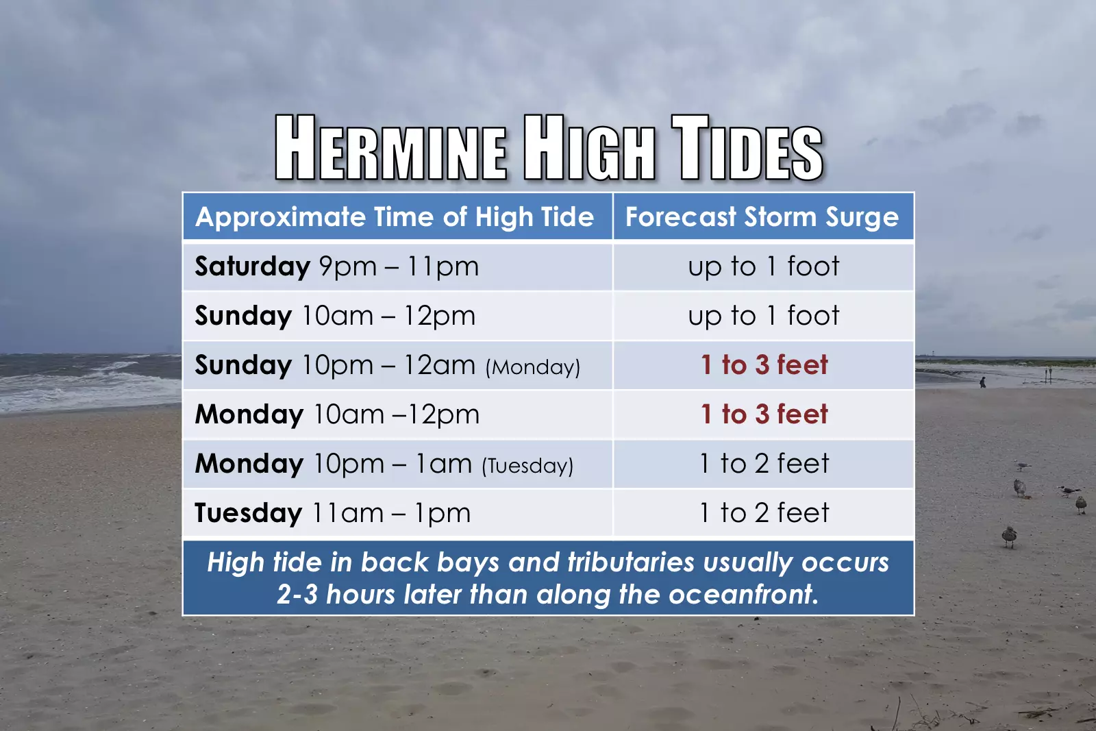
As the numbers show, the worst high tide cycles will occur late Sunday evening and late Monday morning. That's not to say coastal flooding won't occur at other times - those just look to be the worst.
Final Thoughts
Even though Hermine is no longer a "tropical" system... Even though the center of the storm won't even come close to making landfall over New Jersey... Hermine's impact on the Garden State will be rough, peaking over the next 24 to 48 hours (Sunday and Monday).
If you haven't already, you need to consider the safety of yourself, your family, and your property NOW.
If you live along a tidal waterway, you need to consider the impact of 3 or 4 additional feet of water on top of the ambient high tide, and take appropriate action.
If you have travel plans over the rest of the Labor Day Weekend, you need to seriously consider whether it's really necessary, given the flooding and wind threats.
As I often say... Be smart, be safe... And continue to stay tuned for the latest.
Unless there are significant overnight developments, the next weather blog update will be posted by 8 a.m. Sunday.
More From WPG Talk Radio 95.5 FM