Monday NJ Weather: Very Humid, Very Warm, Strong Thunderstorms
The Bottom Line
There are two big headlines in the forecast.
Number one is the biggest push of heat and humidity of the season so far. Somewhere in New Jersey will most likely hit 90+ degrees every day this week. 100+ is possible.
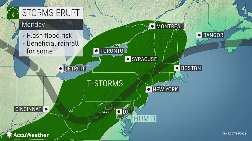
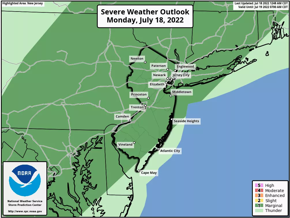
Number two is a round of strong, super-soaker thunderstorms sweeping through on Monday. While we do need the rain, I am concerned about downpours leading to flooding in addition to gusty winds and intense lightning.
I am going to try very hard not to badger you with heat safety tips this week. It's summertime — you know the drill. Dress for the heat. Stay hydrated. And take breaks in a cool place as much as possible.
By the way, if you're looking for a break in the heat and humidity, you'll have to wait until next week. This will be a 7+ day heat wave.

Monday
For other parts of the country and the world, it has been a ferociously hot summer so far. And now it's New Jersey's turn to really crank up the heat and step into the sauna.
It's a steamy start to your Monday, as temperatures have not fallen below 70 degrees for the vast majority of NJ overnight. High temperatures will push into the 85 to 90 degree range Monday afternoon. Factor in the high humidity, and the heat index (the "feels like" or apparent temperature) will end up around 95 degrees. That is some thick, stifling air.
Much of the Jersey Shore will be toasty too. Although beaches with a southern exposure — such as those in Atlantic and Cape May counties — will benefit from a sea breeze. However, a moderate risk of rip currents is posted.
Again, the other big story on Monday will be some stormy weather, fueled by that juicy air.
Round one of showers and thunderstorms is happening as of this writing (6:15 a.m.) That cluster of wet weather is primarily affecting the area north of Interstate 78 and west of Interstate 287. However, a few isolated storms have occasionally popped up to the southeast. Exiting by late morning, up to an inch of rain is possible, along with rumbles of thunder.
Monday's second wave of thunderstorms will be more widespread and more impactful. Starting around 3 or 4 o'clock, we'll have to watch the western sky for dark clouds. My biggest concern with these big storms will be areas very heavy rain — some models show 2+ inches in localized pockets. Gusty winds and intense lightning are likely too.
By about Midnight, storms should exit. There could be some lingering showers into early Tuesday morning. But we'll generally see partly cloudy skies and muggy conditions overnight. Lows will once again only dip into the lower 70s at the coolest.
Tuesday
Humidity will dial back a bit, with dew points descending from the 70s into the 60s. But it's still going to be a hot, sticky summer day.
As skies turn to sunshine, high temperatures will push into the lower 90s. Northwestern New Jersey and the Shore will be the only spots to miss the magic 90-degree mark.
No storms. Just heat.
Wednesday
Another hot, semi-humid day with lots of hazy sunshine. High temperatures will push into the lower to mid 90s. Getting awfully close to the danger zone.
Thursday
We start talking about "dangerous heat" when either the air temperature and/or the heat index reaches 100 degrees. The heat index — also called the "feels like" or "apparent" temperature — is an important indicator of human health, which is why we use it so often in the summer.
By the thermometer, highs on Thursday will shoot for to the mid to upper 90s. By my calculation, the heat index could soar as high 105. Definitely hot and humid. You need to consciously take care of yourself in such conditions.
Skies will be partly sunny on Thursday. A few forecast models have hinted at a thunderstorm chance on Thursday. Our atmosphere will be pretty well capped — the heat creates a layer of convective inhibition, preventing thunderstorms from developing. But if a storm busts through the cap — most likely right around sunset — it would become strong pretty quickly.
Friday & Beyond
Temperatures on Friday nose downward by a degree or two. But if you're looking for any real relief from the heat and humidity, you'll have to wait until next week.
The weekend looks steamy, with more temperatures in the 90s than not. Depending on dew points, we could see the heat index make another run for the triple-digit mark. I can't rule out a storm on Sunday — at the very least, they'll be in the neighborhood.
The Euro model says rain and cooldown will arrive on Monday. The GFS says Tuesday. I hope one of them are right, or else the heat wave (and impending drought concerns) will roll right along through the end of July.
LOOK: 31 breathtaking images from NASA's public library
Gallery Credit: Deborah Brosseau
8 sharks you may find off New Jersey's coast
Gallery Credit: Dino Flammia
More From WPG Talk Radio 95.5 FM


