
NJ Weather: Low Humidity and Bright Skies — A Nice Summer Treat
The Bottom Line
I love low humidity. It is such a rarity here in New Jersey in the middle of summer. And we need to celebrate any time it happens, as we enjoy comfortable days and nights.
Monday will be number 2 of 4 days featuring dry air and mainly dry weather for the Garden State. It will be "practically perfect". Temperatures will end up slightly below seasonal normals, feeling a bit September-ish by midweek. And there is one chance of a shower worth mentioning.
Starting on Thursday, we will see some changes. Our weather will become more humid and cloudier. And our next chance of widespread showers and thunderstorms will kick in Thursday afternoon.

Monday
If you liked Sunday's weather, I think you will like Monday a lot, too.
Monday morning is comfortable and crisp and even downright cool. Temperatures to start the final day of the month are mainly in the 50s, with some 60s in cities and along the coast.
There have been some sprinkles passing through central and southern NJ early Monday morning. Just don't be surprised if you see or feel a few raindrops around.

High temperatures Monday afternoon will reach the lower 80s, with 70s at the beach. That is a touch below normal for the average-hottest time of the year. For the most part, we will enjoy partly sunny skies and bargain-basement humidity. A beautiful day.
There is one hesitation though: A popup shower or thunderstorm is possible. Especially in far South Jersey around dinnertime. It will be very isolated though — most of the state will stay high and dry.
Dry air will once again yield a cool overnight, with lows dipping to around 60 degrees.
Tuesday
August begins with another splendid day. With a mix of sun and clouds, high temperatures will make it to around 80 degrees. Humidity still low. Rain chances practically zero.
Forecast models do show the return of our arch nemesis: Canadian wildfire smoke. The plume arriving on Tuesday does not look that thick, and should be elevated. Therefore, the sky may turn hazier and more washed out, but air quality problems are unlikely.
Wednesday
One more low-humidity day. Wednesday looks to be the sunniest of the bunch. But also the coolest, with 50s in the morning and then upper 70s in the afternoon. Such beautiful weather would be typical for mid-September. Not really early August.
Thursday
Changes kick in on Thursday. First of all, it will turn more humid. Not quite to the "tropical" category, but you will probably notice more stickiness in the air.
Second, cloud cover will increase on Thursday too.
Third, high temperatures will bounce back to the almost-normal lower 80s.
And fourth, a few shortwaves through the second half of the week will drive a period of unsettled weather. So Thursday presents our next chance of widespread rain.
As it stands now, spotty to scattered showers and thunderstorms will be possible starting Thursday afternoon, through Thursday night. There could be some pockets of heavy rain, if atmospheric moisture ramps up enough.

Friday & Beyond
Guidance keeps showers and thunderstorms around through Friday and possibly Saturday too. Even though neither day looks like a washout at this point, clouds, raindrops, and rumbles of thunder could keep temperatures down. And would make for less-than-stellar beach days.
Your best chance of a dry, seasonable weather day in the medium-range forecast is Sunday.
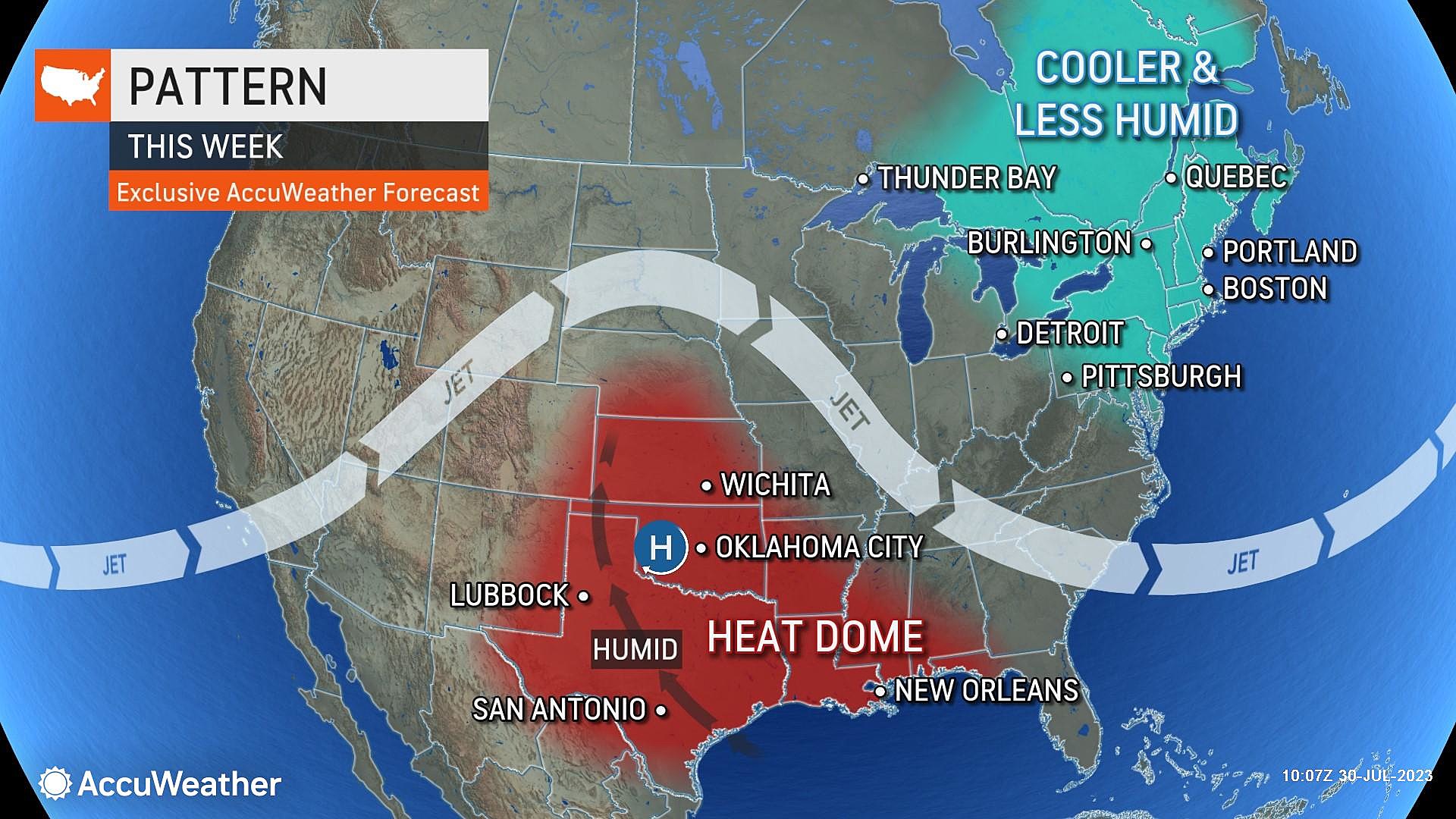
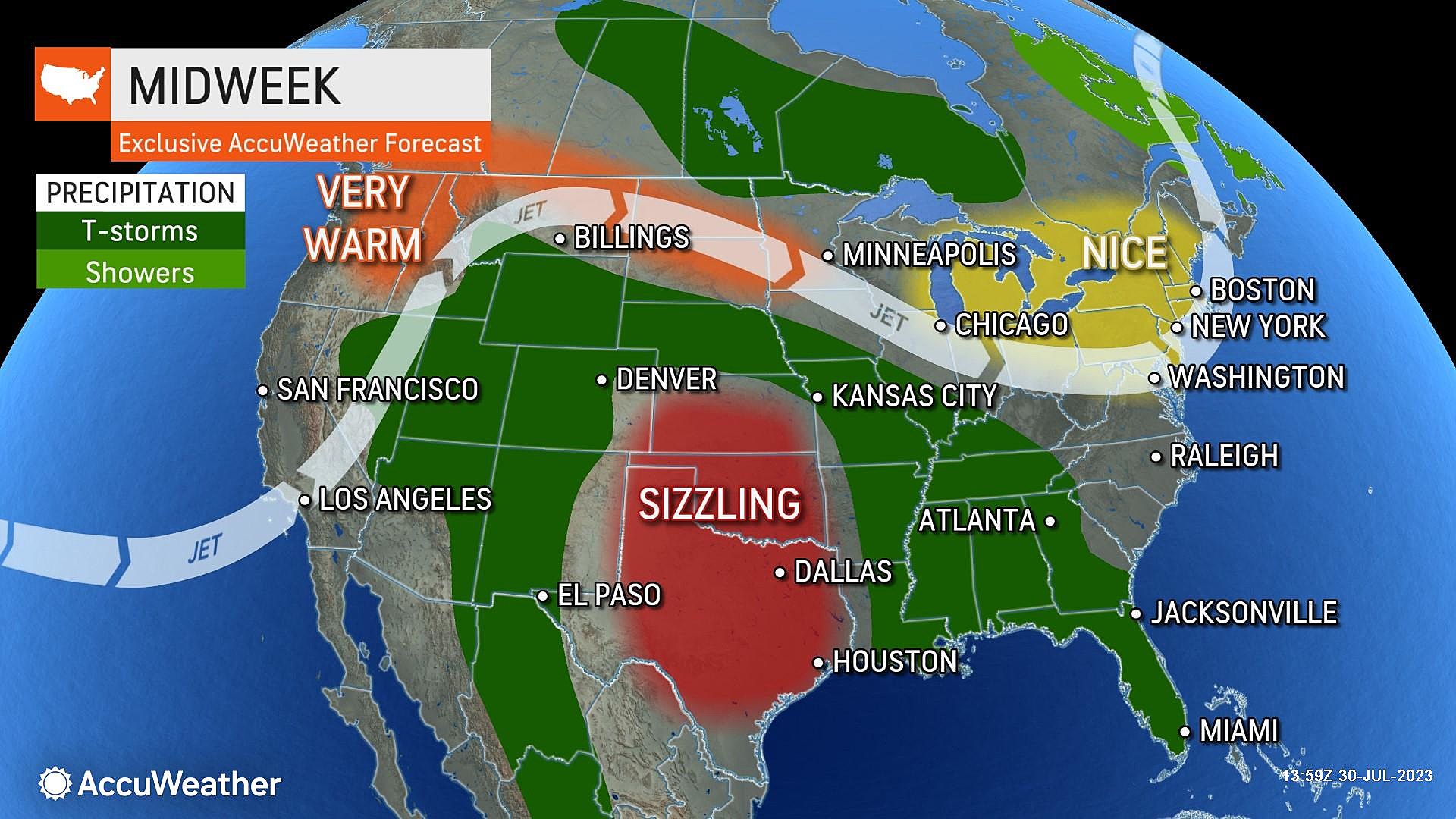
I do not see any sustained heat ridge building into New Jersey within the next 7 to 10 days. While there are a couple of tropical waves under investigation in the Atlantic basin, neither pose an imminent threat to the U.S. East Coast.
CHECK OUT: All the free beaches in New Jersey
Hidden gem half-day trip in South Jersey
Gallery Credit: Dennis Malloy
More From WPG Talk Radio 95.5 FM


