NJ Weekend Weather: Calendar Reads Fall, Thermometer Says Summer
A warming trend carries New Jersey into the first weekend of Autumn as we continue to keep an eye on the hyper-active tropics.
We bid a fond farewell to Summer at 4:02 p.m. EDT Friday, as the Autumnal Equinox arrives. This summer will be remembered for having big temperature swings — some cool periods, some hot and humid days. And it was quite wet, with statewide precipitation almost 2 inches above normal for June-July-August.
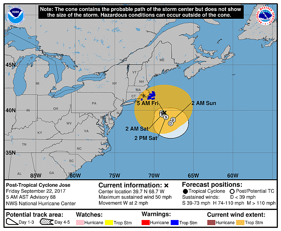
Jose is dying. Now classified as a "Post-Tropical Cyclone," the storm's circulation, winds, and rainfall are getting weaker by the minute. As we've previously discussed, Jose's interactions with much-stronger Hurricane Maria will result in Jose fading from the map completely.
No complaints there. I had been concerned about Jose drifting close enough to shove some showers and clouds toward New Jersey this weekend. In fact, we may end up with a completely dry forecast for the next week.
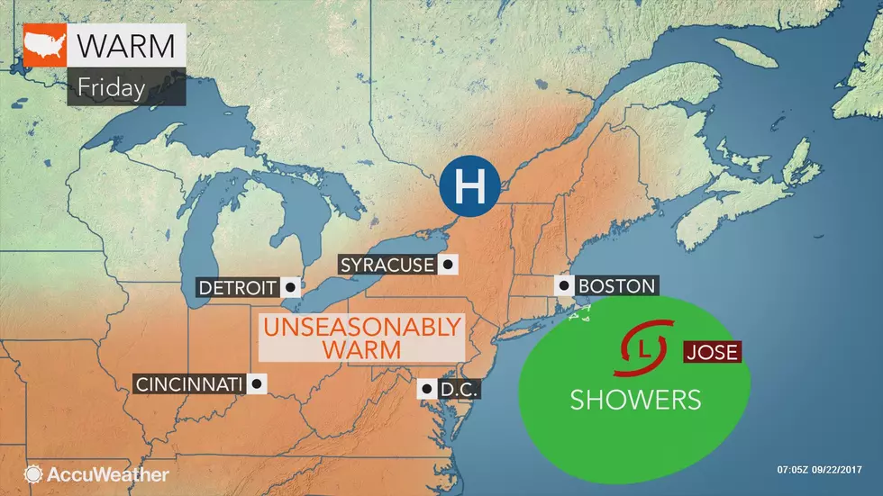
Friday morning is starting off comfortable, thanks to drier air arriving overnight. These lower humidity levels will be with us for a day or two, and is making for quite the autumnal morning with temperatures between about 55 and 65 statewide.
We'll see a mix of sun and clouds through Friday afternoon, with an occasional north breeze up to 15 mph. High temperatures will probably end up in the lower 80s for most of the state. (Upper 70s in North Jersey.)
The weekend is looking great, and very summery indeed! I'd call both days mostly sunny. Temperatures will continue to climb, into the mid 80s on Saturday and upper 80s on Sunday. It is totally conceivable that we touch 90 degrees by early next week. Near-record, and very un-September-ish!
I do have one concern for the weekend, however. With the nice, warm weather, I suspect many New Jerseyans will head to the Jersey Shore for one last "hurrah" of summertime. However, the ocean remains very much churns up — a High Risk of dangerous rip currents continues for the entire Jersey Shore on Friday. As many beaches are now unguarded in the off-season, it would be extremely wise to just stay out of the ocean for the time being.
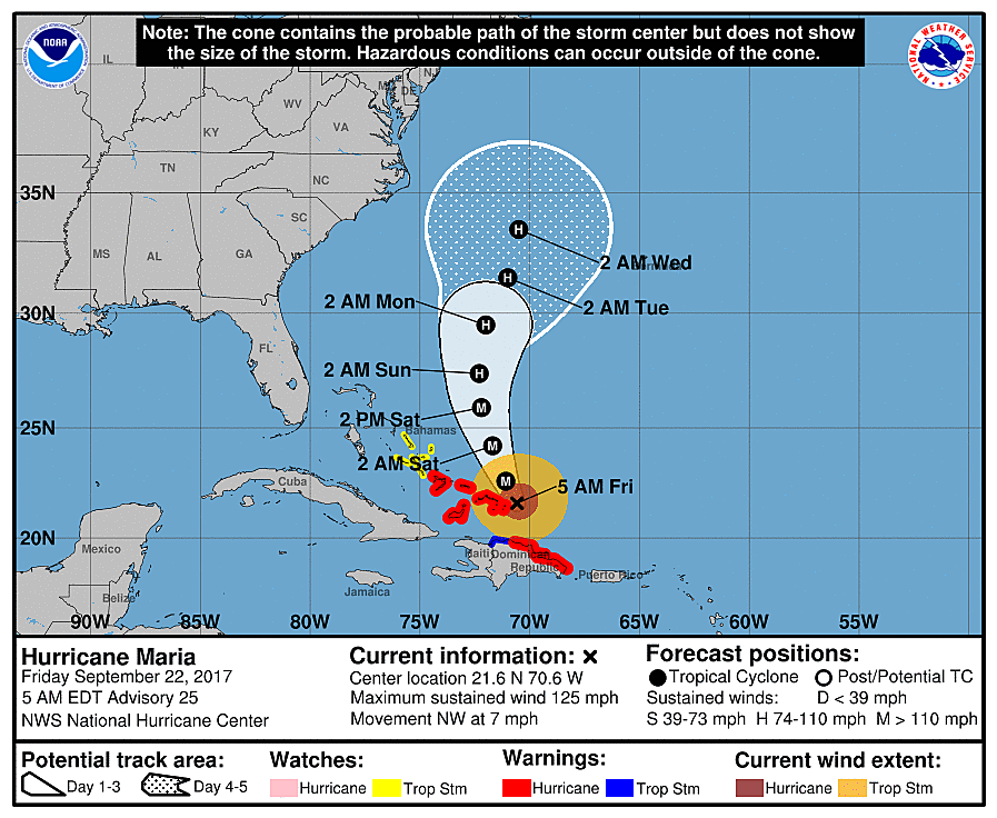
Meanwhile, Hurricane Maria is passing the Turks and Caicos and the Bahamas. Still a powerful category 3 hurricane, Maria will continue charging northward into the more open waters of the Atlantic.
Several runs of all major forecast models show Maria flirting with the Carolina coast, but NOT making landfall and turning out to sea. Good news! While I think this is a fairly confident consensus forecast, there are still a few variables in play. IF Jose dies faster than expected, IF the heat ridge over the Eastern U.S. isn't as strong as expected, IF Maria strengthens and/or speeds up, it could have a big impact on the forecast.
So, Maria remains worth watching, especially for continued rough surf concerns. The storm wouldn't be anywhere near New Jersey until about Wednesday, so there's plenty of time for the forecast to settle.
I do not intend to publish any web write-ups this weekend. But if there's any change at all to the Maria forecast, you'll be the first to know.
More From WPG Talk Radio 95.5 FM