NJ Weekend Weather: Jumping From the Sauna Into the Fire
As I was unloading groceries from the car Thursday, it took all of about 7 seconds before I was drenched in sweat from head to toe, given the high humidity. And then the sky opened up and I got poured on. Of course. Oh, and the rain was not refreshing in the slightest.
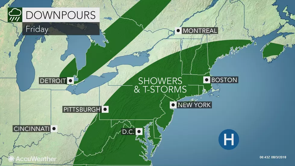
Anyway, we've got about 30 hours of steamy, unsettled weather to go before our pattern changes settles in this weekend. Just be prepared for those 30 hours to contain some loud thunderstorms and drenching rains.
As of this writing Friday morning, radar is clear and conditions are muggy. Temperatures are in the lower to mid 70s, and I've seen some fog/haze obscuring sight distances in spots. I've seen visibility as low as 3/4-mile (at Somerville) — noticeable, but not dense.
Just like Thursday, the bulk of Friday will be partly sunny, very warm, and very humid. Look for high temperatures once again generally between 85 and 90 degrees.
And just like Thursday, the intense humidity will break into scattered thunderstorms during the afternoon and evening hours. While the best chance for stormy weather will be to the north and west, even the Jersey Shore could see shower or storm. While it's certainly not going to rain all day, brief heavy downpours and lots of lightning are expected at times.
So if you're headed to the beach for an early start to the weekend, you'll need to keep an eye on the sky for a potentially quick-hitting storm. Also, a Moderate Risk for rip currents continues along the entire Jersey Shore.
I have to keep the chance for showers and thunderstorms alive for Friday evening, but the atmosphere should calm a bit by Midnight. It will be pretty muggy once again, with lows only falling into the lower to mid 70s.
The grand finale of this period of soggy, unsettled weather will come Saturday morning. Yes, that means we will have a wet start to Saturday for most of New Jersey, with a period of steady or heavy rain possible for a time. Be patient — eventually we'll clear away to sunshine, with high temps in the lower to mid 80s. Saturday will indeed turn into a pleasant summer day... Eventually.
I'm sure you're wondering, hoping, and crossing fingers that the horrendous humidity goes away this weekend. We should see dew points drop ever so slightly. Specifically, that change will be most noticeable Sunday morning with some low temperatures in the upper 60s (compared to mid 70s for most of this week).
Even though we kick the rainy, humid, unsettled weather to the curb, Mother Nature will quickly transition our weather forecast to the dog days of summer starting on Sunday. It will be mostly sunny and dry for the second half of the weekend — but it is going to get HOT! High temperatures Sunday afternoon will soar into the lower 90s for all but the immediate coast. Add the marginally high humidity, and you get the heat index ("feels like" temperature) pushing against 100 degrees.
That may be the start of a heat wave, with more 90s expected for Monday and possibly Tuesday too. Next chance for showers and thunderstorms will be late Tuesday to early Wednesday, but it doesn't look like we'll cool down much.
Have a great weekend!
More From WPG Talk Radio 95.5 FM