
60 to 90° — A Huge Range of Temperatures Across NJ Wednesday
The Bottom Line
Happy June 1st! This is the beginning of climatological summer, the warmest three months of the year. It is also the official start of the Atlantic hurricane season, which runs until November 30.
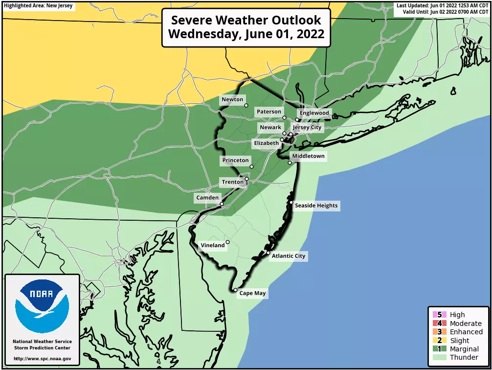
Wednesday is going to be a weird weather day. It is definitely going to be cooler than Tuesday's record heat, no matter where you are. But it is an incredibly tricky temperature forecast thanks to a backdoor cold front.
Some raindrops may clip New Jersey late Wednesday. The better chance for widespread thunderstorms will come as a traditional cold front approaches on Thursday. We do have to ring some alarm bells for locally heavy rainfall and gusty winds.
And then the first weekend of June is looking great.
Wednesday
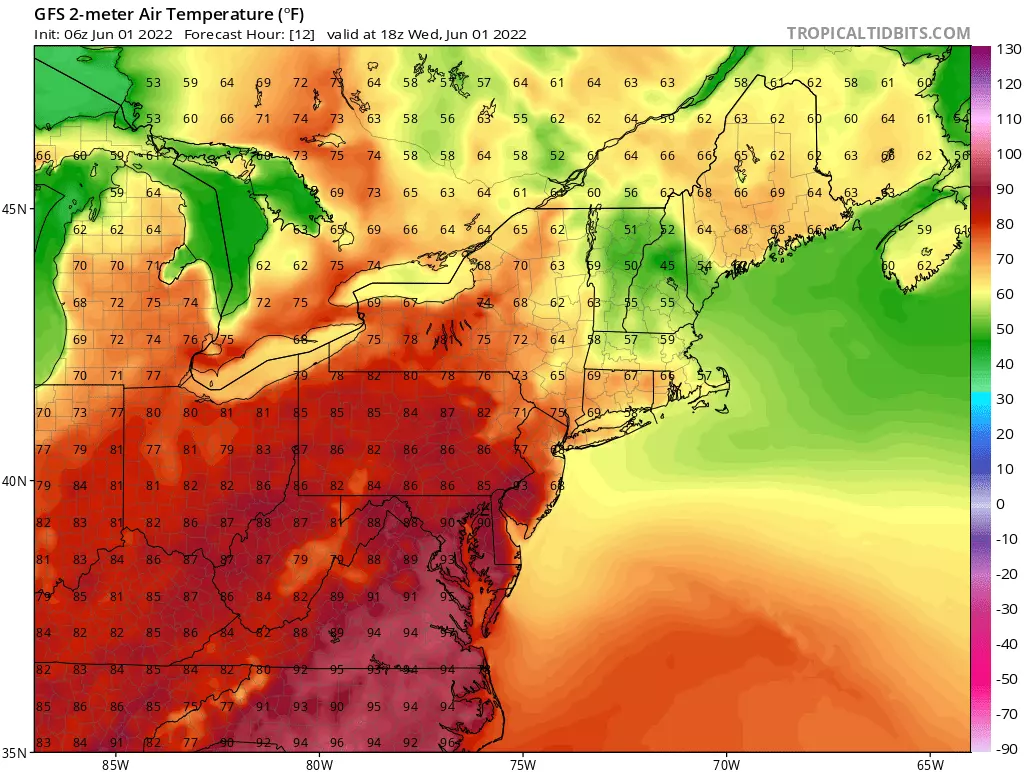
Usually in New Jersey, in the middle latitudes, our weather moves from west to east. But Wednesday's influx of cooler air is coming through the "back door," from the ocean side. It happens pretty often in the spring and summer. And it always leads to a precarious temperature forecast.

As of this writing (6 a.m.), the edge of that cooler air has pushed as far inland as Burlington and Atlantic counties. Northeast of that point, temperatures are in the 50s and 60s. To the southwest, we're still in the sticky 70s.
The east-southeast breeze will dictate temperatures Wednesday afternoon. Let's break the forecast into three sectors:
—Coast... Unseasonably, even miserably cool. Easily the coolest part of the state, stuck in the 60s all day.
—Most of the state... 70s. Definitely cooler than Tuesday, but still fairly seasonable for this time of year.
—Southwestern NJ... The area around Gloucester, Salem, and Cumberland counties will be on the warm side of that frontal boundary, allowing temperatures to soar well into the 80s.
No matter where you are, the day should generally look nice, with periods of sun and clouds.
A batch of spotty thunderstorms is expected to develop over Central New York and Pennsylvania Wednesday afternoon. Those storms may clip the northern edge of NJ. But as they enter our cooler air mass, thunderstorm cells should quickly disintegrate to just showers.
I will keep a chance of showers throughout the northern half of the state Wednesday evening. Fog is possible overnight too, with a hint of humidity in the air. Temperatures should normalize by Thursday morning, bottoming out in the lower 60s.
Thursday
Good start, stormy finish.
The first part of Thursday will be partly sunny and warm, with high temperatures primarily reaching the lower 80s. (Cooler 70s in NW NJ and along the coast.)
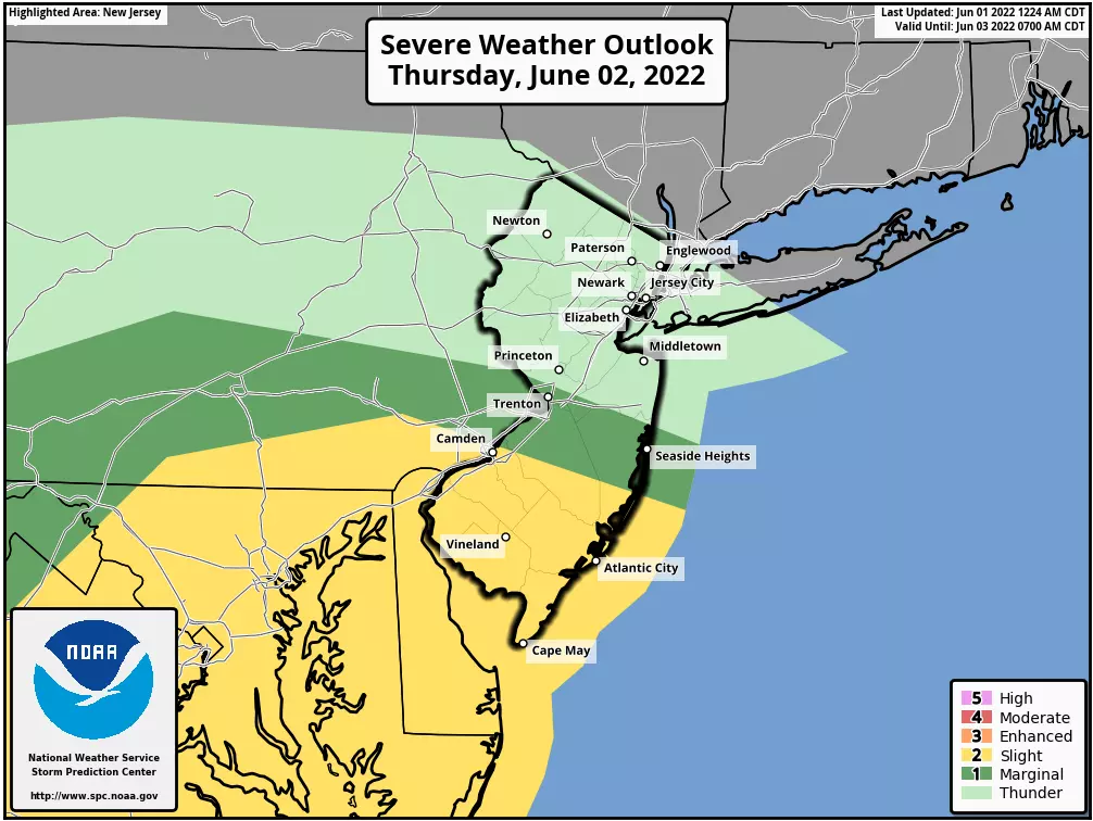
But you will have to watch the sky starting around 2 or 3 p.m. Thursday afternoon, as a round of thunderstorms pushes in from the west. The storm threat will continue until about Midnight Thursday evening.
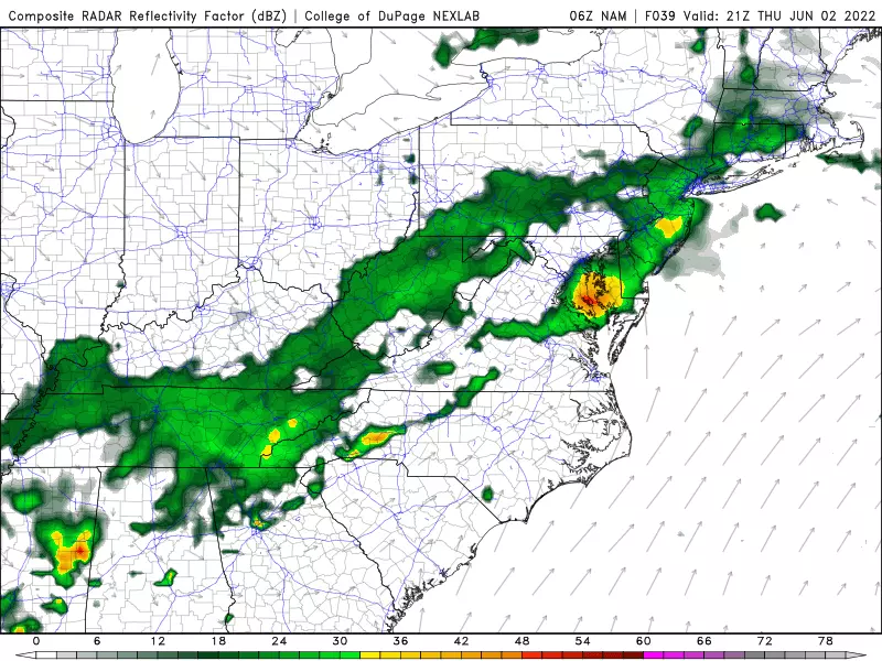
Those storms are going to be widespread. Latest model guidance shows at least a half-inch of rain across the Garden State. But the big concern is for pockets of locally heavy rainfall, possibly totalling 2 to 3+ inches. That could cause some significant ponding and flooding issues. Severe thunderstorm cells with gusty winds are possible, too. And, unfortunately, the worst weather could coincide with Thursday evenings commute.
Friday
Cooler, drier air returns. And that's going to contribute to a beautiful June day.
As skies become sunny, high temperatures should hit upper 70s or so. It will be breezy, with winds out of the northwest up to 20 mph — I think it will feel refreshing. We'll also enjoy lower humidity and dry weather all day.
The Weekend & Beyond
Sunshine and mid to upper 70s on Saturday. Partly sunny and upper 70s to around 80 on Sunday. Sounds great to me!
Our next chance of rain won't come until early next week. Late Sunday night at the latest.
One more item worth noting. Hurricane Agatha made landfall along the Pacific coast of Mexico on Mexico. As of Wednesday morning, that piece of energy (no longer tropical) is over the Yucatan Peninsula. As it enters the Gulf of Mexico, there's a good chance it gets organized and redvelops into a tropical storm. If so, it will earn the first name on the Atlantic hurricane list for 2022: Alex.
We have been in a very active tropical period lately, with New Jersey suffering some highly impactful storms over the last two years. (Fay, Isaias, Ida.) So we have to watch the development of every storm carefully, in case direct and/or indirect impacts eventually threaten New Jersey.
LOOK: The most extreme temperatures in the history of every state
NJ beach tags guide for summer 2022
More From WPG Talk Radio 95.5 FM


