NJ weekend weather: Big warmup with a few rain showers
The Bottom Line
Welcome to the bottom of the barrel. Thursday was a brisk, almost uncomfortably cool day — at least we enjoyed gorgeous sunshine for most of the day. Friday morning's temperatures are close to record lows, with a widespread frost/freeze across inland New Jersey.
Let's talk about a warmup, shall we? Both Friday and Saturday will make it to around 60 degrees — still below normal for this time of year, but better. Sunday surges to 70. Monday will bring 80+ to NJ. Quite a temperature swing — of course, that volatility is a hallmark of springtime in New Jersey.
There will be a few bumps in the road. Including some raindrops over the weekend.

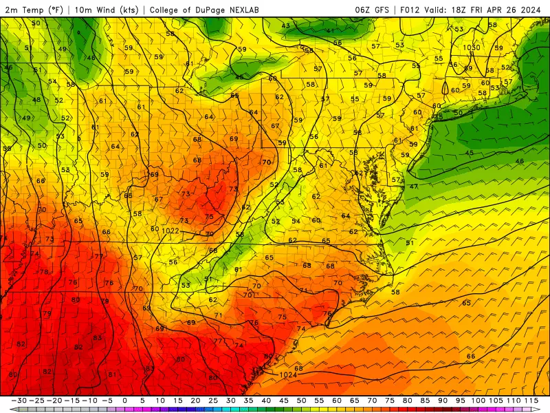
Friday
Cold start, nice finish.
The coldest corners of New Jersey — the northwest hills and the Pine Barrens — have bottomed out at 28 degrees. A freeze for some, a frost for most, with temperatures mainly in the 30s across New Jersey. That is unseasonably cold here in late April, and may be reason enough to reach for a heavier coat and/or warm up the car a bit.
At least it is also clear, crisp, and calm to start the day. And temperatures will moderate once the sun gets higher in the sky.
Highs Friday afternoon should reach about 60 degrees. That is slightly warmer than Thursday, so the day overall will be less brisk. But we are still holding 5 to 10 degrees below normal for this time of year.
It will be sunny and dry all day, with only a light breeze.
It is not a sure bet, but Friday night could be our last widespread frost/freeze of the season. (Or at least for a while.) Lows will average upper 30s by Saturday morning.
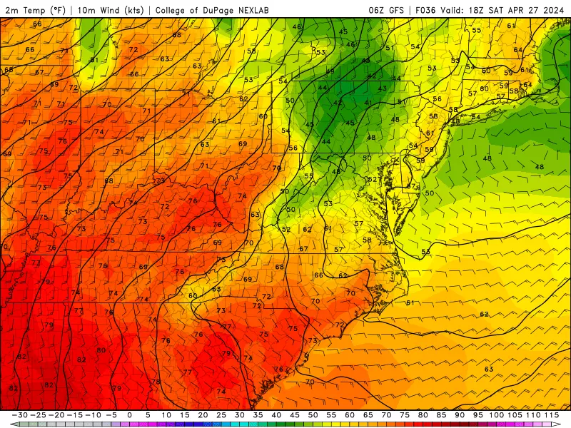
Saturday
Temperatures on Saturday will be similar to Friday, tempered by clouds and eventually some raindrops.
You may catch a continuation of sunshine into Saturday morning, before clouds fill-in by the afternoon. Expect high temperatures again close to 60 degrees.
Rain chances will go up late-day Saturday, as a warm front lifts into New Jersey. I could see some spotty to scattered showers developing over New Jersey starting around 4 p.m. and extending through the evening hours.
This will not be a big super-soaker or total washout. Just some evening showers.
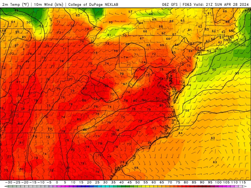
Sunday
There are two slight chances of rain on Sunday: lingering showers in the morning, and then perhaps a popup thunderstorm later.
In the middle, it should be a very nice April day. Expect partial sunshine and high temperatures surging into the lower 70s (away from the coast). Just like that, we swing to the warm side of "normal".
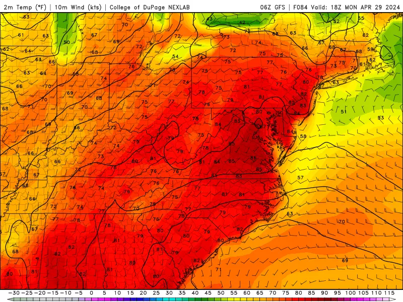
Monday
The effects of our newfound warm air will peak on Monday, sending high temperatures into the 80s for inland central and southern NJ. You will even feel a hint of humidity in the air, as dew points potentially push into the 60s.
Rain chances look low, although I would not completely rule out a quick popcorn shower. Otherwise, skies should average partly sunny overall.
The Extended Forecast
Above-normal temperatures will hold on for most of next week, as we turn the calendar page from April to May.
Tuesday is one little hiccup, as some models show a cooldown due to clouds, rain, and and on-shore breeze. I do think temps will dip into the 70s with a round of late-day scattered showers and thunderstorms. But it will only be a temporary setback.
80s return for much of the state on Wednesday, with only an isolated popup thunderstorm chance.
Eventually, a cold front will push in an extended period of rain and cooler air. Probably in the Thursday-Friday time frame. We will pinpoint that further as it gets closer.
How much does parking cost at NJ fun spots?
Gallery Credit: Dan Alexander
Dan Zarrow is Chief Meteorologist for Townsquare Media New Jersey. Follow him on Facebook for the latest forecast and realtime weather updates.
The best supermarkets in New Jersey
More From WPG Talk Radio 95.5 FM