A ‘Blah’ Weekend for NJ: Cloudy, Breezy, Showers, Tidal Flooding
The Bottom Line
We'll squeeze out one more nice day Friday, before damp and dreary conditions return this weekend. Rainfall totals will be light, but skies will be grey with a persistent on-shore breeze. That wind will also drive a few rounds of widespread minor coastal flooding at the Jersey Shore.
Want to see sunny skies again? You'll have to wait until the middle of next week.
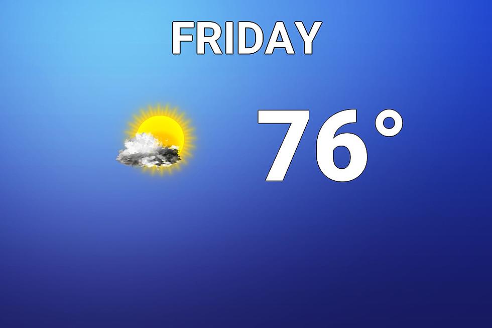
Friday
If you liked Thursday, you'll be happy with Friday's forecast too. Soak it in — this will be NJ's last perfectly pleasant day for a little while.
Once again, there are some pockets of dense fog out there to start the day. It looks like the fog is thickest and most widespread in North Jersey, with some visibility sensors reporting only a quarter-mile. By mid-morning (9 a.m. or so), the fog will lift, and we'll enjoy a mix of sun and clouds. High temps will be back in the mid 70s.

The daytime hours will be mild and dry. But late Friday evening, a backdoor cold front will slide across the state. (The name comes from the fact it will move from northeast to southwest, rather than the traditional northwest to southeast direction.) A few showers and sprinkles may pop up. And that front will be the main driver of some lousy weather this weekend.
Saturday
Blah. Not stormy, soggy, messy, nasty, or even wet. Just blah.
Expect cloudy skies and occasional waves of sprinkles throughout the day Saturday. Yes, just drizzly sprinkles — the risk of anything resembling heavy or steady rain is low. The chance of thunder or severe weather is very low as well.
A strong breeze will blow out of the east, gusting to 20 to 30 mph. That is an on-shore breeze, raising alarm bells for coastal flooding.
As an extra foot or two of ocean water is driven toward the coast, we'll likely see widespread minor flooding of tidal waterways at high tide. Water levels could even touch the "moderate" category in spots. The highest tides will occur Saturday morning (around 10 a.m. on the oceanfront) and Sunday morning. A Coastal Flood Advisory has been issued for the entire Jersey Shore.
High temperatures will reach the upper 60s or so Saturday afternoon. Sure, that's cooler than it has been. But not too far off from seasonal normals here in early to mid October.
The forecast does trend drier Saturday night. But the combination of clouds, wind, and residual moisture will still make it feel raw.
Sunday
About the same as Saturday. Furthermore, as a coastal storm system approaches from the south, we'll have a chance for more "showers" rather than "sprinkles".
You may recall that earlier this week, I was pondering the possibility of a period of soaking, steady rain Sunday morning if that coastal low tracked directly over NJ. Model consensus now resoundingly rejects that solution, keeping the heaviest precipitation south and east of the state. (GFS 1, Euro 0.)
Once again, don't expect much if any sun on Sunday. But once again, it won't be a total washout. My forecast puts temperatures about a degree warmer than Saturday, thanks to lighter on-shore winds, in the upper 60s to around 70 degrees.
Monday
That coastal low is going to hang off New Jersey's coast for another day, keeping skies pretty grey and unsettled. Having said that, the chance of showers looks lower (although not zero). And we'll hopefully see just enough breaks of sun to push the thermometer toward a seasonable 70 degrees.
Tuesday & Beyond
Our not-so-friendly coastal storm system finally shoves out to sea on Tuesday. That means we'll see improving weather, as skies progress from mostly cloudy in the morning to partly sunny in the afternoon. And temperatures should respond nicely, pushing into the lower 70s.
Warm weather should continue through at least Wednesday and Thursday, as thermometers potentially flirt with 80.
If you're looking for a more seasonable autumn chill, you'll have to wait a while. Sometime in the neighborhood of next weekend, we'll probably see a strong cold front sweep in wind and cooler, drier, crisper air. That means we're probably 10 to 14 days away from the first of first frost.
Try to have a great weekend, despite the weather. I'm taking a personal day Monday, so the weather blog will be resume on Tuesday.
Haunted Hayrides and Attractions in New Jersey for 2021
What to know about the spotted lanternfly & tree of heaven in NJ
More From WPG Talk Radio 95.5 FM