
A Farewell to Storms: Much Drier, Cooler Air Has Returned to NJ
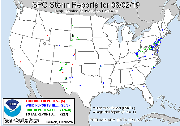
For the fifth time in eleven days, New Jersey experienced severe weather on Sunday. Several rounds of strong thunderstorms caused driving rain, impressive cloud-to-ground lightning, hail, and damaging winds. There were many, many downed tree reports from all corners of the state.
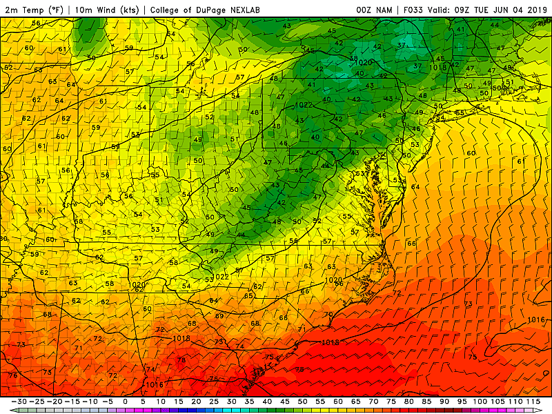
Now, the big pattern change we've been advertising has arrived. Cooler, drier air has been filtering into the Garden State overnight. And your Monday is looking comfortable, refreshing, and almost fall-like, thanks to that deliciously dry air.
Monday morning temperatures are mostly in the 50s. (A little cooler to the north, a little warmer to the south.) We'll top out in the upper 60s to around 70 degrees Monday afternoon. That's almost 10 degrees below-normal for early June. It could be our coolest day since mid-May.
Skies will be bright and sunny on Monday. A stiff breeze will blow out of the northwest at about 10 to 20 mph.
Temperatures for Monday night are promising to be quite cool, if not chilly. Most of the state will dip into the upper 40s overnight! Not cold enough to ring frost or freeze alarm bells, but you might need a jacket first thing Tuesday morning.
Tuesday also looks pleasant, although still below-normal. Highs should reach the lower 70s, with continued mostly sunny skies and dry weather.
There is only one day this week with a chance of rain and thunderstorms in the forecast — Wednesday. As clouds and humidity increase starting Wednesday morning, a few showers may pop up. The better chance for thunderstorms will arrive later Wednesday afternoon into Wednesday evening. Some of those storms may be on the strong side. High temperatures will climb into the lower 80s away from the coast.
By Thursday morning, we should be clearing out and drying out again. It's still going to be warm and humid though, with highs bumping into the summerlike mid 80s.
The extended forecast shows clouds, dry weather, and warm temps again in the lower 80s for Friday.
It's still a little bit early to talk about details for next weekend. For now, it looks like we'll be under the influence of an on-shore flow. That east-southeasterly could keep coastal communities particularly cool, no better than 70s. It might lead to increased cloud cover and some showery, drizzly weather too. Again, we'll add some more confident specifics as the week presses on.
More From WPG Talk Radio 95.5 FM


