Active weather for NJ: Clouds, heavy rain, wind, warmup, cooldown
By the time I write my next blog, a batch of very heavy rain will be knocking on New Jersey's door. On top of some fierce wind and wild temperature swings. Our weather forecast over the next 24 to 48 hours is going to get pretty wild!
Your Thursday morning is starting with cooler temperatures than the past couple of mornings, generally in the 30s across New Jersey. Not a very pretty weather day shaping up for the rest of Thursday, as skies become mostly cloudy to overcast. Patchy drizzle is possible along the way too. High temperatures will be limited to the upper 40s to lower 50s — at least that is near-normal for mid-March.
Thursday evening gets a bit wetter, as more showers, drizzle, and fog roll into the Garden State. Temperatures will only dip a few degrees overnight, into the upper 40s.
Friday is going to be quite the active weather day. This forecast can be broken down into four W's:
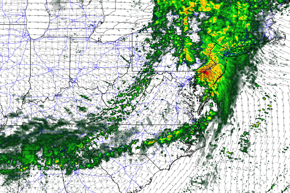
—Wet... We are going to get soaked Friday morning, as a batch of heavy rain arrives from the west. My estimation puts that rain in the 4 a.m. to 10 a.m. window, with the heaviest downpours around 7-8 a.m. Models suggest over an inch of rain is possible in that short time frame, which raises the concern for flash flooding. And, of course, the timing is just awful as the soggy weather coincides with the Friday AM commute.
—Windy... Even before the rain wraps up, a big wind will blow in. Southeasterly gusts to 40 mph are possible throughout Friday, likely peaking around Friday mid-morning. That's enough to blow around garbage cans, make driving and walking somewhat difficult, and perhaps cause isolated power outages. Minor coastal flooding is possible at high tide too.
—Warm... Did you miss the unseasonable warmth? Ha, it's coming back for one and only one day. Highs Friday afternoon will range from the lower 60s (far north) to mid 60s (central) to near 70 degrees (south). That is 10 to 20 degrees above normal for mid-March.
—Wonderfully sunny... (OK, I had to stretch a little to make that a W.) Following the early morning rain, clouds will rapidly depart. I fully expect bright sunshine to break out by the afternoon.
We are going to cool down eventually. But our latest forecast models hold off on the tumbling temperatures until Friday night.
Our weather finally settles down just in time for the weekend — the last weekend of winter, by the way!
Saturday will feature bright sunshine and cooler temperatures, in the lower to mid 50s. It looks like a pleasant mid-March day.
A storm system looks to dive south of New Jersey Saturday night through early Sunday morning. Some models clip the Garden State with showers, especially to the south. Could be snow, could be rain, no biggie. And again, the timeline has shifted to the overnight hours.
Sunday will start with leftover clouds, before sunshine resumes by Sunday afternoon. The cooldown continues, with highs only in the upper 40s — that would be slightly below normal for this time of year.
Monday will be cool in the 40s again, with an on-shore breeze. Clouds will increase throughout the day.
Our next storm system is scheduled to arrive on Tuesday, with periods of light to moderate rain.

More From WPG Talk Radio 95.5 FM


