
Miserably wet and cold: Timeline and impacts for Zeta’s remnants in NJ
Background
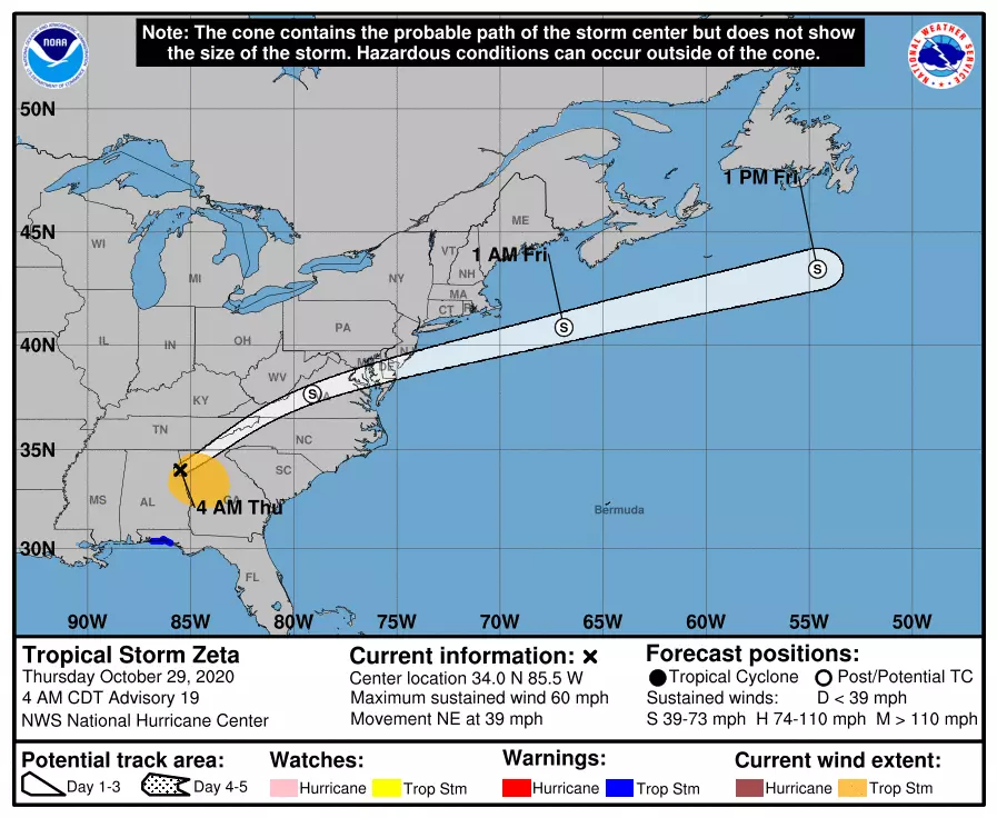
Zeta made landfall along the Louisiana coast Wednesday evening as a powerful category 2 hurricane, with 100 mph winds. As of 5 a.m. Thursday morning, Tropical Storm Zeta is centered over northeastern Alabama, flying to the northeast at 39 mph. The storm is expected to transition to a "post-tropical" or "extra-tropical" storm Thursday.
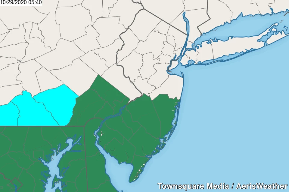
Radar over New Jersey is just starting to fill in with scattered rain. The first of many raindrops to come.
Bottom line: Other than the flash flooding and coastal flooding threats, it's hard to call this storm truly dangerous. Having said that, the combination of soaking rain, wind, and the coldest air of the season (so far) will result in downright miserable weather for both Thursday and Friday.
Rundown of Zeta's Impacts on NJ
—Rainfall... 1 to 2 inches in North Jersey, 2 to 3 inches across southern and coastal NJ. Areas of flooding are possible, if not likely.
—Top Wind Gusts... 30 to 40 mph, again maxing out to the south and east.
—Storm Surge... Up to 2 feet, enough to cause minor to localized moderate flooding of tidal waterways. Peak will occur during Friday's high tide cycles.
—Snowfall... Snowflakes are likely north of Interstate 80, and possible north of Interstate 78 on Friday morning. Light, slushy accumulations and slippery spots are possible around the Sussex-Passaic-Morris county area.
—Cooldown... Temperatures will go nowhere Thursday, stuck in the 50s all day. Cooler 40s on Friday. A widespread frost or freeze is expected Saturday morning (away from coastal and urban areas) — the first of the season.
Timeline
—6 a.m. to 6 p.m. Thursday... Rain, rain, rain. Moderate to heavy intensity. Rumbles of thunder possible. Breezy, with wind gusts 20 to 30 mph.
—6 p.m. to 10 p.m. Thursday... As the rain breaks up, the wind kicks up. Gusts between 30 and 40 mph.
—10 p.m. Thursday to 4 a.m. Friday... A relative lull. Scattered light rain, with breezy conditions.
—4 a.m. to Noon Friday... One more push of moderate to heavy rain. Snowflakes possible to the north. Minor to localized moderate coastal flooding at high tide. Breezy.
—Friday afternoon and evening... Drying out and calming down, with slowly clearing skies. Temperatures will decline through the 40s.
—Saturday morning... Calm wind, clear skies, and temperatures in the 30s. Widespread frost or freeze, away from urban and coastal areas.
—Saturday afternoon... Sunny, quiet, and chilly. High temps only around 50.
Action Steps
Flooding (both due to rain and surge) will be our biggest concern for both Thursday and Friday. Expect road closures in low-lying areas. And never attempt to drive, walk, or swim through flooded areas.
The wind will blow around garbage cans and Halloween decorations. It may be strong enough to cause a few downed trees and sporadic power outages.
While the first snowflakes of the season present a dramatic headline, accumulations and travel impacts will be limited (both in geography and magnitude).
And then the cold air settles in. While we'll be nowhere near the dangerous cold threshold, it will be time to break out the heavier jackets and heaters. And we'll all have to wear an extra layer or two under our Halloween costumes.
The Extended Forecast
Sunday will be mild, with highs back to around 60 degrees. Increasing clouds will lead to our next storm system, a cold front expected to arrive Sunday evening. That will result in a quick round of rain showers, followed by tumbling temperatures (again).
And if you thought Zeta's remnants brought in some intense wind and cold, just wait until next week! On Monday, wind gusts between 40 and 50 mph are looking likely. And with high temperatures only reaching about 45 to 50 degrees, we'll be bundling up quite a bit.
Election Day Tuesday will be blustery too, in the 40s, before temperatures moderate midweek.
High pressure will dominate our weather through the rest of next week, keeping things sunny and quiet and relatively pleasant.

10 ways to know you're from New Jersey
More From WPG Talk Radio 95.5 FM


