NJ weather: Heavy rain is over, but 3 flooding concerns remain
The Bottom Line
For the third time this December, New Jersey got drenched by a "super soaker" storm system. Since Wednesday, rainfall totals have ranged from under an inch along the southern coast, to just about 3 inches across much of North Jersey.
As of this writing (6:30 a.m.), the main band of steady, heavy rain has exited New Jersey. There's just some coastal showers, drizzle and fog left.
However, as you start your Thursday, flood watches and warnings remain in effect for much of New Jersey. There are three types of flooding you will need to watch out for:
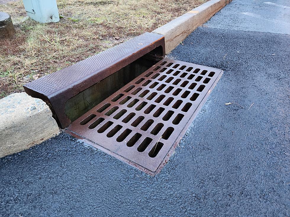
—Flash Flooding... When heavy rain overwhelms drainage systems, roadways and low-lying areas develop "big puddles". Since the downpours have already stopped, areas of flash flooding are already subsiding.
—River Flooding... Runoff from heavy rain enters rivers, streams, and creeks, which usually crest hours or even days after a heavy rain event. Most waterways in the northern half of New Jersey are expected to crest above flood stage late Thursday into Friday. Elevated water levels may persist for several days.
—Coastal Flooding... Even though this coastal storm system did not pack significant wind, there is just enough storm surge to cause minor category flooding of tidal waterways. The high tide cycle of concern is Thursday morning.
Let's talk about brighter skies, drier weather, and cooler temperatures on the way for New Year's and beyond.

Thursday
Be sure to read my flooding discussion above for some relevant and very important information for Thursday.
We are drying out Thursday morning. As the coastal low pulls away, the heavy rain has exited the Garden State. You may encounter some drizzle and lingering fog early Thursday. Along with cloudy skies and fairly mild temperatures, around 50 to 55 degrees.
There is a good chance for a reemergence of spotty rain showers Thursday afternoon. Up to a quarter-inch of additional rainfall is possible. Just weather, dreary weather — nothing like the overnight heavy rain.
I will keep a shower chance alive Thursday night. Under a blanket of clouds, low temperatures will dip into the mid 40s or so. That is closer to our normal high temperatures for this time of year.
Friday
An early morning cold front will open the door to a slightly cooler, drier air mass.
Friday's forecast has trended brighter and substantially drier. We should see some breaks of sun on Friday. And temperatures are not going to "nosedive" per se — I think thermometers will still end up close to 50 degrees in the afternoon.
I can't completely rule out a quick sprinkle, especially Friday night.
Saturday
Settling into a quiet, seasonably cool weather pattern for the last weekend of the year.
Saturday morning will turn chilly, with lows in the 30s. Our first potential frost or freeze in a while.
Highs will only reach the mid 40s. Typical for late December. Look for mixed sun and clouds, dry weather, and a light westerly breeze throughout the day.
Sunday (New Year's Eve)
All things considered, NYE looks good.
It will be partly sunny and dry, with highs again in the mid 40s.
For those planning to ring in 2024 outdoors, I'd estimate the Midnight temperature to be about 36 degrees.
The Extended Forecast
Quiet weather continues through the first few days of 2024. The long-range forecast contains variable cloudiness and an occasional breeze. Morning low temperatures will likely dip below freezing each day. Daily high temperatures will probably hold steady around the mid 40s.
I do not see any major storm systems developing in the next week. Models hint at a near miss to the south around January 4-5. Diving deeper into snow season, and approaching the "dead of winter" coldest part of the year, we will be watching closely for any hint of sloppy, slippery weather.
Dan Zarrow's Top 10 Weather and Climate Stories of 2023
Gallery Credit: Dan Zarrow
Dan Zarrow is Chief Meteorologist for Townsquare Media New Jersey. Follow him on Facebook for the latest forecast and realtime weather updates.
Glossary of NJ winter weather words and phrases
Gallery Credit: Dan Zarrow
More From WPG Talk Radio 95.5 FM


