
NJ Weather: Quick Update on Sunday-Monday Storm System
Good morning and Happy Thanksgiving, New Jersey! Even though the weather will not bring you any travel concerns on this holiest of turkey days, we are still monitoring a storm system aiming for the Garden State at the end of the holiday weekend. We're not necessarily facing big snow or widespread icing. But it could be quite a grand finale to one of the busiest travel weeks of the year, with a messy mix of weather conditions looking likely.
The Short-Range Forecast
I don't know about you, but the howling wind kept waking me up early Thursday morning. The top wind gust I could find in New Jersey was 52 mph at Pennsauken, Camden County. The fiercest wind gusts are behind us now, although it's going to be a blustery Thanksgiving Day overall. Regular gusts over 30 mph and occasional bursts to 40 mph are expected through about sunset.
A Wind Advisory continues until 6 p.m. for 16 counties in New Jersey: Atlantic, Burlington, Camden, Cape May, Cumberland, Gloucester, Hunterdon, Mercer, Middlesex, Monmouth, Morris, Ocean, Salem, Somerset, Sussex, and Warren.
Other than the wind, we're looking at a quiet and dry first 75% of the holiday weekend. Temperatures will be stuck cooler-than-normal — near 50 on Thursday, mid 40s Friday, and lower 40s Saturday (with increasing clouds).
Our Next Weathermaker
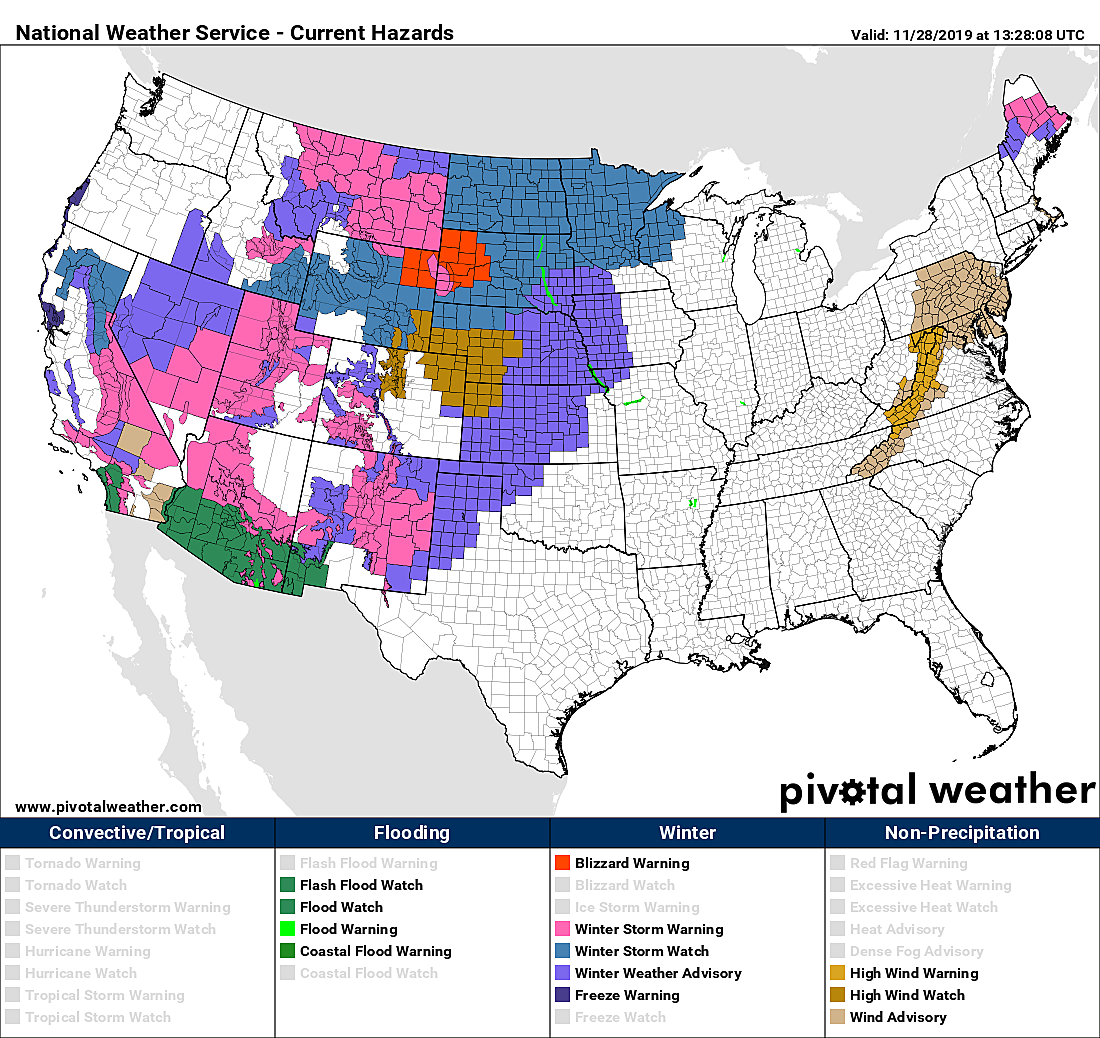
The strong storm system we're watching has been wreaking havoc on holiday travel across the country. As of this writing (8 a.m. Thursday), winter weather warnings and advisories are posted from California to Wisconsin, covering about a third of the continental U.S.
As that low pressure arrives here in the Northeast on Sunday, it will tap into moisture stemming from the Gulf Mexico. That means precipitation will potentially be heavy. And then as our primary low strengthens over the Atlantic Ocean and a secondary low approaches from the west, things get even more iffy.
As of this morning, our forecast models are showing pretty good consensus of how this complicated weather situation will play out. I remind you that we're still about 72 hours away from first snowflakes or raindrops, so things can absolutely still change. (That's how weather forecasts work — they always evolve and shift, as new data comes in.)
Realizing that countless New Jerseyans have travel plans for the end of the holiday weekend, I want to lay out a forecast timeline for you as it stands now. The bottom line: It doesn't really matter whether temperatures are conducive to rain, snow, sleet, freezing rain, or all of the above (wintry mix) — travel conditions will be messy at the end of the weekend.
Part 1: Sunday Morning
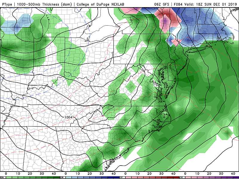
Again, Thursday, Friday, and Saturday look dry. The first band of precipitation shouldn't enter New Jersey until pre-dawn Sunday, at the earliest. At that time, surface temperatures are forecast to range from about 28 degrees in far North Jersey to 38 degrees along the southern coast. Hmmm, pretty close to that magical freezing mark. It is looking likely that precipitation will begin as snow or wintry mix away from NJ's southern and coastal counties.
Through the rest of Sunday morning, I could see a quick half-inch to an inch of snow accumulation for northern, central, and western New Jersey. (Especially on colder, non-paved surfaces.)
Part 2: Sunday Afternoon
Temperatures will warm into the 40s from Sunday late morning through midday, forcing almost all wintry precipitation to transition to a cold rain. (I am a little concerned about North Jersey, along and above Interstate 80, where colder temperatures at higher elevations may allow an icy mix to stick around for the duration.)
In addition, don't think for a second that travel conditions are going to be perfect just because we're talking about wet and not wintry conditions. Rainfall will probably become quite heavy during the Sunday afternoon hours, reducing visibility and traction.
New Jerseyans forget how to drive on a sunny day. Add in rain and the fact it's one of the busiest travel days of the year, and you've got a potential headache of a drive.
It's also worth mentioning that coastal flooding is a possibility on Sunday, as a period of east-northeast winds forces some ocean water toward the Jersey Shore. Surge models are not currently showing anything overly worrying — just something to watch.
On the backside of the primary low, we'll encounter some drier air. So rainfall should become more scattered (broken apart) Sunday evening into Sunday night. The current outlook keeps temperatures above-freezing overnight, so flash freeze and black ice conditions are not a concern for now.
Part 3: Monday
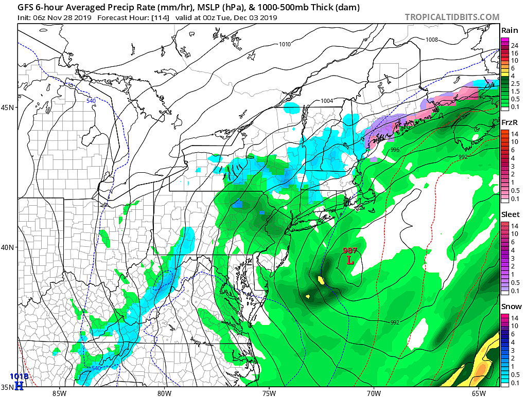
And now we come to the least confident part of this forecast. One more wave of precipitation is expected on the backside of our main storm system starting around midday Monday. Meanwhile, a secondary low will float from the Ohio Valley to our south. The exact position of those two centers of low pressure will dictate the exact temperatures and therefore what kind of weather we see. A simple concept, but a very difficult forecast.
Both the GFS and Euro models paint a rainy picture for Monday, not snowy. But I'm not totally convinced — a little shift in this setup could drag some cold air down from the north, forcing a transition to more wintry weather.
Travel Advice
Rainfall totals could top an inch. Snowfall totals up to an inch are possible early Sunday, away from South Jersey and the Jersey Shore. As I mentioned, we will have to watch for higher accumulations and/or icing in NW NJ, along and north of I-80.
Again, let me copy and paste my bottom line forecast... It doesn't really matter whether temperatures are conducive to rain, snow, sleet, freezing rain, or all of the above (wintry mix) — travel conditions will be messy at the end of the weekend.
If you have a long-distance drive home coming up, my best travel advice would be to plan to avoid most of the daytime hours on Sunday if possible. There will be exactly zero weather issues on Friday and Saturday. And even Sunday night should be mainly quiet — although road conditions will be wet in NJ, and potentially icy to the north.
That's it for now. Even though it's a holiday weekend, you can count on our weather, traffic, and news teams to provide regular updates on the latest conditions.
Next weather blog will be published on Black Friday (as soon as my shopping is done!)
I truly hope you and your family have a wonderful Thanksgiving!

More From WPG Talk Radio 95.5 FM


