NJ Weather: 3 More Cool, Showery Days Then Big Improvements
The Bottom Line
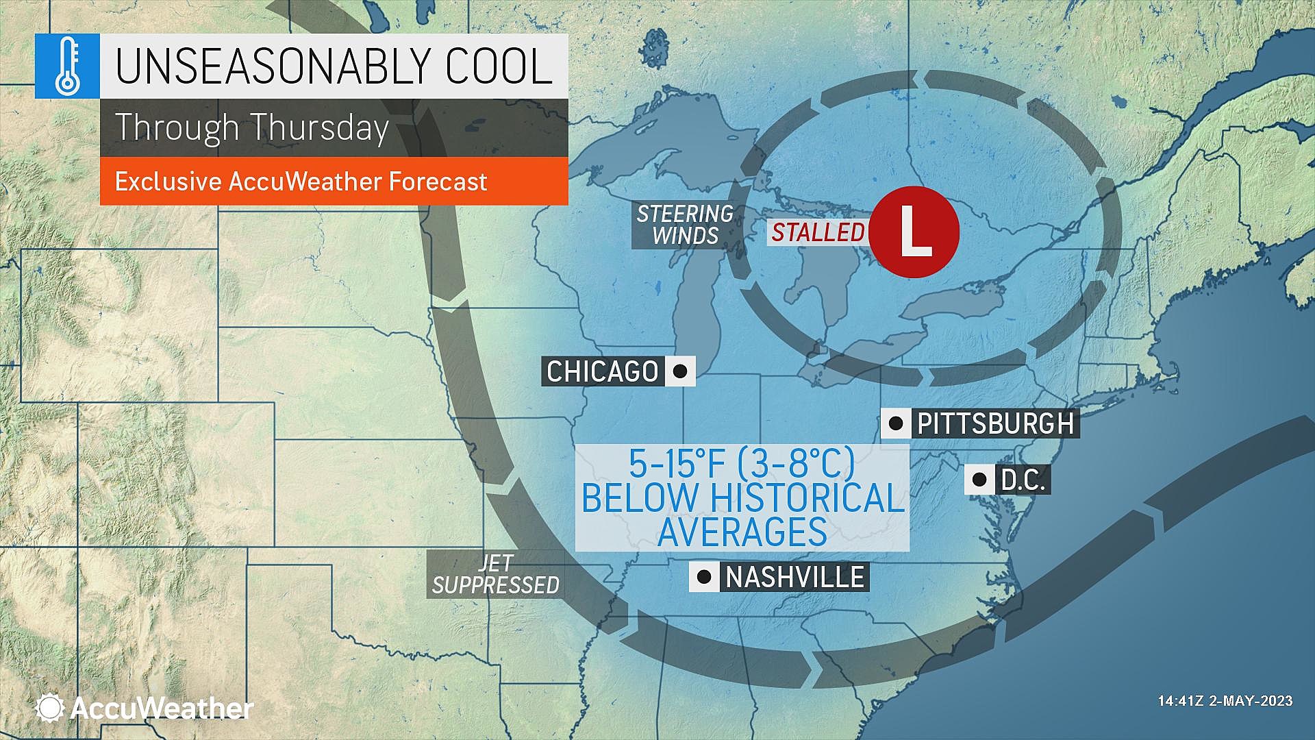
Same story, different day. The same area of low pressure that drove showers and clouds into New Jersey on Tuesday is still in the neighborhood, spinning over the Great Lakes. So the forecast still contains clouds, raindrops, and unseasonably cool temperatures for a few more days.
Big improvements will come with a big pattern change later this week. The weekend outlook is still fantastic.

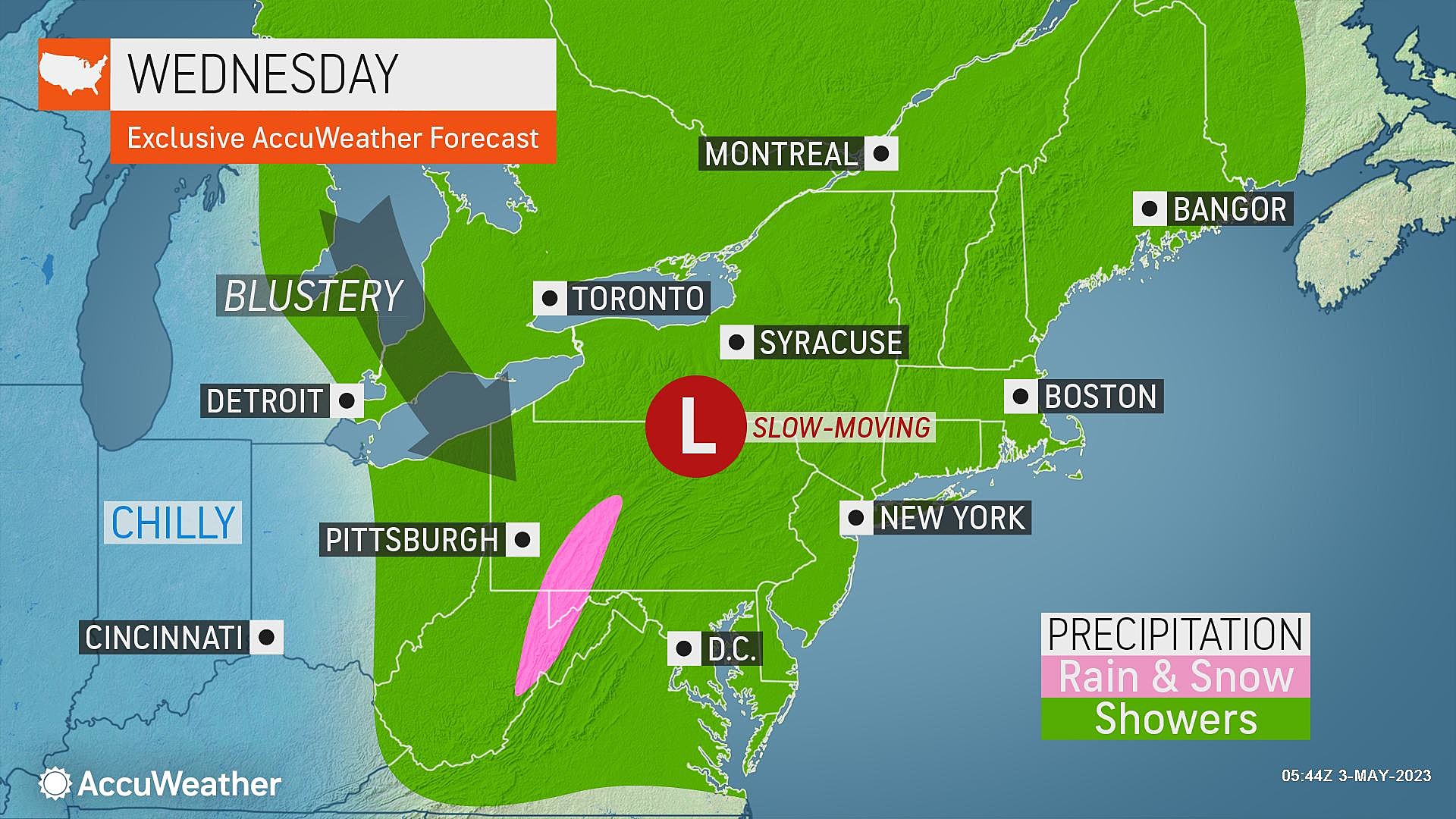
Wednesday
Once again, we have to talk about showers and cloud cover for Wednesday. But probably the bigger weather story here is the chill in the air.
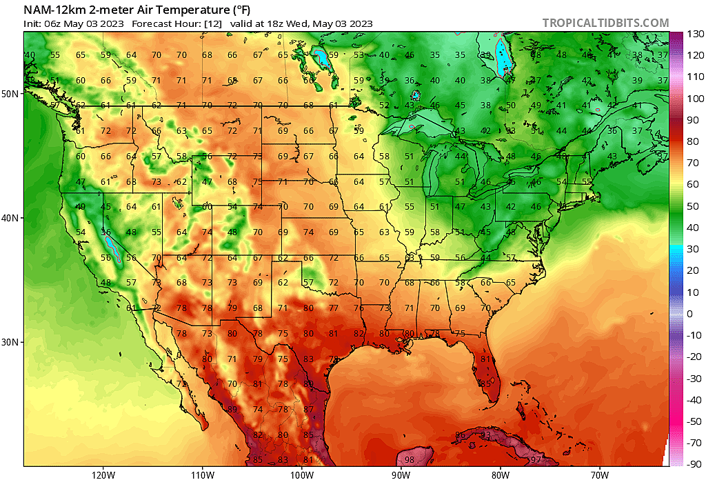
40s in the morning. Only 50 to 55 for highs Wednesday afternoon, probably the coolest day of the week.
In the middle of winter, 50s would be a beautiful day. In early spring (late March), lower-mid 50s would be a typical day. But here in May, we are still holding about 15 degrees below seasonal normals.
As of 6 a.m. Wednesday, radar shows only a few sprinkles along the northern and western edges of the state. But we will see one or two waves of spotty showers arrive during the daytime hours. Nothing prolonged or torrential. Just more damp and dreary weather.
I'll call the sky mostly cloudy. But not overcast. The difference is about 25% sunshine — glimmers of blue sky, as the day goes on.
Wednesday night looks quiet, with scattered clouds and chilly temperatures. Once again we will bottom out in the 40s. Patchy frost is possible in NW NJ. Patchy light fog is possible anywhere.
Thursday
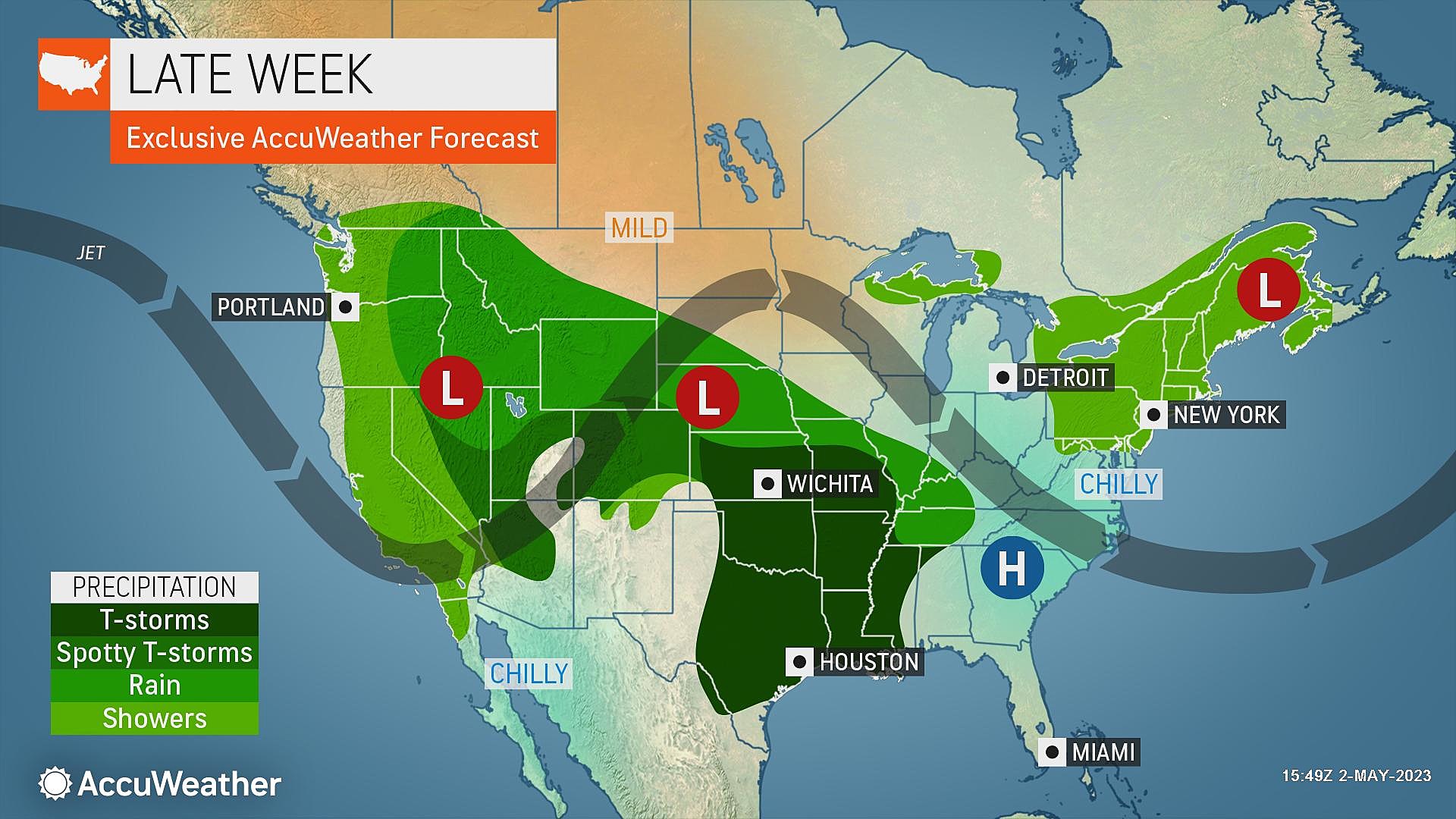
Some improvements are expected, as that broad storm system finally unhinges itself, aiming for an out-to-sea trajectory.
Just like Wednesday, we'll see clouds and some sun on Thursday. And high temperatures will still be below seasonal norms. But better, reaching about 55 to 60 degrees.
Only a quick shower or two is expected, centered on the afternoon hours Thursday. There's actually a good shot part of NJ stays completely dry.
Friday
One more isolated shower chance during the day on Friday, and then our atmosphere settles down.
Skies will continue to brighten and temperatures will continue to warm on Friday. Highs should peak around 60 degrees. Not bad. (Although again, keep in mind, the long-term average high for early May is closer to 70.)
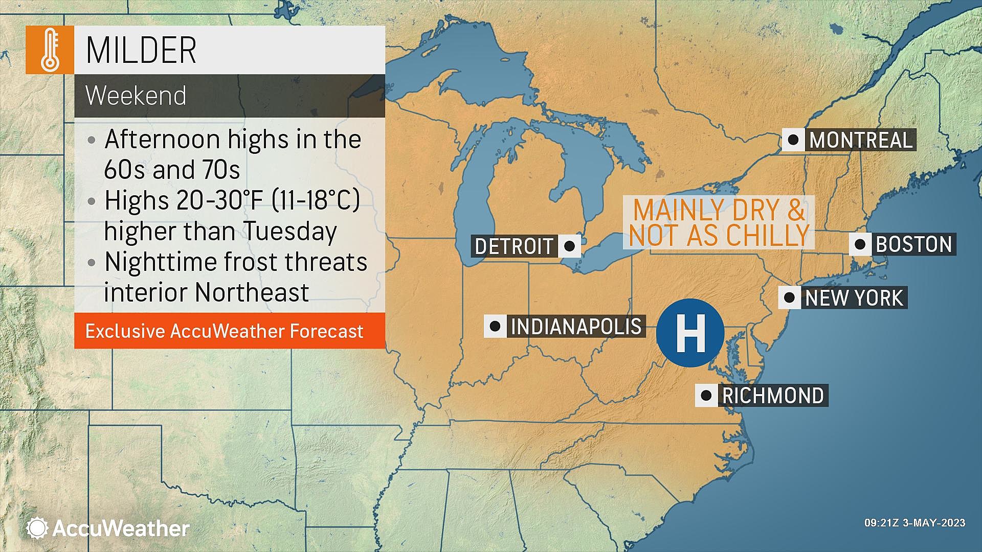
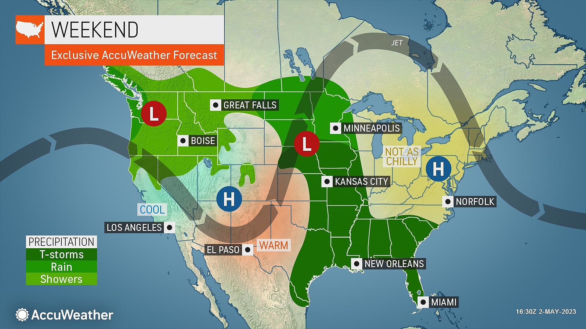
Saturday & Sunday
The first weekend of May looks great. Welcoming news after three consecutive weekends of not-so-perfect weather.
Skies should become mostly sunny by lunchtime Saturday. And temperatures will jump into the seasonably mild upper 60s. Winds will stay light, and rain chances are pretty much zero. Yes, we actually get to enjoy a beautiful mid-Spring day.
Sunday gets a touch warmer, pushing into the lower 70s. Again, sunshine and dry conditions dominate.
The Extended Forecast
Monday looks great too, well into the 70s. What happens after that gets a bit hazy. The warming trend may continue into Tuesday, with more 70s (at least). But our next bout of rainy weather looks to come into play Tuesday into Wednesday.
LOOK: The best minigolf in every state
LOOK: Here are 25 ways you could start saving money today
More From WPG Talk Radio 95.5 FM