NJ weather: Thursday warmest day since October, Friday rainy
The Bottom Line
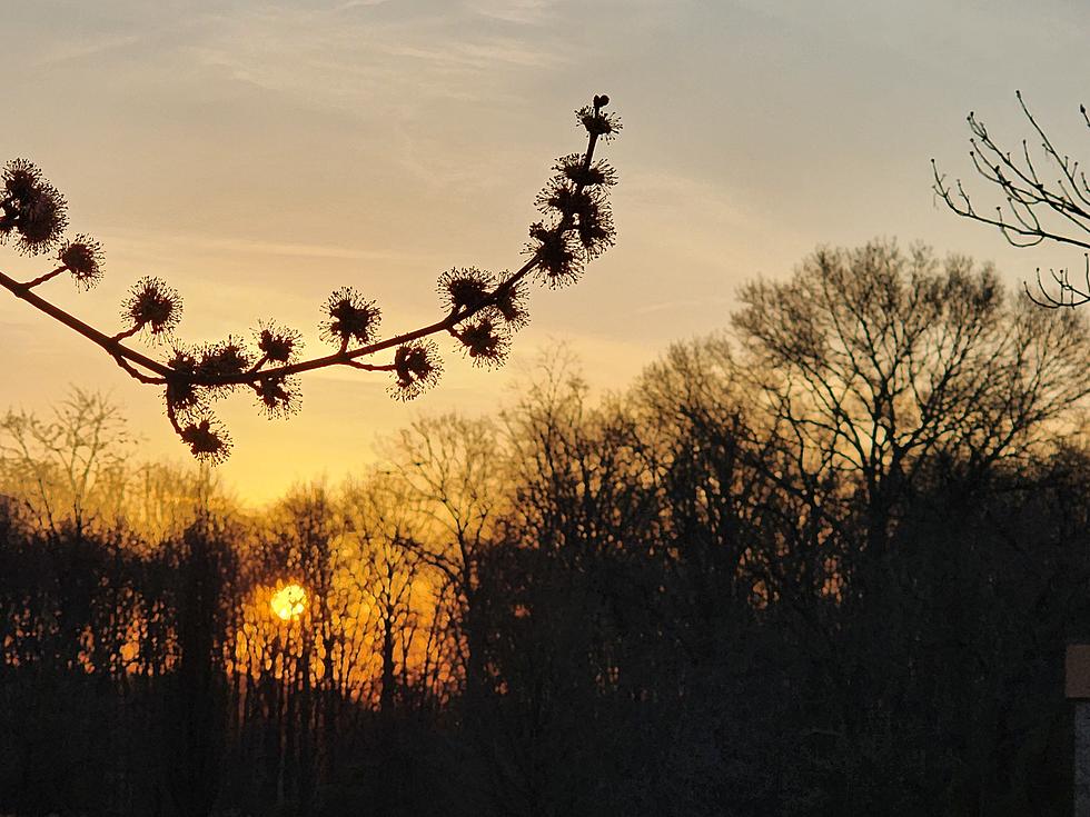
If you liked Wednesday's weather, odds are very good that you will love Thursday too. This will be our third day of unseasonable warmth, feeling more like May than March. Temperatures will run 20+ degrees above normal for this time of year, firmly in the 70s away from the chilly coast.
Changes are ahead though. A slow-moving cold front swings through New Jersey on Friday. That will introduce a couple rounds of rain showers. And then a cooldown for the final weekend of winter.
But the weekend actually looks pretty good, especially as temperatures stay above seasonal normals.
Next week is a whole 'nother story though. A surprising chill will carry through the transition from winter to spring. (The equinox is on Tuesday.) Highs for much of next week may be stuck in the 40s.
Thursday
One more pleasant, dry, very warm day.
Having said that, you will probably still reach for the jacket Thursday morning. The day begins with temperatures mainly in the 40s. Even some 30s in spots.
High temperatures today are forecast to reach about 70 to 75 degrees. As usual, the Jersey Shore will be the cool spot in the state, closer to 60 degrees. Barrier islands probably get stuck in the 50s again, surrounded by that chilly ocean/bay water.
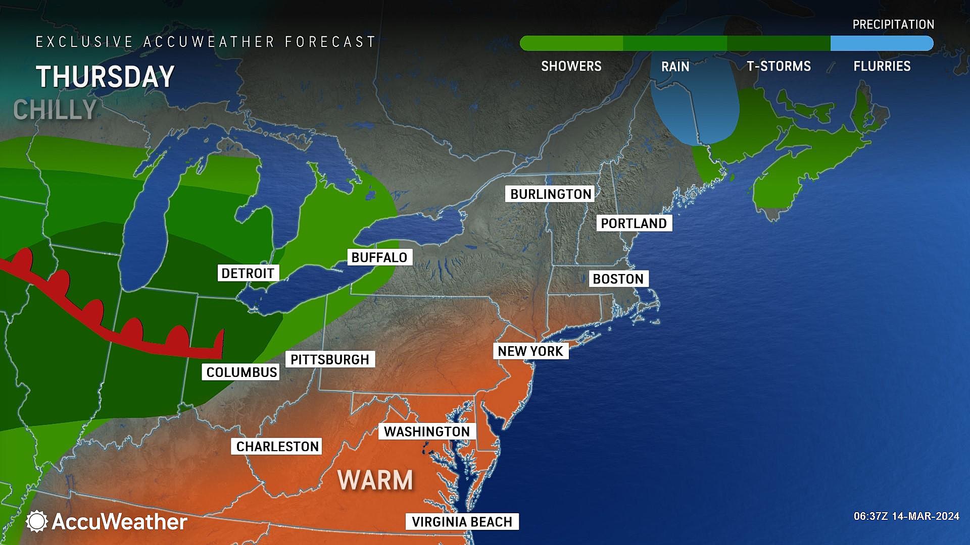
Throughout Thursday's daytime hours, we will see abundant sunshine with passing clouds. Our weather stays completely dry, with barely a breeze up to 10 mph. Enjoy the day!
Clouds will increase Thursday night, with showers potentially developing toward daybreak. Overnight low temperatures will only dip into the lower 50s or so.
Friday
Friday will be an unsettled weather day. A day of transition, as that slow-moving cold front drives in clouds, raindrops, and eventually cooler air.
I think we will see approximately 2 rounds of rain showers affect New Jersey on Friday. One in the early morning. And the other around the afternoon hours. It's not a total washout — meaning it is not going to rain all day. And we are really just talking about a "run of the mill" rain event here — no flooding, no severe weather, no winter weather. Just upwards of a half-inch of total rainfall.
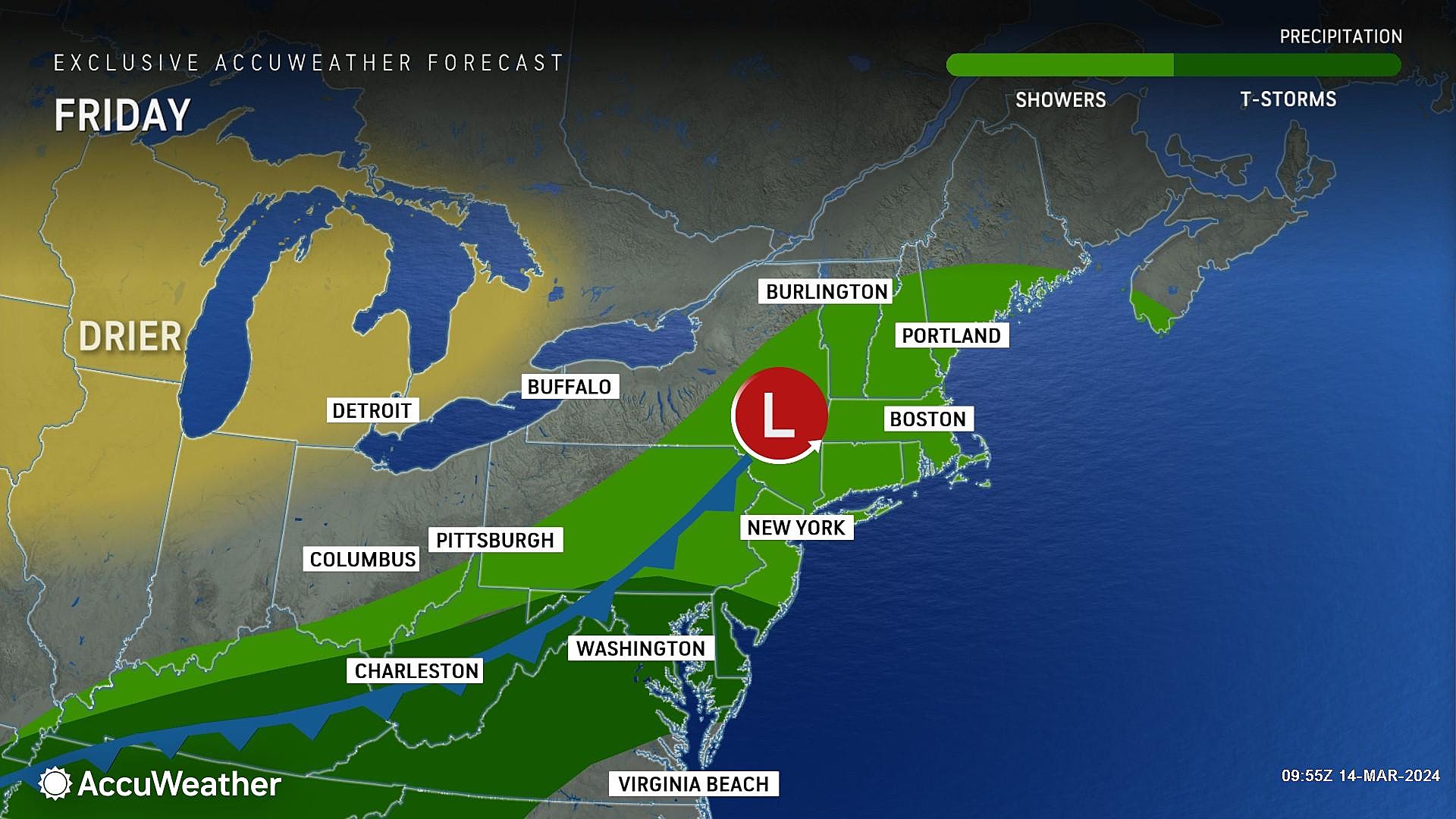
Meanwhile, it will be a mostly cloudy and breezy day. And still warm, as high temperatures range from the mid 60s (North) to the lower 70s (South). Those temps may start to slide backward in the afternoon, as rain fills in and cooler air arrives.
Friday night clears out and dries out. Temperatures will probably bottom out in the 40s by Saturday morning. Not cold, but noticeably colder than it has been.
Saturday
Saturday looks good. Yes, temperatures will be about 10 to 15 degrees cooler than earlier in the week. But highs around 55 to 60 degrees are still above seasonal normals. In other words, we change from May-like temperatures to typical April weather.
Saturday does look dry, with a bright (partly sunny) sky. There will be a north-northwest breeze, but it should not be too blustery.

Sunday
Sunday is St. Patrick's Day. And the weather will mainly cooperate.
A weak disturbance could clip North Jersey with a shower Sunday morning. Otherwise, our weather should be dry. Expect a mix of sun and clouds, with a prominent west-northwest breeze.
High temperatures for Sunday are a tricky call. Latest model guidance goes for 60-ish degrees, which would be quite pleasant. But colder air will be knocking on our door once again, and I have to wonder if that estimate is too high.
The Extended Forecast
Next week marks the big transition from winter to spring, with the arrival of the Vernal Equinox on Tuesday at 11:06 p.m. And temperatures are going to swing to the chilly side — a shock to the system after this week of warmth.
High temperatures for much of next week will settle in the 40s, feeling more like February than March. Daily morning freezes are likely. And while our weather pattern looks relatively quiet, we could very well see some snow showers and snow squalls along the way too.
Latest additions to NJ DOT's 2024 collection of humorous safety messages
Gallery Credit: Dan Alexander
2024 Philadelphia Flower Show
Gallery Credit: Jen Ursillo
More From WPG Talk Radio 95.5 FM