NJ weather: Unsettled and mild this week, with one really wet day
The Bottom Line
The operative word in this week's weather forecast is "unsettled". You might add "mild" to the mix too, as temperatures will stay above seasonal normals (and above freezing) until the weekend.
There will be lots of clouds, fog, and some showers around Tuesday. A coastal storm system will drive a period of steady to heavy rain from Wednesday to Wednesday night.
The eventual cooldown will be slow, but noticeable, as high temperatures slide back from the 50s to the 40s by New Year's Eve.
Snow is unlikely through the remainder of 2023.

Tuesday
That may not be a post-egg-nog-coma haze you are seeing Tuesday morning — fog has developed across much of the Garden State. I have seen visibilities down a half-mile in spots. While foggy conditions will improve by late morning, it may linger to some extent all day.
So Tuesday will be an "OK" day overall. Foggy. Cloudy. 40s in the morning. 50-ish in the afternoon.

A stray rain shower is possible at any time Tuesday. And Tuesday night too. But I think it is fair to call it a "mainly dry" day.
Dense fog could become an issue again Tuesday night. Low temperatures will drop into the lower-mid 40s.
Wednesday
Wednesday is the one wet day in this forecast.
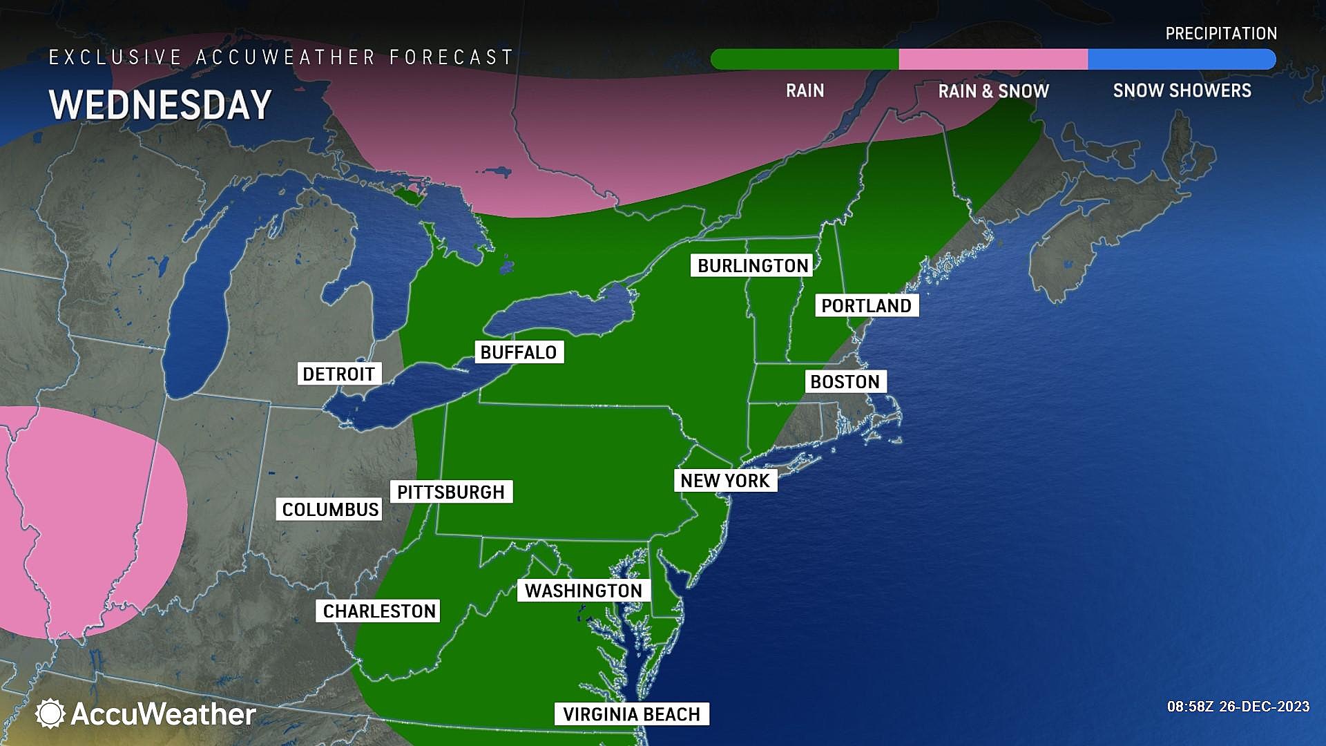
But here's the thing. Even though we are talking about a coastal low passing directly over New Jersey, this is not a "batten down the hatches" kind of storm. I do not see any enhanced risk for wind or severe thunderstorms. It's way too warm for wintry weather. And even the coastal flooding threat seems low.

The only alarm bell I have to ring is for moderate to heavy rain. Latest guidance shows total rainfall will reach 1 to 2 inches, especially across the southern half of New Jersey. While not as extreme as last week's 5+ inch soaking, that could be enough to cause travel delays and some ponding/flooding issues.
A shower is possible Wednesday morning. Then steadier rain builds in Wednesday afternoon. The heaviest rain from this storm system looks to come in the Wednesday evening and overnight hours — let's say 8 p.m. to 4 a.m. Rain should end by daybreak Thursday.
Despite the rain and abundant cloud cover, high temperatures on Wednesday should still reach the lower to mid 50s. More typical of mid November than late December.
Thursday
It all goes well, we could squeeze out several hours of reasonably pleasant weather Thursday. Rain showers should wrap up early. And will not return until late (if at all).
We will hold on to lots of cloud cover. But high temperatures are forecast to reach the mid to upper 50s. Maybe even 60 degrees in South Jersey.
Not too shabby.
Friday
On Friday, a piece of energy and cooler air will be in play. That presents the chance for a few on-and-off showers. But again, we're talking about the wet kind, not the wintry variety.
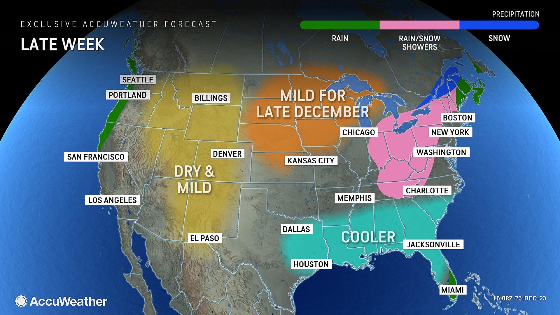
More prominently, temperatures on Friday will slide backward to the 40s through the afternoon. Not a dramatic "arctic blast" — but a noticeable difference from the mild temperatures earlier in the week.
The Extended Forecast
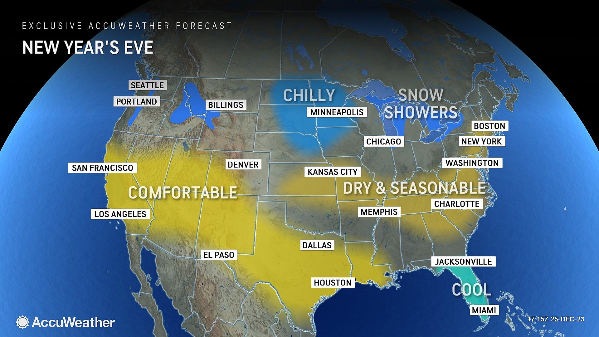
The final weekend of 2023 looks much more seasonable, with highs around the mid 40s for both Saturday and Sunday (New Year's Eve). Sunday morning looks like our next threat of a widespread frost or freeze. Sun should break out for a majority of NYE, with light winds and dry weather.
Early January looks to trend on the cool side. All it will take is a strong-enough storm system and cold-enough pocket of air to translate into accumulating snow. We'll see how things continue to develop — we are now less than a month away from "the dead of winter".
LOOK: Biggest snowfalls recorded in New Jersey history
Gallery Credit: Stacker
Dan Zarrow is Chief Meteorologist for Townsquare Media New Jersey. Follow him on Facebook for the latest forecast and realtime weather updates.
LOOK: Best counties to raise a family in New Jersey
Gallery Credit: Stacker
More From WPG Talk Radio 95.5 FM
![A Life Was Saved: Atlantic City, NJ Police “Clap Out” [Amazing Photos]](https://townsquare.media/site/564/files/2026/06/attachment-img_4395-1.jpeg?w=980&q=75)
![Try These Two Crab Cakes In The Atlantic City, NJ Area [Photos]](https://townsquare.media/site/564/files/2026/06/attachment-img_4352-1.jpeg?w=980&q=75)