No More Storms – Calmer, Cooler Weather for New Jersey
The forecast for the Garden State calls for a cooldown for Thursday afternoon, followed by sunny yet blustery conditions through the start of the weekend.
Here are your weather headlines for Thursday, February 25, 2016...
Storm Recap
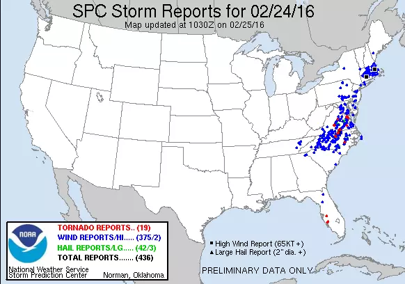
What a crazy, stormy night! The combination of warm air, plentiful moisture, a strong storm system, and a powerful low-level jet fueled some fierce thunderstorms on Wednesday evening. Two rounds of severe thunderstorms rolled through New Jersey, prompting widespread warnings for wind and flooding. Such storms would be common in the spring or summer... But in February?! Definitely unusual.
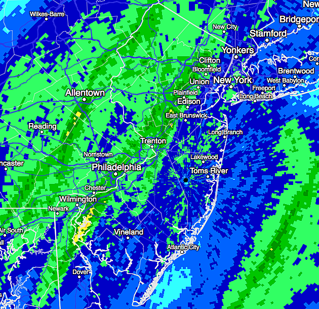
The heavy, unrelenting rain flooded roadways and quickly filled rivers, creeks, and streams throughout the state. Numerous rainfall totals over 2 inches were reported. The overall winner was Walpack in Sussex County, which recorded an incredible 3.17 inches from these thunderstorms. And that is likely an underestimate, as automated "tipping bucket" rain gauges generally have trouble keeping up with totals during torrential downpours.
While the heaviest rain fell across the western half of New Jersey, the gusty winds did not discriminate. According to the NJ Weather and Climate Network, 50+ mph winds were reported across all corners of the Garden State. Numerous downed trees and power lines were reported across the state.
The top wind gusts from Wednesday evening included:
--62 mph in Berkeley Twp (Ocean)
--60 mph in East Amwell (Hunterdon)
--55 mph in Mullica Twp (Atlantic)
--55 mph in Wantage (Sussex)
--51 mph in Oceanport (Monmouth)
--51 mph in Upper Deerfield (Cumberland)
--50 mph in Cream Ridge (Monmouth)
--50 mph in Sea Girt (Monmouth)
--50 mph at Silas Little (Burlington)
Multiple flood warnings and advisories remain in effect Thursday morning, due to high water along roadways, rivers, creeks, and streams.
Cooling Down
Radar will be much quieter on Thursday, although a few showers will be possible throughout the day as this storm system departs. A northwesterly wind will carry cooler air into New Jersey, so temperatures will take a tumble. Even though Thursday morning has been mild with temperatures still near 60 degrees, thermometers are expected to fall into the lower to mid 40s by Thursday afternoon.
So, while you may not need a jacket to start on Thursday, you may want one by the afternoon and evening.
Friday and Saturday will end up on the cool side of normal for New Jersey, with high temperatures in the lower 40s at best. Friday will be sunny but windy, with gusts as high as 35 mph. Winds will be lighter on Saturday, with continuing sunshine.
Warming Up
On Sunday, winds will flip to a southwesterly direction. That is generally a warming wind, and temperatures will respond accordingly.
Highs on Sunday will top out in the mid 50s. With partly sunny skies and a light breeze, it looks like a fantastic late February day.
Leap day Monday looks good to start, although a front could bring a few showers by midday. That front will also spell the (temporary) end to our warm temperatures.
Our next major storm system is currently modeled for Thursday. It's too early to have any resolution on details - we'll keep you posted.
More From WPG Talk Radio 95.5 FM