
One Day Burst of Stormy Weather for NJ, Then Back to Beautiful
The Bottom Line
I have to start by reflecting upon what a phenomenal weekend of weather we just had. Oh yes, it was hot. Especially away from the coast. But humidity was relatively low, and we were 100% storm-free. That doesn't happen very often in the summertime — hopefully you were able to enjoy the sunshine.
We begin the new week with a surge of humidity. And a round of stormy weather, sparked by an approaching cold front. The big concerns will be for pockets of heavy rain and wicked lightning, centered on Monday afternoon.
And then we flip right back to beautiful, refreshing weather for Tuesday. A warmup will ensue, likely leading to our first heat wave of the year late this week.
Of course, coming up late this week is the big 4th of July weekend. And we're starting to get a snapshot of the holiday weather — it's a smorgasbord of weather, with something for everyone.

Monday
Monday's unsettled weather will play out in three parts.
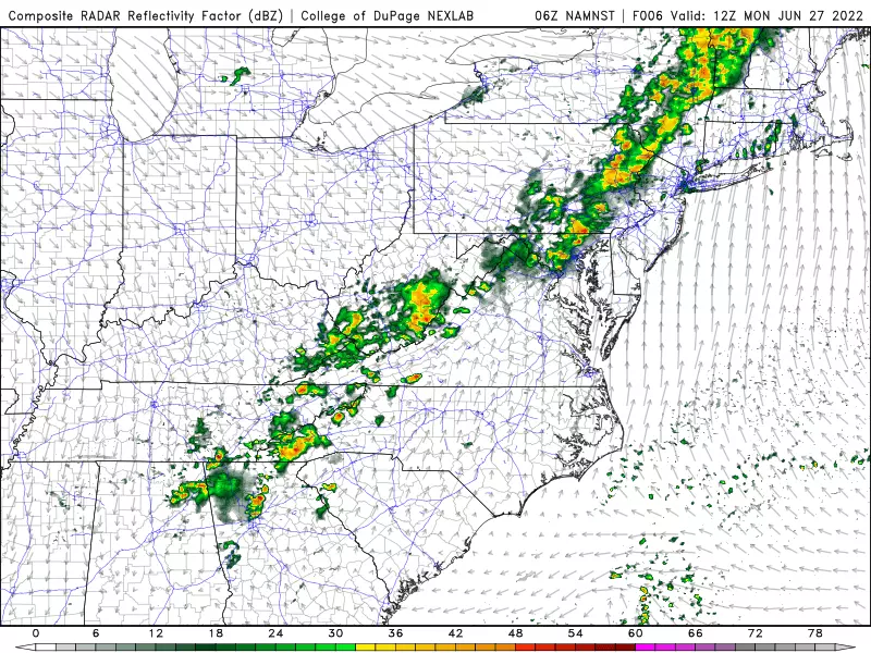
First of all, it is a muggy morning. The moisture in our atmosphere has a direct connection to the Gulf of Mexico. So humidity is much higher than it was this weekend. Monday is starting out with temperatures in the sticky 70s. Under mostly cloudy skies, highs will reach the mid 70s (North Jersey) to mid 80s (South Jersey) before rain arrives.
The second piece of the day will be the threat of scattered showers and thunderstorms. They'll generally progress from northwest to southeast, from mid-morning through late afternoon. (In fact, coastal areas and southern NJ should stay completely dry until some time in the afternoon.) The most widespread storm activity and the strongest storm cells will be out there Monday afternoon.
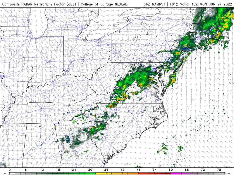
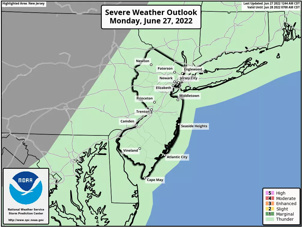
The risk of severe weather (wind, hail, tornado) is pretty low. But we do have to ring minor alarm bells for downpours and flooding. The ground is pretty thirsty, given a drier-than-normal June so far. Having said that, iff heavy rain inundates poor drainage areas, we might see areas of ponding through Monday evening's commute. Some loud thunder and vivid lightning are likely too.
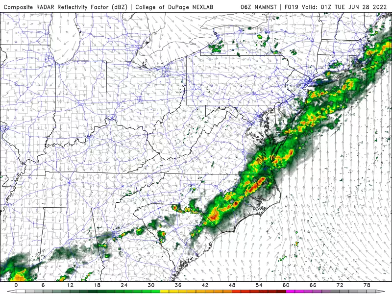
Around dinnertime/sunset, storms will be sliding off the coast. So part three of this active weather day will take over as we dry out and clear out Monday evening. It is going to turn much more comfortable overnight, as humidity levels drop significantly. Low temperatures should fall to about 60 degrees by Tuesday morning.
Tuesday
Flipping right back to refreshing weather, thanks to nice, dry dew points in the 50s. High temperatures will be limited to 75 to 80 degrees Tuesday afternoon — warm, but 5 to 10 degrees below normal for late June. Skies will be partly sunny and our weather stays completely dry.
Wednesday
Still nice. Although warmer, as highs push into the 80s across most of the state. Again, I'll call skies partly sunny.
A couple models put a stray shower over New Jersey around Wednesday evening. (It's such a slight chance, I have left it out of my on-air forecast for now.)
Thursday
The warmup continues to close out June. With plenty of sunshine, highs will reach the summer 85 to 90 degree range. Humidity levels will creep upward too, as dew points return to the 60s.
With 90 degrees a possibility for interior South Jersey, Thursday may be the start of New Jersey's first heat wave of 2022. (Definition: 3+ consecutive days of 90+ degrees.)
The Extended Forecast
We're coming up on one of the most important weather forecasts of the entire year: the 4th of July weekend. And the current forecast calls for a transition from hot to stormy to great.
As I mentioned, heat and humidity will surge late-week. In fact, Friday looks like the hottest of the bunch, with 90s for almost the entire state (away from the coast). It will be a sunny and dry start to July.
Saturday starts hot, but then turns stormy. Similar to Monday, it's not going to rain all day — but noisy thunderstorms may produce some downpours, temporarily dampening outdoor plans.
Behind the storms will come a cold front. Behind the front will come somewhat cooler, drier air. I'm seeing highs still in the 80s for Sunday, with a shower chance clipping South Jersey.
Monday is the 4th of July, and might be the nicest of the bunch. Mostly sunny, near 80 degrees, and storm-free? Sounds good to me.
Obviously, we'll continue to update this forecast as the week goes on, so you can make holiday weekend plans accordingly.
BEEP BEEP BEEP: These are the 13 types of Wireless Emergency Alerts auto-pushed to your phone
Gallery Credit: Dan Zarrow
One of the Top 50 Candy stores in the US is right here in Jersey
Gallery Credit: Jordan Jansson
More From WPG Talk Radio 95.5 FM


