
Saturday NJ Weather: Strong Thunderstorms With Wind and Downpours Likely
Well, it's certainly not an ideal weather day to kick off the first full weekend of summer. There will be rain. There will be thunderstorms. And some of those storms will likely be strong to severe. But there will be some breaks in the rain, so the entire day (and the weekend) will not be a total washout.
Timeline
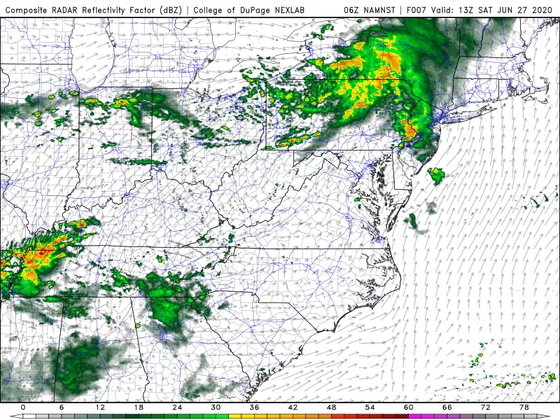
—8 a.m. to 11 a.m... First blob of rain arrives, affecting almost all of the Garden State. While radar shows solid, heavy rain over Pennsylvania, models suggest this line will fall apart over New Jersey. There could be some rumbles of thunder and pockets of heavier stuff. But nothing severe here, and no significant flooding issues expected. Just turning into a wet morning.
—11 a.m. to 3 p.m... Steamy and unsettled. Lingering showers will meet mostly cloudy skies, increased humidity, and warm temperatures — we should top out in the 80s today. There could be some breaks of sun, which will push temperatures even close to 90 degrees. That warming would also destabilize the atmosphere, increasing the potential energy for our second round of thunderstorms later on.
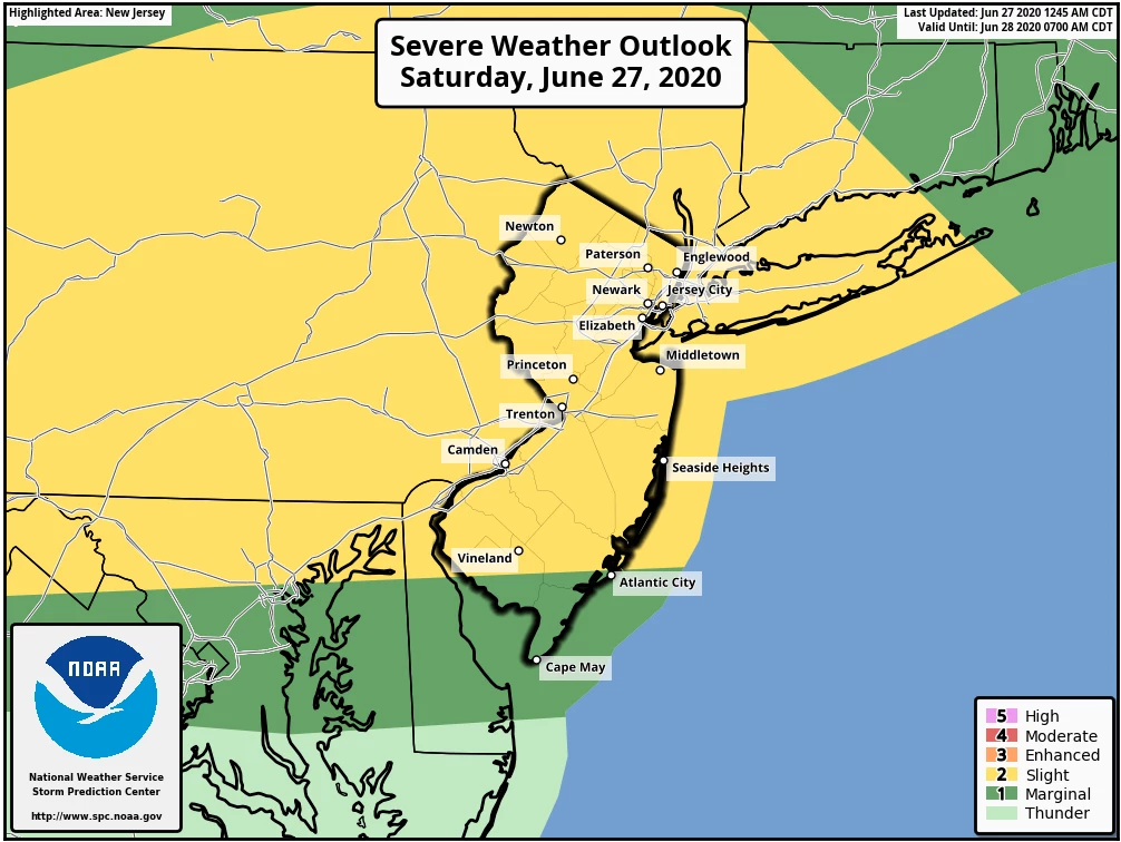
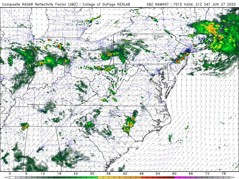
—3 p.m. to 8 p.m... Scattered thunderstorms will pop up, generally moving from west to east. Not everyone will see a storm from this round, but if you do it's likely to be strong. High-resolution mesoscale models show the best chance of severe storm cells will be over central and southern New Jersey. But I think everyone needs to stay "weather aware" and alert to the risk of dangerous conditions. (Keep reading for an outline of the severe weather threats possible here.)
—8 p.m. and beyond... Showers and storms will fade away once the sun sets. Then we'll see gradually clearing skies overnight. It's going to be muggy as heck, with low temperatures struggling to drop below the 70s.
—Sunday... Easily the brighter, better day of the weekend. Skies will range from partly to mostly sunny. It is going to be steamy, with areas away from the coast probably aiming for 90 degrees. In addition, a few spotty showers and thunderstorms are likely to pop up in the afternoon — again in that 3 p.m. to 8 p.m. window.
Thunderstorm Threats
Again, it is the late afternoon-early evening round of thunderstorms that is most likely to produce severe weather. Here are our biggest concerns...
—Damaging Winds... Given the "juicy" profile of our atmosphere, this will be our greatest concern. As thunderstorms grow and move, they can push out an enormous amount of air, called "outflow". Those outflow winds can sometimes blow in excess of 60, 70, or even 80 mph. In fact, we saw a very similar severe wind scenario play out several times in New Jersey this Spring. I'm not seeing high likelihood for another "derecho" — that's a long-distance, long-duration wind event. But any storm that pops up this afternoon could bring down trees causing power outages and damage. That's why it will be especially important to seek shelter in a sturdy building if you can hear thunder or see lightning Saturday afternoon.
—Flooding Rains... The good news is the strong storms will be compact, and they will be moving quickly. However, our humid atmosphere will help fuel some very heavy rainfall. Total rainfall from the strongest storms will likely top an inch. Flash flooding may occur along roadways and other low-lying areas, where storm drains are inundated. Remember, most flooding looks like "just a big puddle". But that puddle can be deeper than expected, moving faster than expected, and downright dangerous (and disgusting). Never attempt to drive, walk, or swim through flooding areas.
—Frequent Lightning... By definition, every thunderstorm contains thunder and lightning. And there could be a lot of it Saturday. While not technically part of "severe weather," lightning is still a significant danger and weather killer. When thunder roads, head indoors.
—Small Hail... If a storm really gets going, there could be some hail, up to the size of pennies or pickles. Not likely to do any big damage — but just know that a hail-producing thunderstorm is almost always a strong to severe thunderstorm.
—Isolated Tornado... Given the cellular nature of Saturday afternoon's thunderstorms, and the heat and humidity in the atmosphere, there is a slight chance a tornado forms over New Jersey. (The Storm Prediction Center shows a 2% risk of a tornado storm in NJ.) A tornado would produce exactly the same hazards as the Damaging Winds category above. If a Tornado Warning is issued for your area, seek shelter immediately in the center part of the lowest flood of a sturdy building.
In closing, I really hate weekend rain during the summertime. Saturday will be a pretty lousy weather day overall, but I hope you can find some time for the pool, backyard, outdoor dining, shopping etc. And again, Sunday will be much calmer — although hot and humid.
Be smart and stay safe out there!

KEEP READING: Places in South Jersey We Can't Wait to Visit Again
More From WPG Talk Radio 95.5 FM


