
Thursday NJ Weather: Steamy and Stormy
The hot spots in New Jersey on Wednesday were Hamilton, Mercer County and West Deptford, Gloucester County which both topped out at 93 degrees. Of course, with the high humidity, it felt closer to 100. Thursday will be another steamy day, although limited sunshine will keep temperatures cooler. Furthermore, that humidity will help fuel some soaking thunderstorms, before we transition back to more comfortable, pleasant weather.
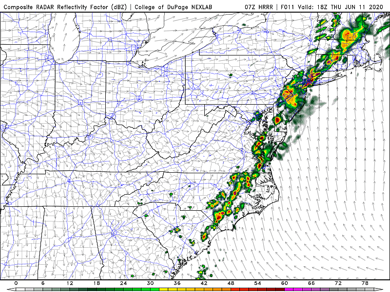
As of this writing (5:30 a.m.), the first of approximately two rounds of rain Thursday is progressing through New Jersey. This scattered rain is really just clipping us, with pockets of steady stuff along and north/west of the Route 1 corridor. There are a few spotty showers south of that point.
For the majority of New Jersey, it feels like a steamy and highly unsettled morning. Dew points are in the 70s. Temperatures are stifling, in the 70s. We'll top out near 80 degrees Thursday — definitely cooler than Wednesday, but still very humid all day. Skies will be cloudy, with a warm breeze (10 to 20 mph).
Thursday's second round of rain — the main event, if you will — will arrive from midday through the afternoon, sweeping from west to east. Pockets of heavy rain (1+ inch) are almost a guarantee here, which may lead to some ponding and flooding issues. There is a marginal risk of gusty winds too, even though sunshine and heat (energy) are limited.
By the way, not that it's a great beach day, but a moderate risk of rip currents and rough surf is posted for the Jersey Shore once again Thursday.
As showers and thunderstorms exit Thursday evening (by about 9 p.m .at the latest), we'll feel the effects of a cold front. As skies clear, humidity will start to drop. So, by the time you wake up Friday morning, it will be much more comfortable and much more pleasant. Overnight low temperatures will fall into the lower to mid 60s.
Friday looks great. Sunny, dry, and warm. (Although some model guidance paints some pesky clouds hanging over the Jersey Shore.) High temperatures should reach about 80 to 85 degrees.
And Saturday is shaping up pretty nicely too. (Certainly the better day of the upcoming weekend.) Skies will progress from mostly to partly sunny. Temperatures will be slightly cooler, but still seasonable, in the upper 70s to around 80 degrees. A stray shower is possible late-day (probably in the evening hours).
On Sunday, our weather goes downhill again with the return of clouds and raindrops. Scattered rain and an on-shore breeze will limit high temperatures to the mid 70s.
And I'm afraid that will probably be a familiar story through the first half of next week (at least). A storm system will sit and spin just east of New Jersey, maintaining a regular on-shore (easterly) wind. There will be clouds. Temperatures will be on the cool side, in the 70s each day from Sunday through Wednesday. And we'll probably see more rain, although I'm not seeing any washouts or dramatic severe weather in the forecast for now. Not a very pretty weather week.
But hey, at least your air conditioner will get a break from the heat and humidity.

The 15 Hardest Town Names To Pronounce In New Jersey
More From WPG Talk Radio 95.5 FM


