
Thursday Will Be Another Big Weather Transition Day for NJ
We have a number of big changes to talk about, as our weather transitions from wet to dry and from mild to cold. Yes, it's finally going to feel like February around here! (Well, for two whole days, at least...)
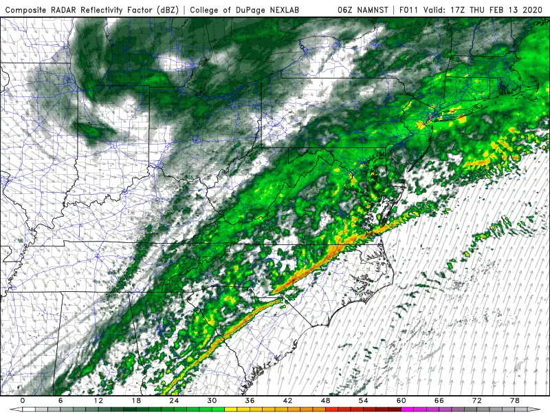
We're waking up to scattered light to moderate rain passing through New Jersey. Most of Thursday looks pretty soggy, with periods of rain continuing through about mid to late Thursday afternoon. Morning temperatures are in the upper 30s to around 40. And afternoon high temperatures will range from the mid 40s (north) to lower 50s (central) to upper 50s (south). Upwards of 15 degrees above seasonal normals — nice and toasty warm!
However, as rain exits, we'll start to feel the effects of a cold front Thursday evening. Overnight low temperatures will dip into the upper 20s. By itself, that number isn't so bad — it's actually close to normal for mid-February. It will get breezy overnight though, adding a bite to the chilly air. And it's only the beginning of our impending cold snap.
On Friday (Valentine's Day), high temperatures will only reach the lower 30s. That's pretty frigid — a full 25 degrees cooler than Thursday and about 10 degrees below normal. And, with a steady biting breeze in the 10 to 20 mph range, the wind chill will do no better than the lower 20s all day. Skies will progressively clear to bright winter sunshine.
It's definitely cold, but we're not breaking records or talking about truly "dangerous" cold here. It's just time to don the heavier winter gear. In case you're keeping score, Friday will only be New Jersey's 7th below normal day of 2020 so far.
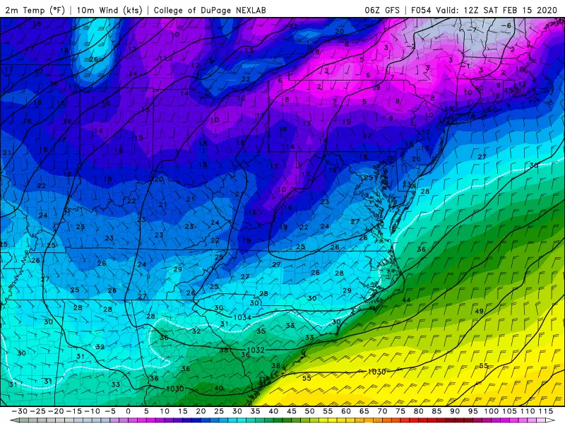
Saturday will become below-normal day #8. As the core of this cold air mass lands right on top of us, Saturday morning low temperatures will be in the teens for most of New Jersey. (Single-digit temps are a possibility in NW NJ and the Pine Barrens!)
Saturday afternoon's highs will once again only hit lower 30s. Winds will be lighter, so it will be less bitter. And we'll have plenty of sunshine again.
And that's the end of the cold snap! A southwesterly flow will warm temperatures on Sunday, into the above-normal kit to upper 40s. Look for scattered to broken clouds overhead.
Temperatures will ping-pong a bit heading into Monday (President's Day), as a northwesterly breeze limited temperatures to the cooler lower 40s. Just like Friday-Saturday, cool air is dry air, so we should see abundant sun shining down.
Our next warmup and storm system is set to arrive on Tuesday. As temperatures warm into the 50s, we'll see rain arrive eventually. Current models show wet weather arriving Tuesday afternoon, but that's subject to wiggle earlier or later. We're also just expecting wet (and not wintry) yet again.
That front will once again open the door to the arctic on Wednesday, with another big cooldown in the works.
It's worth mentioning that long-range models show no substantial snowstorms for New Jersey through the end of February. However, there are three important footnotes on this note:
1.) Model forecasts literally mean nothing beyond 7 to 10 days. You might as well flip a coin.
2.) To me, the overall weather pattern in the last third of February looks more conducive to a snowstorm (read: possible nor'easter). New Jersey will probably end up right on the edge of cold-dry air and warm-moist air. That's right where you want to be to see some snow pile up.
3.) March is renowned for being a very active weather month. (That whole "coming in like a lion" thing.) I will maintain cautious, uncertain optimism for a winter storm until the beginning of Spring (March 19).

More From WPG Talk Radio 95.5 FM


