Atlantic Hurricane Season Starts June 1: What to Expect in NJ
The 2022 Hurricane Season
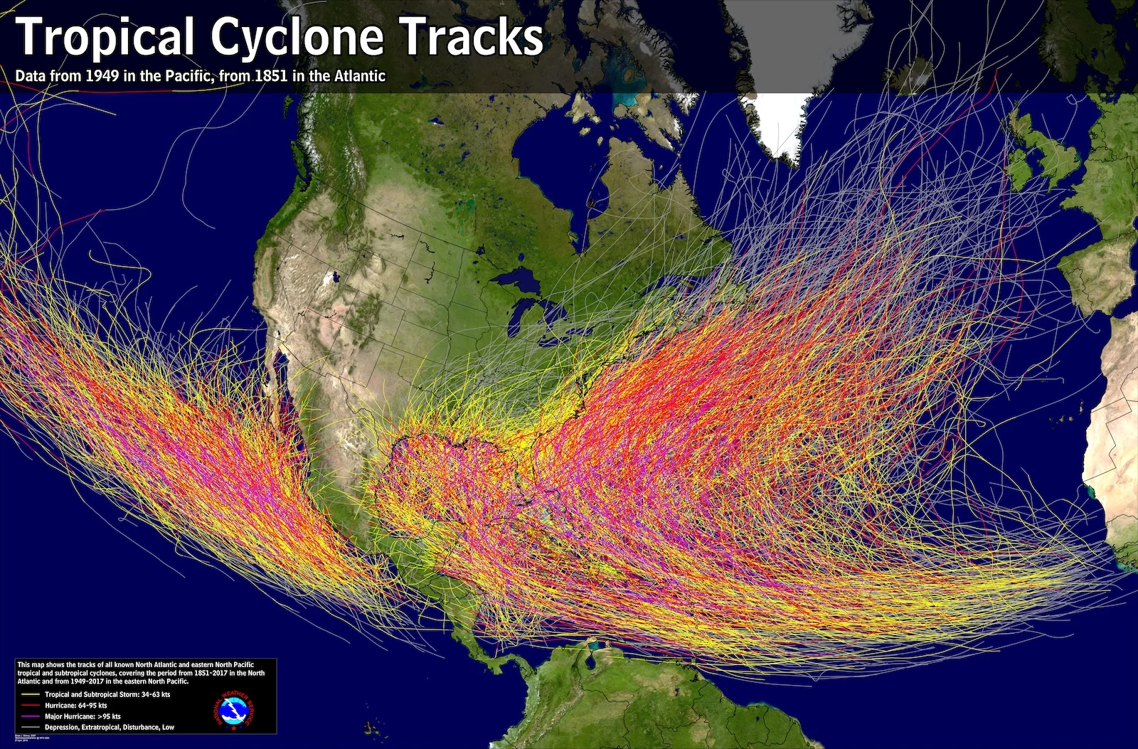
Although tropical systems can form in any month of the year (and they have), the official hurricane season for the Atlantic basin runs from June 1 to November 30.
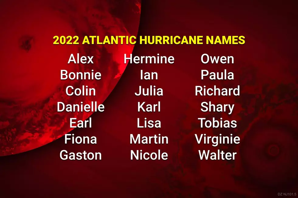
Tropical storms and hurricanes are named via a 6-year rotating list, standardized by the World Meteorological Organization. Representatives from hurricane-prone nations contribute names for the lists, which alternate between male and female. The letters Q, U, X, Y, and Z are not used.
Here are the 21 potential hurricane names for 2022:
Some of the names here may be familiar from the last time this list was used, in 2016. The memes about Shrek-related Fiona and Disney-related Gaston were on point. More seriously, Bonnie, Danielle, Julia, and Matthew had indirect impacts on New Jersey, enhancing rainfall and churning up the surf. And Hurricane Hermine posed a serious threat for the Jersey Shore over Labor Day Weekend 2016, before east at the last minute.

There have been two changes to the list since 2016. Matthew was retired after causing almost 600 deaths and over $16 billion in damages. It has been replaced by Martin in the 2022 list. Otto caused substantial damage in Central America in November 2016, and will be replaced by Owen in 2022 and beyond.
If a hurricane season turns hyperactive with more than 21 named storms, the National Hurricane Center will then proceed to a supplemental list of names.
This is a new procedure put into effect prior to the 2021 season. Previously, in seasons that exhausted the standard 21-name list — 2005 and 2020 — officials named storms after the Greek alphabet.
The 2022 Forecast
If you regularly follow my weather blog, you know I'm pretty skeptical about seasonal forecasting. Whether it's the winter or the summer or hurricane season, too many forecasters try to get way too specific. And, since the weather is a perfect example of "chaos theory" — where one little change in initial conditions can cause dramatically different results — such predictions always prove to be wrong.
Having said that, there are some key signals that can provide broad, general clues to how long-term weather conditions will play out.
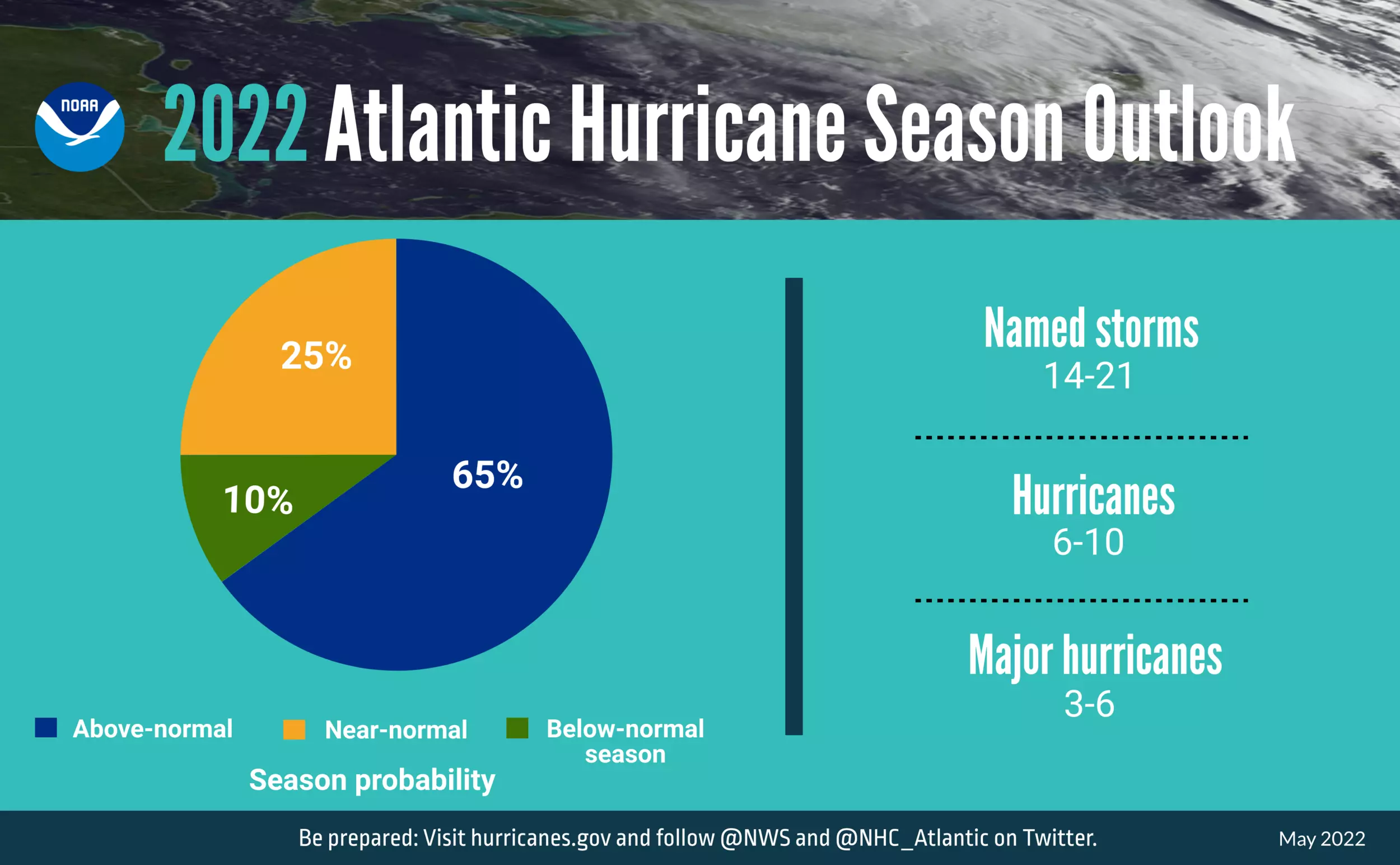
Last week, the Climate Prediction Center, a branch of the National Oceanic and Atmospheric Administration, issued their latest outlook for the 2022 Atlantic hurricane season.
The most important and most relevant takeaway here is this is expected to be an active tropical season in the Atlantic basin. More specifically, forecasters declare a 65% chance of above-normal storm activity. There are several factors contributing to this stormy outlook:
—ENSO has been in a La Niña phase since 2020. That means the water in the western Pacific Ocean (Australia) is usually warm compared to the eastern Pacific Ocean (South America). Historically, such conditions lead to decreased hurricane activity in the Pacific but increased storm formation in the Atlantic.
—Sea surface temperatures in the Atlantic Ocean and the Caribbean Sea are running above average for this point of the year.
—Wind patterns along the tropical Atlantic are more conducive to long-tracking storms forming over the ocean. Specifically, an enhanced west African wind.
One Big Asterisk
It is worth mentioning that the numbers of named storms, hurricanes, and major hurricanes is a very rough estimate. And, in my professional opinion, it is a terrible indicator for a seasonal forecast — it's just too specific.
There are definitive guidelines for the progression of a system from a named 39+ mph tropical storm to a 74+ mph hurricane to a 111+ mph major hurricane. But those upgrades are still rather subjective — and the National Hurricane Center has been known for making sketchy judgment calls. (Especially by naming "fish storms" that have no chance of impacting land. Or declaring potential tropical storms with poor circulation and organization.)
Again, seasonal predictions are sketchy, at best. Blur your eyes, keep your expectations reasonable, and focus on the top-level headlines here.
What to Expect in New Jersey
Tropical storms and hurricanes are often long-duration, multi-impact weather events. Wind and damage, rain and inland flooding, surge and coastal flooding, and tornadoes are all on the table.
So how many of those "14 to 21 named storms" are going to hit New Jersey? Couldn't tell you. That is too specific a prediction to make on a seasonal basis — it just goes beyond the science of meteorology and climatology.
Having said that, I think there's good reason for concern this year, for two specific reasons (related to the forecast above):
1.) La Niña rolls on. All of New Jersey's worst, deadliest storms in the modern era — without exception — occurred in La Niña years: Sandy (2012), Ida (2021), Irene (2011), Connie (1955), Floyd (1999), Felix (1995), Fay (2020), etc.
2.) The increased likelihood of storms forming from west African tropical waves is concerning. Those are the hurricanes that we have to track for 10 to 14 days before even reaching (or not reaching) the U.S. East Coast. Again, some of our most prominent storms came from that storm corridor, including Irene and Floyd. (Although notably not Ida, nor Sandy.)
Let's also not forget the potential for indirect impacts from any passing hurricane: enhanced rainfall and humidity from inland storm systems, rough surf and rip currents along the coast, and substantial tidal flooding. Even a storm several hundreds of miles away can cause significant issues.
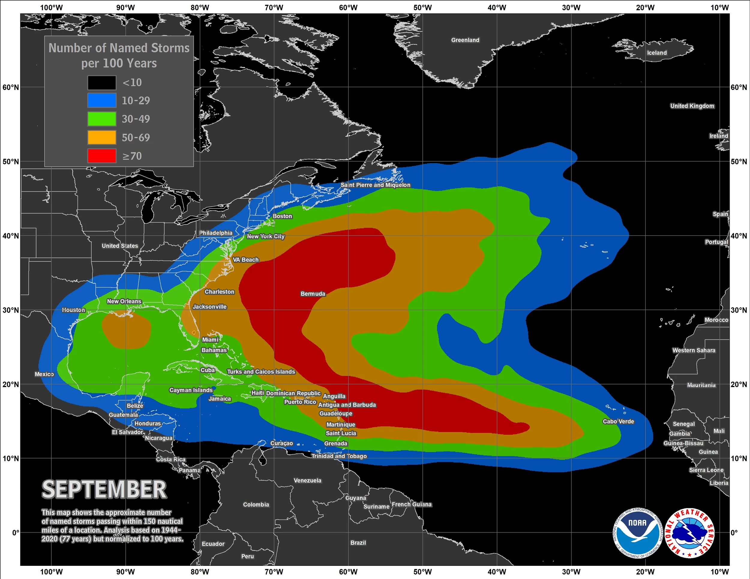
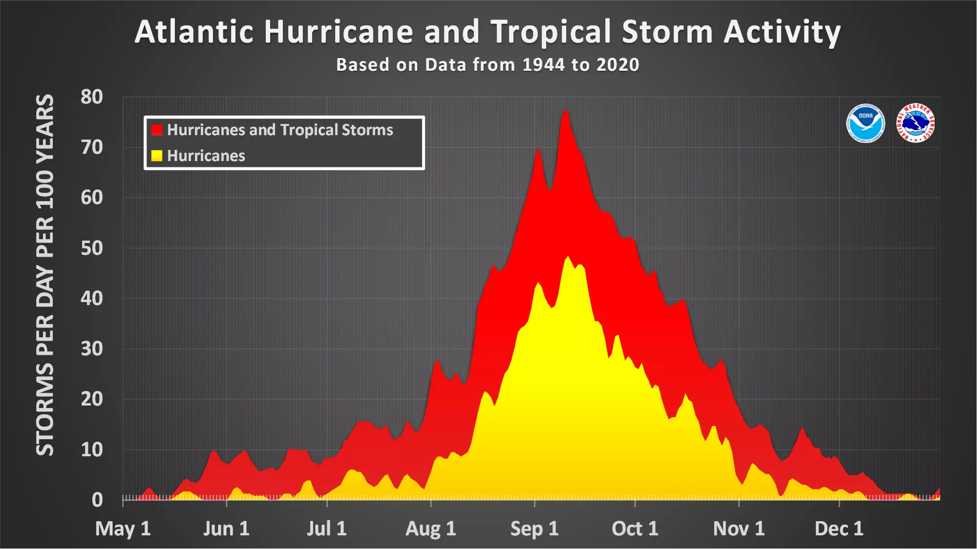
Remember, the peak of the Atlantic hurricane season is from late August to mid September. That is when warm water and weather patterns present the greatest threat for a big storm. (Examples: Ida, Irene, Floyd.)
Final Thoughts
Every season, I remind you that it only takes one bad storm to make a season memorable, historic, and/or catastrophic. That is why I urge calm vigilance, proactive preparedness, and patience throughout every hurricane season.
Of course, our team will be on top of any hurricane or tropical storm that potentially threatens New Jersey this summer and fall. Thanks for following along our forecasts and relying on us for critical weather and safety information.
Incredible, heartbreaking images of Ida's damage in New Jersey
Gallery Credit: Dan Alexander
LOOK: The most expensive weather and climate disasters in recent decades
Gallery Credit: KATELYN LEBOFF
More From WPG Talk Radio 95.5 FM